File:Patternedground.JPG
Jump to navigation
Jump to search
Size of this preview: 726 × 599 pixels. Other resolutions: 291 × 240 pixels | 581 × 480 pixels | 866 × 715 pixels.
Original file (866 × 715 pixels, file size: 143 KB, MIME type: image/jpeg)
Captions
Captions
Add a one-line explanation of what this file represents
Summary
[edit]
| Description |
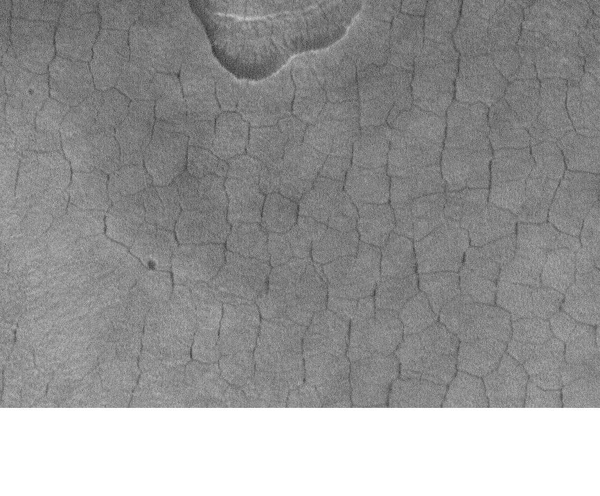
English: Patterned ground in Casius. Location is 45.06 degrees north latitude and 270.33 degrees west longitude. |
| Date | |
| Source | http://www.msss.com/mars_images/moc/publicresults/2006/07/S20-00646 |
| Author | Jim Secosky modified NASA image. |
Licensing
[edit]
| This file is in the public domain in the United States because it was solely created by NASA. NASA copyright policy states that "NASA material is not protected by copyright unless noted". (See Template:PD-USGov, NASA copyright policy page or JPL Image Use Policy.) | ||
 |
Warnings:
|
Original upload log
[edit]
Transferred from en.wikipedia to Commons by Magnus Manske using CommonsHelper.
The original description page was here. All following user names refer to en.wikipedia.
- 2009-01-13 21:43 Jimmarsmars 866×715× (146126 bytes) {{Information |Description=Patterned ground in Casius. Location is 45.06 degrees north latitude and 270.33 degrees west longitude. |Source=http://www.msss.com/mars_images/moc/publicresults/2006/07/S20-00646 |Date=January 13, 2009 |Author=Jim Secosky modi
File history
Click on a date/time to view the file as it appeared at that time.
| Date/Time | Thumbnail | Dimensions | User | Comment | |
|---|---|---|---|---|---|
| current | 08:44, 20 February 2011 | | 866 × 715 (143 KB) | File Upload Bot (Magnus Manske) (talk | contribs) | {{BotMoveToCommons|en.wikipedia|year={{subst:CURRENTYEAR}}|month={{subst:CURRENTMONTHNAME}}|day={{subst:CURRENTDAY}}}} {{Information |Description={{en|Patterned ground in Casius. Location is 45.06 degrees north latitude and 270.33 degrees west longitude |
You cannot overwrite this file.
File usage on Commons
The following page uses this file:
File usage on other wikis
The following other wikis use this file:
- Usage on en.wikipedia.org
- Usage on es.wikipedia.org
- Usage on fa.wikipedia.org
- Usage on pnb.wikipedia.org
- Usage on uk.wikipedia.org
- Usage on ur.wikipedia.org