File:Patrick Beaulieu, Nuée d'éclosions, 2015. (29647874400).jpg
Original file (1,920 × 1,080 pixels, file size: 329 KB, MIME type: image/jpeg)
Captions
Captions
Summary
[edit].jpg&action=edit§ion=1)
| Description |
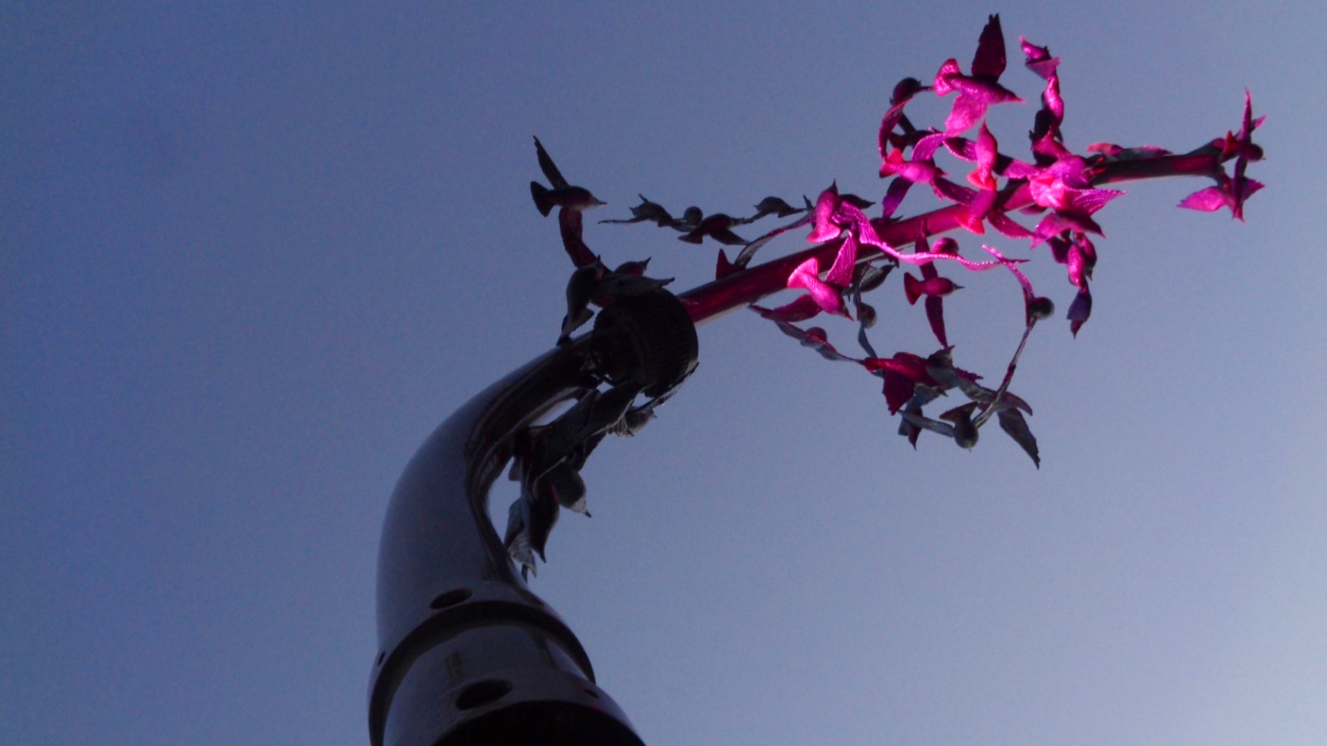
Cette œuvre poétique nous amène à contempler un regroupement de majestueux étourneaux en aluminium, grandeur nature. Évoluant dans un jeu de courbes, de reflets et de variations lumineuses, ces oiseaux en vol prennent la forme d’une succession d’éclosions florales, inspirées par la riche végétation du parc du Domaine-Howard. Depuis les sentiers et la route qui mènent à la Maison bleue, on peut observer en contre-plongée certains détails esthétiques qui caractérisent ces oiseaux, telles leur silhouette élancée, la texture de leur plumage et leur queue triangulaire. Ceux-ci sont fixés à une structure élancée vers le ciel alliant un fût traditionnel et une console moderne de lampadaire, faisant écho à la fois à la noblesse de l’histoire et du patrimoine du Domaine Howard et au développement urbain dans lequel le parc évolue. L’œuvre rend hommage ainsi aux jardiniers d’hier, comme aux horticulteurs et aux botanistes d’aujourd’hui, œuvrant à cultiver les fleurs qui ornent la ville. Dans ce lieu de rassemblement et de services dédiés à la vie culturelle, communautaire et sportive, la vivacité et le synchronisme des oiseaux symbolisent la recherche d’un équilibre harmonieux, d’un épanouissement pour l’individu et pour la collectivité. <a href="https://www.ville.sherbrooke.qc.ca/fr/citoyen/oeuvres-dart/oeuvres-dart-public/?tx_lbooeuvresart_list%5Boeuvre%5D=250&tx_lbooeuvresart_list%5Baction%5D=show&tx_lbooeuvresart_list%5Bcontroller%5D=Oeuvre&cHash=243fa2b975d4aedfcd1c9fa67b602cfa" rel="nofollow">www.ville.sherbrooke.qc.ca/fr/citoyen/oeuvres-dart/oeuvre...</a> |
| Date | |
| Source | Patrick Beaulieu, Nuée d'éclosions, 2015. |
| Author | art_inthecity from Montréal, CA |
| Camera location | | View this and other nearby images on: OpenStreetMap |
|---|
.jpg¶ms=045.402111_N_-071.908521_E_globe:Earth_type:camera_source:Flickr_&language=en)
Licensing
[edit].jpg&action=edit§ion=2)
- You are free:
- to share – to copy, distribute and transmit the work
- to remix – to adapt the work
- Under the following conditions:
- attribution – You must give appropriate credit, provide a link to the license, and indicate if changes were made. You may do so in any reasonable manner, but not in any way that suggests the licensor endorses you or your use.
| This image was originally posted to Flickr by art_inthecity at https://flickr.com/photos/57286185@N04/29647874400 (archive). It was reviewed on 4 June 2019 by FlickreviewR 2 and was confirmed to be licensed under the terms of the cc-by-2.0. |
File history
Click on a date/time to view the file as it appeared at that time.
| Date/Time | Thumbnail | Dimensions | User | Comment | |
|---|---|---|---|---|---|
| current | 15:18, 6 May 2019 | | 1,920 × 1,080 (329 KB) | Mindmatrix (talk | contribs) | Transferred from Flickr via #flickr2commons |
You cannot overwrite this file.
File usage on Commons
There are no pages that use this file.
.jpg&oldid=916404995)