File:Paschimavahini Kaveri Srirangapatna Jul22 R16 06188.jpg
Original file (5,472 × 3,648 pixels, file size: 16.42 MB, MIME type: image/jpeg)
Captions
Summary
[edit]DescriptionPaschimavahini Kaveri Srirangapatna Jul22 R16 06188.jpg |
English: 
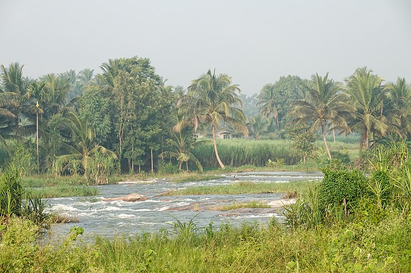
Paschimavahini, western channel of the Kaveri from Ranganathittu to Srirangapatna |
|||
Date | ||||
Source | Own work | |||
Author |
|
Camera location | 12° 25′ 38.76″ N, 76° 39′ 51.79″ E | View this and other nearby images on: OpenStreetMap | 12.427432; 76.664387 |
---|
The geographical information in this file was retrospectively estimated.
The location may therefore be somewhat imprecise. Verifying and refining these coordinates is strongly encouraged. |
Licensing
[edit]- You are free:
- to share – to copy, distribute and transmit the work
- to remix – to adapt the work
- Under the following conditions:
- attribution – You must give appropriate credit, provide a link to the license, and indicate if changes were made. You may do so in any reasonable manner, but not in any way that suggests the licensor endorses you or your use.
- share alike – If you remix, transform, or build upon the material, you must distribute your contributions under the same or compatible license as the original.
This image has been assessed using the Quality image guidelines and is considered a Quality image.
العربية ∙ جازايرية ∙ беларуская ∙ беларуская (тарашкевіца) ∙ български ∙ বাংলা ∙ català ∙ čeština ∙ Cymraeg ∙ Deutsch ∙ Schweizer Hochdeutsch ∙ Zazaki ∙ Ελληνικά ∙ English ∙ Esperanto ∙ español ∙ eesti ∙ euskara ∙ فارسی ∙ suomi ∙ français ∙ galego ∙ עברית ∙ हिन्दी ∙ hrvatski ∙ magyar ∙ հայերեն ∙ Bahasa Indonesia ∙ italiano ∙ 日本語 ∙ Jawa ∙ ქართული ∙ 한국어 ∙ kurdî ∙ Lëtzebuergesch ∙ lietuvių ∙ македонски ∙ മലയാളം ∙ मराठी ∙ Bahasa Melayu ∙ Nederlands ∙ Norfuk / Pitkern ∙ polski ∙ português ∙ português do Brasil ∙ rumantsch ∙ română ∙ русский ∙ sicilianu ∙ slovenčina ∙ slovenščina ∙ shqip ∙ српски / srpski ∙ svenska ∙ தமிழ் ∙ తెలుగు ∙ ไทย ∙ Tagalog ∙ toki pona ∙ Türkçe ∙ українська ∙ vèneto ∙ Tiếng Việt ∙ 中文 ∙ 中文(简体) ∙ 中文(繁體) ∙ +/− |
File history
Click on a date/time to view the file as it appeared at that time.
Date/Time | Thumbnail | Dimensions | User | Comment | |
---|---|---|---|---|---|
current | 04:12, 31 July 2022 | 5,472 × 3,648 (16.42 MB) | Tagooty (talk | contribs) | Uploaded own work with UploadWizard |
You cannot overwrite this file.
File usage on Commons
The following 4 pages use this file:
Metadata
This file contains additional information such as Exif metadata which may have been added by the digital camera, scanner, or software program used to create or digitize it. If the file has been modified from its original state, some details such as the timestamp may not fully reflect those of the original file. The timestamp is only as accurate as the clock in the camera, and it may be completely wrong.
Image title |
|
---|---|
Camera manufacturer | SONY |
Camera model | DSC-RX100M6 |
Author | TA Gonsalves |
Copyright holder |
|
Exposure time | 1/160 sec (0.00625) |
F-number | f/11 |
ISO speed rating | 400 |
Date and time of data generation | 07:14, 30 July 2022 |
Lens focal length | 53.6 mm |
Latitude | 12° 25′ 38.75″ N |
Longitude | 76° 39′ 51.79″ E |
Short title |
|
Horizontal resolution | 300 dpi |
Vertical resolution | 300 dpi |
Software used | Adobe Photoshop Lightroom 6.14 (Macintosh) |
File change date and time | 09:29, 31 July 2022 |
Exposure Program | Aperture priority |
Exif version | 2.31 |
Date and time of digitizing | 07:14, 30 July 2022 |
APEX shutter speed | 7.321928 |
APEX aperture | 6.918863 |
APEX brightness | 7.775 |
APEX exposure bias | 0 |
Maximum land aperture | 4.3359375 APEX (f/4.49) |
Metering mode | Pattern |
Light source | Unknown |
Flash | Flash did not fire, compulsory flash suppression |
Color space | sRGB |
File source | Digital still camera |
Scene type | A directly photographed image |
Custom image processing | Normal process |
Exposure mode | Auto exposure |
White balance | Auto white balance |
Digital zoom ratio | 1 |
Focal length in 35 mm film | 148 mm |
Scene capture type | Standard |
Contrast | Normal |
Saturation | Normal |
Sharpness | Normal |
Receiver status | Measurement interoperability |
Geodetic survey data used | WGS-84 |
GPS differential correction | 0 |
GPS tag version | 0.0.2.2 |
Lens used | 9.0-72.0 mm f/2.8-4.5 |
Date metadata was last modified | 14:59, 31 July 2022 |
Rating (out of 5) | 3 |
Unique ID of original document | 0FFD6B126EB421BAD2F95CCC9240A691 |
Keywords |
|
Sublocation of city shown | Srirangapatna |
IIM version | 4 |
Structured data
Items portrayed in this file
depicts
30 July 2022
12°25'38.755"N, 76°39'51.793"E
400
0.00625 second
11
53.6 millimetre
- Images by User:Tagooty
- Files with coordinates missing SDC location of creation
- Media with estimated locations
- CC-BY-SA-4.0
- Self-published work
- Images by User:Tagooty/India
- Quality images by Tagooty
- Quality images of India by Tagooty
- Quality images of Karnataka by Tagooty
- Quality images of Srirangapatna
- Quality images of rivers in India
- Quality images
- Quality images missing SDC depicts
- Quality images missing SDC creator