File:Part of the counties of Charlotte and Albany, in the Province of New York - being the seat of war between the King's forces under Lieut. Gen. Burgoyne and the rebel army LOC 80693268.jpg
Jump to navigation
Jump to search

Size of this preview: 468 × 600 pixels. Other resolutions: 187 × 240 pixels | 374 × 480 pixels | 599 × 768 pixels | 799 × 1,024 pixels | 1,598 × 2,048 pixels | 2,836 × 3,635 pixels.
Original file (2,836 × 3,635 pixels, file size: 1.69 MB, MIME type: image/jpeg)
Captions
Captions
Add a one-line explanation of what this file represents
Summary
[edit]| Description |
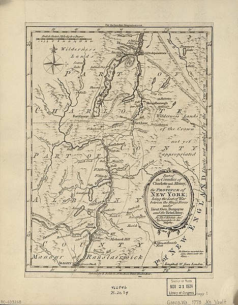
English: Scale ca. 1:575,000. "For the London magazine 1778." Relief shown pictorially. Shows forts and roads from Albany to Ticonderoga. LC Maps of North America, 1750-1789, 1078 Available also through the Library of Congress Web site as a raster image. Vault AACR2: 100; 651/1; 651/2 |
||
| Title | Part of the counties of Charlotte and Albany, in the Province of New York : being the seat of war between the King's forces under Lieut. Gen. Burgoyne and the rebel army | ||
| Shelf ID | G3803.W3 1778 .K5 | ||
| Date | |||
| Source | https://www.loc.gov/item/80693268/ | ||
| Author | Kitchin, Thomas; Baldwin, R. (Robert) | ||
| Permission (Reusing this file) |
|
||
| Other versions |
|
||
| Location | United States · New York · Albany County · New York (State) · Washington County | ||
| Part of | Military Battles And Campaigns · American Memory · Catalog · Geography And Map Division · American Revolution And Its Era: Maps And Charts Of North America And The West Indies, 1750-1789 | ||
| Subject | Albany County · Albany County (N.Y.) · Washington County (N.Y.) · Washington County · United States · Maps · Early Works To 1800 · New York (State) |


Licensing
[edit]
|
This is a faithful photographic reproduction of a two-dimensional, public domain work of art. The work of art itself is in the public domain for the following reason:
The official position taken by the Wikimedia Foundation is that "faithful reproductions of two-dimensional public domain works of art are public domain".
This photographic reproduction is therefore also considered to be in the public domain in the United States. In other jurisdictions, re-use of this content may be restricted; see Reuse of PD-Art photographs for details. | ||||
File history
Click on a date/time to view the file as it appeared at that time.
| Date/Time | Thumbnail | Dimensions | User | Comment | |
|---|---|---|---|---|---|
| current | 22:30, 31 May 2018 | | 2,836 × 3,635 (1.69 MB) | Fæ (talk | contribs) | LOC Maps https://www.loc.gov/item/80693268/ #1146 |
You cannot overwrite this file.
File usage on Commons
The following page uses this file: