File:Parochiekerk-Keerkergen.JPG
Jump to navigation
Jump to search

Size of this preview: 386 × 599 pixels. Other resolutions: 155 × 240 pixels | 309 × 480 pixels | 495 × 768 pixels | 660 × 1,024 pixels | 1,320 × 2,048 pixels | 2,571 × 3,988 pixels.
Original file (2,571 × 3,988 pixels, file size: 4.63 MB, MIME type: image/jpeg)
Captions
Captions
Add a one-line explanation of what this file represents
Summary
[edit]
| Description |
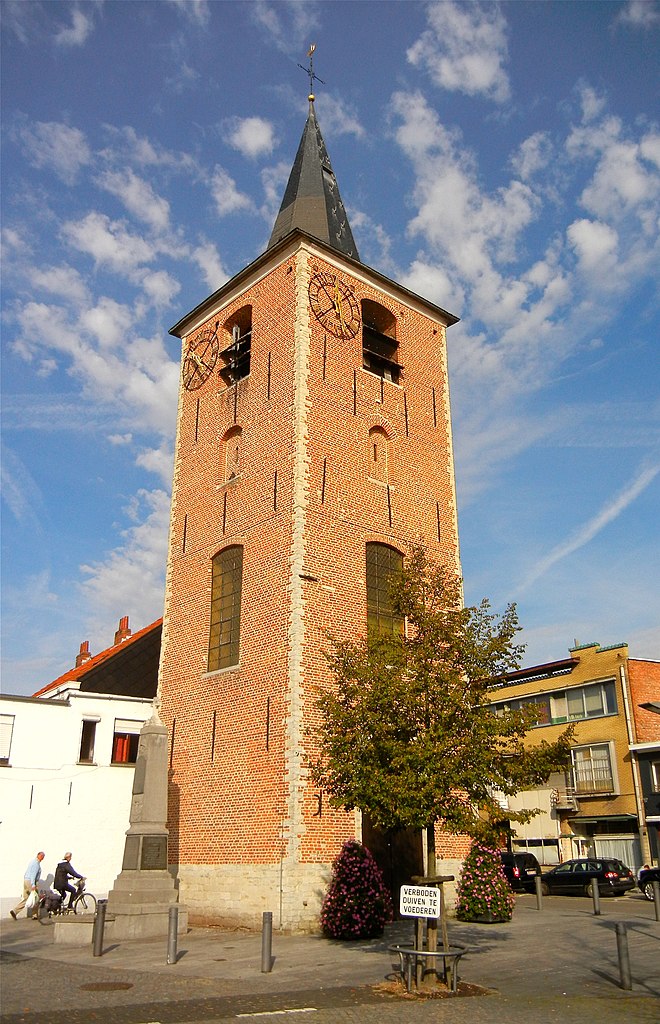
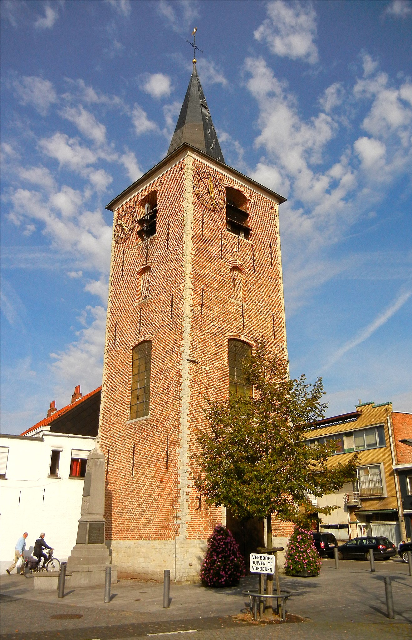
English: St.-Michiel church located in the village of Keerbergen, province of Brabant. This church has been destroyed during the war, only the tower is left.
Français : L'église St.-Michiel est située dans le village de Keerbergen, province de Brabant. Cette église à été détruite pendant la guerre, sauf la tour.
Nederlands: St.-Michielkerk gelegen in het dorp Keerbergen, provincie Brabant. Deze kerk is vernield tijdens de oorlog, behalve de toren.
Deutsch: Die St.-Michiel Kirche befindet sich in das Dorf Keerbergen, Provinz Brabant. Diese Kirche ist zerstört geworden im Krieg, nur der Turm nicht.
|
||
| Date | 30 September 2011 (upload date) | ||
| Source | Own work | ||
| Author | Annemiejans |
| Object location | | View this and other nearby images on: OpenStreetMap |
|---|

|
This image was uploaded as part of Wiki Loves Monuments 2011.
|
 |
Licensing
[edit]
I, the copyright holder of this work, hereby publish it under the following license:
This file is licensed under the Creative Commons Attribution-Share Alike 3.0 Unported license.
- You are free:
- to share – to copy, distribute and transmit the work
- to remix – to adapt the work
- Under the following conditions:
- attribution – You must give appropriate credit, provide a link to the license, and indicate if changes were made. You may do so in any reasonable manner, but not in any way that suggests the licensor endorses you or your use.
- share alike – If you remix, transform, or build upon the material, you must distribute your contributions under the same or compatible license as the original.
File history
Click on a date/time to view the file as it appeared at that time.
| Date/Time | Thumbnail | Dimensions | User | Comment | |
|---|---|---|---|---|---|
| current | 08:06, 30 September 2011 | | 2,571 × 3,988 (4.63 MB) | Annemiejans (talk | contribs) | {{Information |Description = {{en|1=St.-Michiel church located in the village of Keerbergen, province of Brabant. This church has been destroyed during the war, only the tower is left. }} {{fr|1=L'église St.-Michiel est située dans le village de Keerb |
You cannot overwrite this file.
File usage on Commons
The following page uses this file:
File usage on other wikis
The following other wikis use this file:
- Usage on eo.wikipedia.org