File:Parnidis dune.jpg
Jump to navigation
Jump to search

Size of this preview: 800 × 600 pixels. Other resolutions: 320 × 240 pixels | 640 × 480 pixels | 1,024 × 768 pixels | 1,280 × 960 pixels | 2,560 × 1,920 pixels | 4,000 × 3,000 pixels.
Original file (4,000 × 3,000 pixels, file size: 2.67 MB, MIME type: image/jpeg)
Captions
Captions
Add a one-line explanation of what this file represents
Summary
[edit]
| Description |
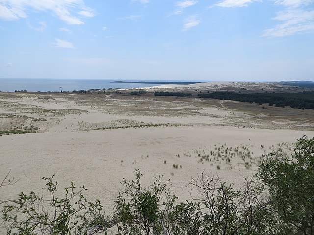
English: Looking south from the top of the 50 meter high Parnidis sand dune near Nida on the Curonian Spit in Lithuania. The border with Russia goes just a couple of kilometer south of the dune, so this is as far south visitors can get on the 98 km long Curonian Spit without a Russian visa.
The green cape stretching out into the Curonian lagoon is known as Grobšto ragas and belongs to Russia. The white dune seen between Grobšto ragas and the Parnidis dune is Sklandytojų kopa or Sklandytojai dune, once 70 meter tall but now about the same height as Parnidis. Sklandytojų means paraglider and was named so because the Nida paraglider school used the dune for exercises from 1933-39. |
| Date | |
| Source | https://www.flickr.com/photos/brostad/9617372074/ |
| Author | Bernt Rostad |
| Camera location | | View this and other nearby images on: OpenStreetMap |
|---|
Licensing
[edit]
This file is licensed under the Creative Commons Attribution 2.0 Generic license.
- You are free:
- to share – to copy, distribute and transmit the work
- to remix – to adapt the work
- Under the following conditions:
- attribution – You must give appropriate credit, provide a link to the license, and indicate if changes were made. You may do so in any reasonable manner, but not in any way that suggests the licensor endorses you or your use.
| This image was originally posted to Flickr by Bernt Rostad at https://www.flickr.com/photos/67975030@N00/9617372074. It was reviewed on 23 November 2013 by FlickreviewR and was confirmed to be licensed under the terms of the cc-by-2.0. |
| Annotations | This image is annotated: View the annotations at Commons |
File history
Click on a date/time to view the file as it appeared at that time.
| Date/Time | Thumbnail | Dimensions | User | Comment | |
|---|---|---|---|---|---|
| current | 10:21, 23 November 2013 | | 4,000 × 3,000 (2.67 MB) | Pofka (talk | contribs) | User created page with UploadWizard |
You cannot overwrite this file.
File usage on Commons
There are no pages that use this file.
File usage on other wikis
The following other wikis use this file:
- Usage on lt.wikipedia.org
- Usage on lv.wikipedia.org
- Usage on nl.wikipedia.org
- Usage on ru.wikipedia.org
- Usage on uk.wikipedia.org