File:Park Downs - geograph.org.uk - 1097818.jpg
Jump to navigation
Jump to search
No higher resolution available.
Park_Downs_-_geograph.org.uk_-_1097818.jpg (640 × 427 pixels, file size: 98 KB, MIME type: image/jpeg)
Captions
Captions
Add a one-line explanation of what this file represents
Summary
[edit]
| Description |
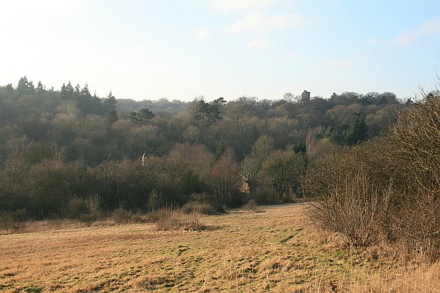
English: Park Downs Park Downs is common land and a site of special scientific interest because of its downland flora, although the battle against scrub encroachment is ceaseless. The Downs are managed by the Banstead Commons Conservators (http://www.bansteadcommonsconservators.org.uk ), but unusually, the rights of common (to graze animals on Park Downs) belong to the National Trust. In the distance, rising above Banstead Wood, is the water tower of the former Queen Elizabeth Hospital, now converted to a residential estate. |
| Date | |
| Source | From geograph.org.uk |
| Author | Hugh Craddock |
| Attribution (required by the license) | Hugh Craddock / Park Downs / |
| Camera location | | View this and other nearby images on: OpenStreetMap |
|---|
_heading:225.00&language=en)
| Object location | | View this and other nearby images on: OpenStreetMap |
|---|
_heading:225.00&language=en)
Licensing
[edit]

|
This image was taken from the Geograph project collection. See this photograph's page on the Geograph website for the photographer's contact details. The copyright on this image is owned by Hugh Craddock and is licensed for reuse under the Creative Commons Attribution-ShareAlike 2.0 license.
|
This file is licensed under the Creative Commons Attribution-Share Alike 2.0 Generic license.
Attribution: Hugh Craddock
- You are free:
- to share – to copy, distribute and transmit the work
- to remix – to adapt the work
- Under the following conditions:
- attribution – You must give appropriate credit, provide a link to the license, and indicate if changes were made. You may do so in any reasonable manner, but not in any way that suggests the licensor endorses you or your use.
- share alike – If you remix, transform, or build upon the material, you must distribute your contributions under the same or compatible license as the original.
File history
Click on a date/time to view the file as it appeared at that time.
| Date/Time | Thumbnail | Dimensions | User | Comment | |
|---|---|---|---|---|---|
| current | 14:56, 24 February 2011 | | 640 × 427 (98 KB) | GeographBot (talk | contribs) | == {{int:filedesc}} == {{Information |description={{en|1=Park Downs Park Downs is common land and a site of special scientific interest because of its downland flora, although the battle against scrub encroachment is ceaseless. The Downs are managed by th |
You cannot overwrite this file.
File usage on Commons
There are no pages that use this file.