File:Parcours étape 19 Tour de France 2015.png
Jump to navigation
Jump to search
Size of this preview: 363 × 599 pixels. Other resolutions: 145 × 240 pixels | 291 × 480 pixels | 465 × 768 pixels | 621 × 1,024 pixels | 1,406 × 2,319 pixels.
Original file (1,406 × 2,319 pixels, file size: 7.25 MB, MIME type: image/png)
Captions
Captions
Add a one-line explanation of what this file represents
Summary
[edit]
| Description |
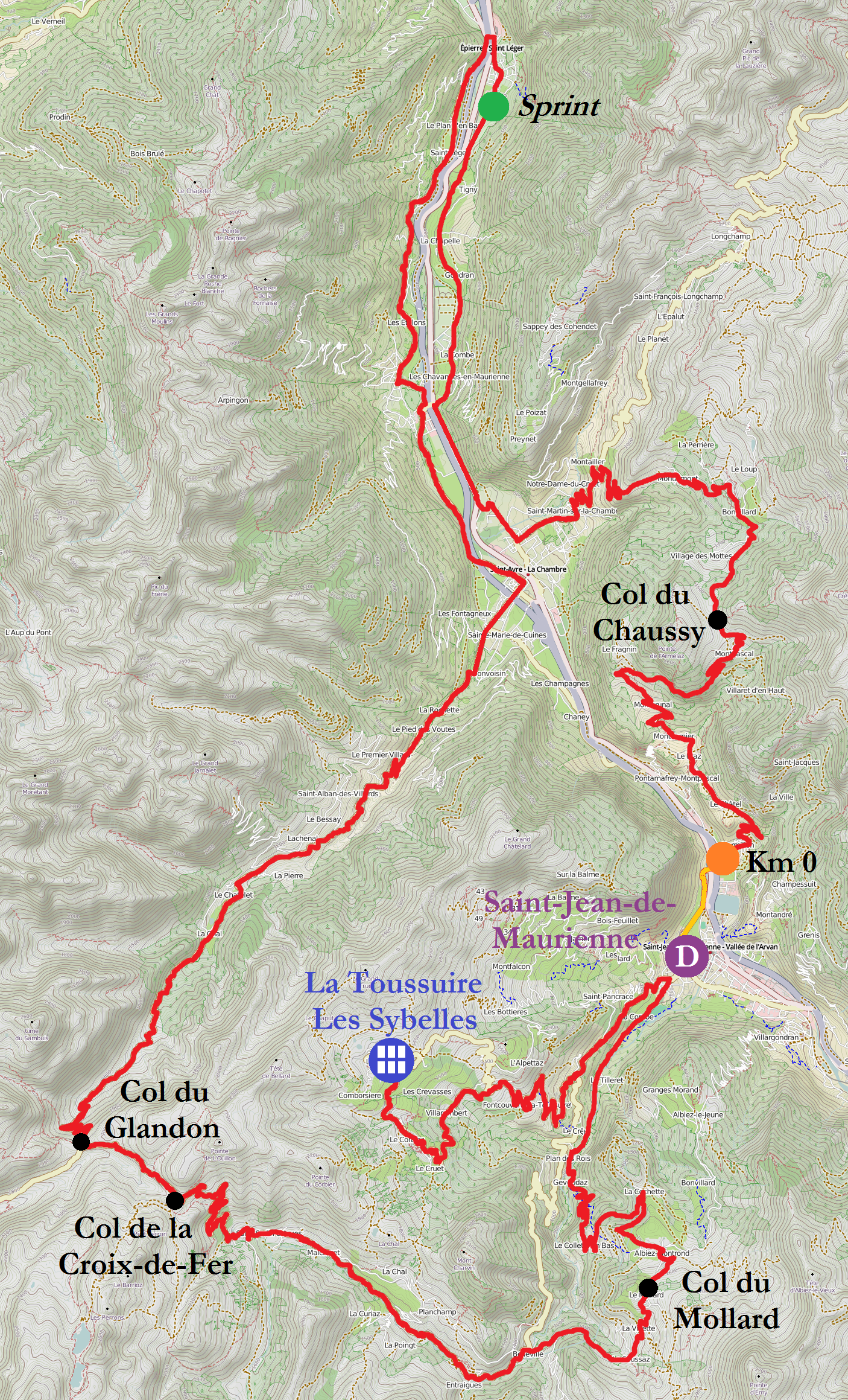
English: Map of the route of the 19th stage of the Tour de France 2015 in the Maurienne valley in Savoie. This route starts in Saint-Jean-de-Maurienne and ends up at La Toussuire ski resort (1 705 meters high).
Français : Carte du tracé de l'étape 19 du Tour de France 2015 dans la vallée de la Maurienne en Savoie. Il part de Saint-Jean-de-Maurienne et se termine à la station de La Toussuire (1 705 mètres d'altitude). |
|||
| Date | ||||
| Source |
Own work Thanks to Tour de France official website |
|||
| Author |
Open Street Map contributors / Contributeurs à Open Street Map + Florian Pépellin for the route / Florian Pépellin pour le parcours |
|||
| Permission (Reusing this file) |
OpenStreetMap data is available under the Open Database License (details). Map tiles are licensed under the Creative Commons Attribution-ShareAlike 2.0 license (CC-BY-SA 2.0).
|
File history
Click on a date/time to view the file as it appeared at that time.
| Date/Time | Thumbnail | Dimensions | User | Comment | |
|---|---|---|---|---|---|
| current | 18:27, 6 July 2015 | | 1,406 × 2,319 (7.25 MB) | Floflo (talk | contribs) | {{Information |Description ={{en|1=Map of the route of the 19th stage of the ''Tour de France 2015'' in the ''Maurienne'' valley in Savoie. This route starts in ''Saint-Jean-de-Maurienne'' and ends up at ''La Toussuire'' ski resort (1 705 meters... |
| 16:03, 5 July 2015 |  | 1,412 × 2,319 (7.27 MB) | Floflo (talk | contribs) | {{Information |Description ={{en|1=Map of the route of the 19th stage of the ''Tour de France 2015'' in the ''Maurienne'' valley in Savoie. This route starts in ''Saint-Jean-de-Maurienne'' and ends up at ''La Toussuire'' ski resort (1 705 meters... |
You cannot overwrite this file.
File usage on Commons
The following page uses this file:
File usage on other wikis
The following other wikis use this file:
- Usage on fr.wikipedia.org