File:Pant Maenog below the forest - geograph.org.uk - 306551.jpg
Jump to navigation
Jump to search
No higher resolution available.
Pant_Maenog_below_the_forest_-_geograph.org.uk_-_306551.jpg (640 × 441 pixels, file size: 97 KB, MIME type: image/jpeg)
Captions
Captions
Add a one-line explanation of what this file represents
Summary
[edit]
| Description |
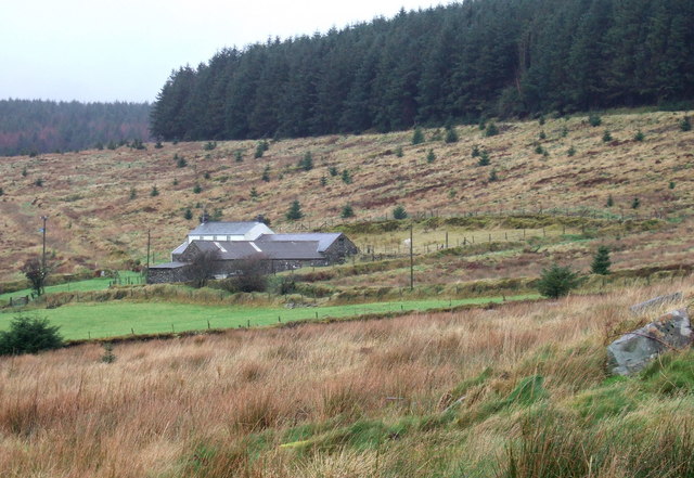
English: Pant Maenog below the forest This shows the dwelling called Pant Maenog with the mature forest of the same name above. The outlying parts of the coniferous plantation here have been clear-felled leaving dispersed regrowth. The smallholding has a strip of fields running down the valley below it and is approached via an unmetalled private track from Rosebush. |
| Date | |
| Source | From geograph.org.uk |
| Author | ceridwen |
| Attribution (required by the license) | ceridwen / Pant Maenog below the forest / |
| Camera location | | View this and other nearby images on: OpenStreetMap |
|---|
_heading:0.00&language=en)
| Object location | | View this and other nearby images on: OpenStreetMap |
|---|
_heading:0.00&language=en)
Licensing
[edit]

|
This image was taken from the Geograph project collection. See this photograph's page on the Geograph website for the photographer's contact details. The copyright on this image is owned by ceridwen and is licensed for reuse under the Creative Commons Attribution-ShareAlike 2.0 license.
|
This file is licensed under the Creative Commons Attribution-Share Alike 2.0 Generic license.
Attribution: ceridwen
- You are free:
- to share – to copy, distribute and transmit the work
- to remix – to adapt the work
- Under the following conditions:
- attribution – You must give appropriate credit, provide a link to the license, and indicate if changes were made. You may do so in any reasonable manner, but not in any way that suggests the licensor endorses you or your use.
- share alike – If you remix, transform, or build upon the material, you must distribute your contributions under the same or compatible license as the original.
- Remove redundant categories and try to put this image in the most specific category/categories
- Remove this template
- The location categories are based on information from this geonames tool and this OpenStreetMap tool combined with a database. You can also have a look at this tool from mysociety.
- The topic category from Geograph was Forestry clear fell (find similar images clear fell at Geograph)
File history
Click on a date/time to view the file as it appeared at that time.
| Date/Time | Thumbnail | Dimensions | User | Comment | |
|---|---|---|---|---|---|
| current | 22:17, 22 December 2010 | | 640 × 441 (97 KB) | GeographBot (talk | contribs) | == {{int:filedesc}} == {{Information |description={{en|1=Pant Maenog below the forest This shows the dwelling called Pant Maenog with the mature forest of the same name above. The outlying parts of the coniferous plantation here have been clear-felled le |
You cannot overwrite this file.
File usage on Commons
There are no pages that use this file.