File:Panoramica-aerea-puerto-berrio.jpg
Jump to navigation
Jump to search

Size of this preview: 800 × 533 pixels. Other resolutions: 320 × 213 pixels | 640 × 426 pixels.
Original file (901 × 600 pixels, file size: 146 KB, MIME type: image/jpeg)
Captions
Captions
Add a one-line explanation of what this file represents
Summary
[edit]
| Description |
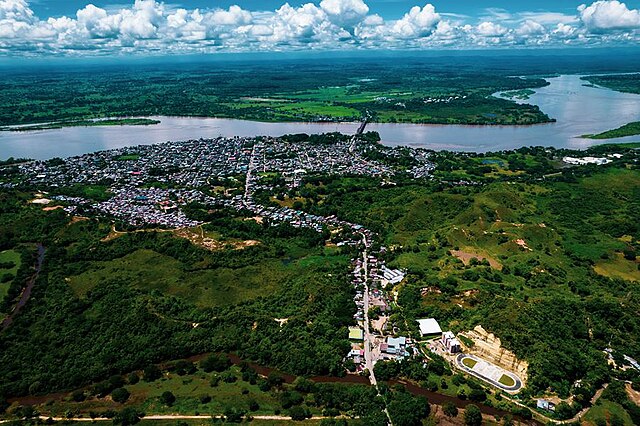
English: Imagen área del municipio de Puerto Berrío del área urbana. |
| Date | |
| Source | http://www.puertoberrio-antioquia.gov.co/tema/municipio |
| Author | Alcaldía de Puerto Berrío |
Licensing
[edit]
This file is licensed under the Creative Commons Attribution-Share Alike 4.0 International license.
- You are free:
- to share – to copy, distribute and transmit the work
- to remix – to adapt the work
- Under the following conditions:
- attribution – You must give appropriate credit, provide a link to the license, and indicate if changes were made. You may do so in any reasonable manner, but not in any way that suggests the licensor endorses you or your use.
- share alike – If you remix, transform, or build upon the material, you must distribute your contributions under the same or compatible license as the original.
File history
Click on a date/time to view the file as it appeared at that time.
| Date/Time | Thumbnail | Dimensions | User | Comment | |
|---|---|---|---|---|---|
| current | 05:10, 12 January 2023 | | 901 × 600 (146 KB) | VibraComunicaciones (talk | contribs) | Uploaded a work by Alcaldía de Puerto Berrío from http://www.puertoberrio-antioquia.gov.co/tema/municipio with UploadWizard |
You cannot overwrite this file.
File usage on Commons
There are no pages that use this file.
File usage on other wikis
The following other wikis use this file:
- Usage on es.wikipedia.org
- Usage on lt.wikipedia.org
- Usage on sh.wikipedia.org