File:Panorama Kraftwerk Niederaußem Neurath Frimmersdorf Vollrather Höhe.JPG
Jump to navigation
Jump to search

Size of this preview: 798 × 173 pixels. Other resolutions: 320 × 69 pixels | 640 × 139 pixels | 1,024 × 222 pixels | 1,280 × 278 pixels | 5,000 × 1,084 pixels.
Original file (5,000 × 1,084 pixels, file size: 2.25 MB, MIME type: image/jpeg)
Captions
Captions
Add a one-line explanation of what this file represents
Summary
[edit]
| Description |
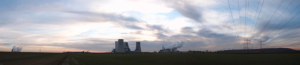
Deutsch: Panoramaaufnahme mit den Kraftwerken Niederaußem, Neurath und Frimmersdorf sowie der Vollrather Höhe.
Rechts im Bild Freileitungen zwischen den Kraftwerken und der Umspannananlage Rommerskirchen: links die teilweise abgeschaltete 220-kV-Verbindungsleitung zwischen dem Kraftwerk Frimmersdorf (sowie Neurath Block F/G) und der UA Rommerskirchen (Abschnitt der Bl. 4535); rechts die 380-kV-Leitung Neurath–Rommerskirchen (Abschnitt der Bl. 4517).
English: Panorama of the powerplants Niederaußem, Neurath and Frimmersdorf from left to right. On the right you can see the mining dump Vollrather Höhe. |
| Date | |
| Source | Own work |
| Author | Stodtmeister |
| Camera location | | View this and other nearby images on: OpenStreetMap |
|---|
The geographical information in this file was retrospectively estimated.
The location may therefore be somewhat imprecise. Verifying and refining these coordinates is strongly encouraged. |
Licensing
[edit]
I, the copyright holder of this work, hereby publish it under the following license:
This file is licensed under the Creative Commons Attribution 3.0 Unported license.
- You are free:
- to share – to copy, distribute and transmit the work
- to remix – to adapt the work
- Under the following conditions:
- attribution – You must give appropriate credit, provide a link to the license, and indicate if changes were made. You may do so in any reasonable manner, but not in any way that suggests the licensor endorses you or your use.
| Annotations | This image is annotated: View the annotations at Commons |
File history
Click on a date/time to view the file as it appeared at that time.
| Date/Time | Thumbnail | Dimensions | User | Comment | |
|---|---|---|---|---|---|
| current | 19:05, 12 February 2011 | 5,000 × 1,084 (2.25 MB) | Stodtmeister (talk | contribs) | {{Information |Description ={{en|1=Panorama of the powerplants Niederaußem, Neurath and Frimmersdorf from left to right. On the right you can see the mining dump Vollrather Höhe.}} |Source ={{own}} |Author =[[User:Stodtmeister|Stodtme |
You cannot overwrite this file.
File usage on Commons
There are no pages that use this file.
File usage on other wikis
The following other wikis use this file:
- Usage on de.wikipedia.org
- Usage on nl.wikipedia.org
- Usage on tr.wikipedia.org