File:Panorama Hverir Námaskarð1 final.jpg
Jump to navigation
Jump to search

Size of this preview: 800 × 570 pixels. Other resolutions: 320 × 228 pixels | 640 × 456 pixels | 1,024 × 730 pixels | 1,280 × 912 pixels | 2,560 × 1,825 pixels | 4,303 × 3,067 pixels.
Original file (4,303 × 3,067 pixels, file size: 10.27 MB, MIME type: image/jpeg)
Captions
Captions
Námafjall Hveir

Summary
[edit]
| Description |
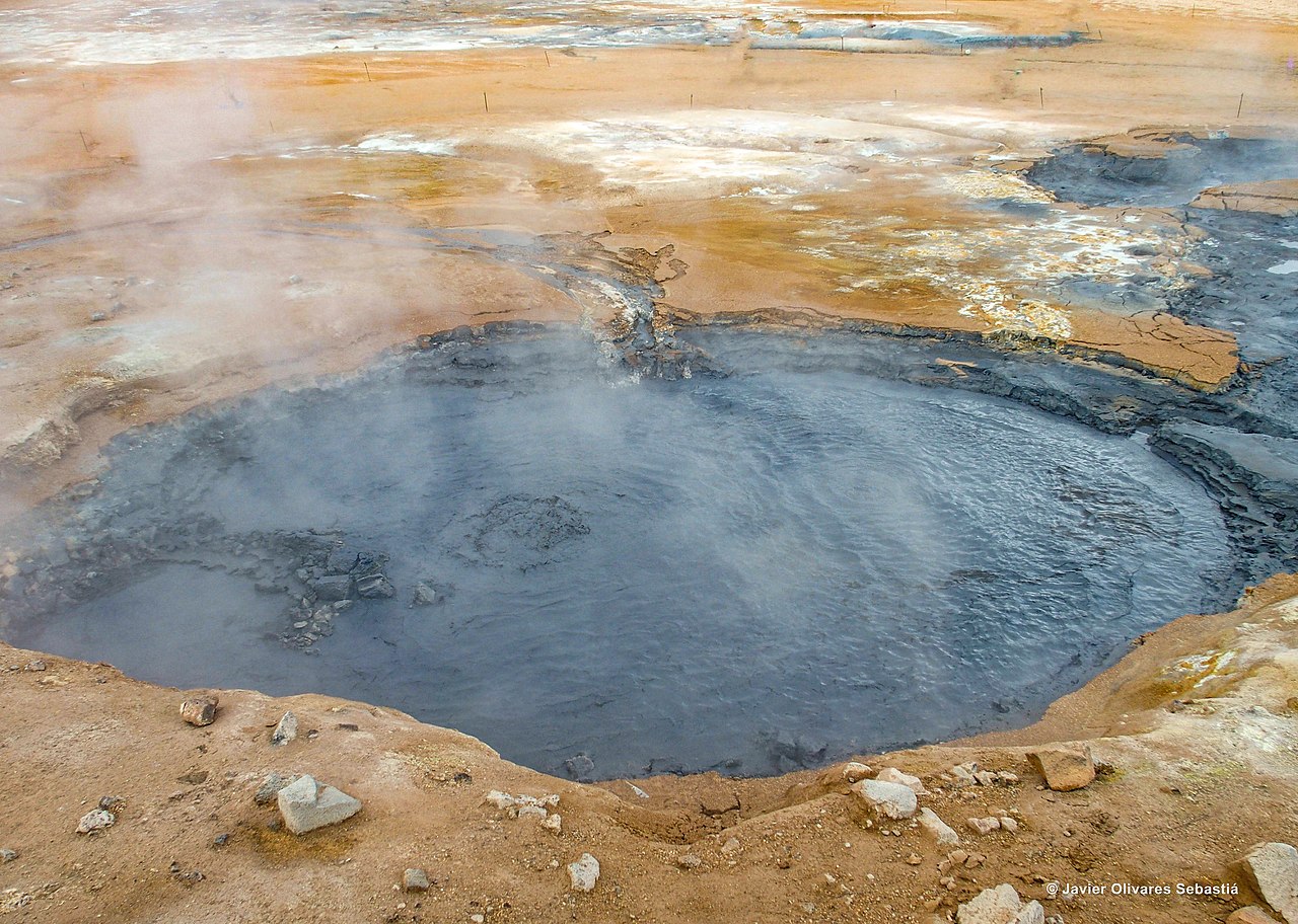
English: Námafjall is a mountain south of Námaskarð, whose eastern side burns yellow due to the geothermal fumes.
In the foothills of Námsfjall, is the geothermal area of Hverir, a strip of thermal waters also known as Hverarönd. Here you can see a series of fumaroles, clay pots and pools that vary in color and are constantly changing. |
| Date | |
| Source | Own work |
| Author | JavierOlivares |
Licensing
[edit]
I, the copyright holder of this work, hereby publish it under the following license:
This file is licensed under the Creative Commons Attribution-Share Alike 4.0 International license.
- You are free:
- to share – to copy, distribute and transmit the work
- to remix – to adapt the work
- Under the following conditions:
- attribution – You must give appropriate credit, provide a link to the license, and indicate if changes were made. You may do so in any reasonable manner, but not in any way that suggests the licensor endorses you or your use.
- share alike – If you remix, transform, or build upon the material, you must distribute your contributions under the same or compatible license as the original.
File history
Click on a date/time to view the file as it appeared at that time.
| Date/Time | Thumbnail | Dimensions | User | Comment | |
|---|---|---|---|---|---|
| current | 06:12, 24 June 2019 | | 4,303 × 3,067 (10.27 MB) | JavierOlivares (talk | contribs) | User created page with UploadWizard |
You cannot overwrite this file.
File usage on Commons
There are no pages that use this file.