File:Panorama över Flaten, juli 2020.jpg
Jump to navigation
Jump to search

Size of this preview: 799 × 244 pixels. Other resolutions: 320 × 98 pixels | 640 × 195 pixels | 1,024 × 313 pixels | 1,280 × 391 pixels | 6,666 × 2,036 pixels.
Original file (6,666 × 2,036 pixels, file size: 4.36 MB, MIME type: image/jpeg)
Captions
Captions
Add a one-line explanation of what this file represents
Summary
[edit]
| Description |
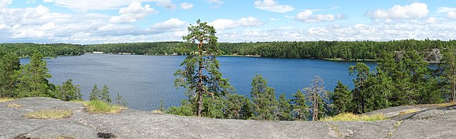
Svenska: Panorama över Flaten med Flatenbadet på andra sidan |
| Date | |
| Source | Own work |
| Author | Holger.Ellgaard |
| Camera location | | View this and other nearby images on: OpenStreetMap |
|---|
Licensing
[edit]
I, the copyright holder of this work, hereby publish it under the following license:
This file is licensed under the Creative Commons Attribution-Share Alike 4.0 International license.
- You are free:
- to share – to copy, distribute and transmit the work
- to remix – to adapt the work
- Under the following conditions:
- attribution – You must give appropriate credit, provide a link to the license, and indicate if changes were made. You may do so in any reasonable manner, but not in any way that suggests the licensor endorses you or your use.
- share alike – If you remix, transform, or build upon the material, you must distribute your contributions under the same or compatible license as the original.
File history
Click on a date/time to view the file as it appeared at that time.
| Date/Time | Thumbnail | Dimensions | User | Comment | |
|---|---|---|---|---|---|
| current | 15:09, 2 July 2020 | 6,666 × 2,036 (4.36 MB) | Holger.Ellgaard (talk | contribs) | Uploaded own work with UploadWizard |
You cannot overwrite this file.
File usage on Commons
There are no pages that use this file.
File usage on other wikis
The following other wikis use this file:
- Usage on sv.wikipedia.org