File:Pancake ice on the Allagash River, Maine.jpg
Jump to navigation
Jump to search
Size of this preview: 800 × 598 pixels. Other resolutions: 320 × 239 pixels | 640 × 478 pixels | 1,024 × 765 pixels | 1,280 × 956 pixels | 2,592 × 1,936 pixels.
Original file (2,592 × 1,936 pixels, file size: 1.92 MB, MIME type: image/jpeg)
Captions
Captions
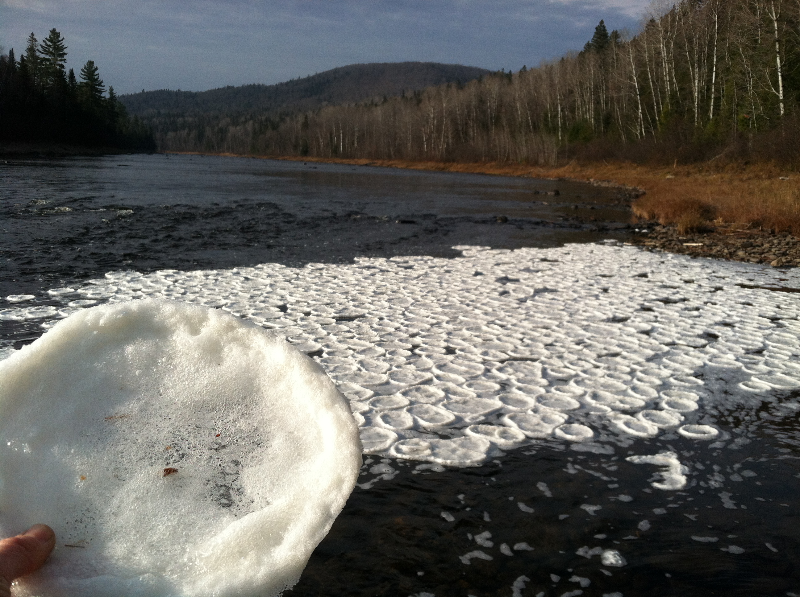
Pancake ice on the Allagash River, Maine, US.
Summary
[edit]
| Description |
English: During an October 31 site visit to USGS streamgage on the Allagash River, Maine, hydrologic technician Laura Flight took this photo of pancake ice, also known as pan ice, collecting in an eddy on the shore of the Allagash River.
The formation of ice on the rivers monitored by the USGS causes a change in the stage-discharge relationship we rely on, so we document ice conditions whenever possible. On the Allagash, we typically see backwater from ice in the last couple weeks of November. Credit: Laura Flight, USGS |
| Date | |
| Source | https://www.flickr.com/photos/usgeologicalsurvey/10690025663/ |
| Author | U.S. Geological Survey |
| Camera location | | View this and other nearby images on: OpenStreetMap |
|---|
Licensing
[edit]
This image is in the public domain in the United States because it only contains materials that originally came from the United States Geological Survey, an agency of the United States Department of the Interior. For more information, see the official USGS copyright policy.
|
| This image was originally posted to Flickr by U.S. Geological Survey at https://flickr.com/photos/27784370@N05/10690025663. It was reviewed on 5 June 2021 by FlickreviewR 2 and was confirmed to be licensed under the terms of the cc-zero. |
File history
Click on a date/time to view the file as it appeared at that time.
| Date/Time | Thumbnail | Dimensions | User | Comment | |
|---|---|---|---|---|---|
| current | 14:23, 5 June 2021 | | 2,592 × 1,936 (1.92 MB) | W.carter (talk | contribs) | Uploaded a work by U.S. Geological Survey from https://www.flickr.com/photos/usgeologicalsurvey/10690025663/ with UploadWizard |
You cannot overwrite this file.
File usage on Commons
The following page uses this file:
File usage on other wikis
The following other wikis use this file:
- Usage on ca.wikipedia.org
- Usage on ceb.wikipedia.org
- Usage on ce.wikipedia.org
- Usage on cy.wikipedia.org
- Usage on es.wikipedia.org
- Usage on eu.wikipedia.org
- Usage on fr.wikipedia.org
- Usage on ht.wikipedia.org
- Usage on hu.wikipedia.org
- Usage on it.wikipedia.org
- Usage on mzn.wikipedia.org
- Usage on pl.wikipedia.org
- Usage on ro.wikipedia.org
- Usage on tt.wikipedia.org
- Usage on www.wikidata.org