File:Palazzo Pisani Gritti 1828.jpg
Jump to navigation
Jump to search
Size of this preview: 800 × 403 pixels. Other resolutions: 320 × 161 pixels | 640 × 322 pixels | 1,024 × 515 pixels | 1,280 × 644 pixels | 3,326 × 1,674 pixels.
Original file (3,326 × 1,674 pixels, file size: 835 KB, MIME type: image/jpeg)
Captions
Captions
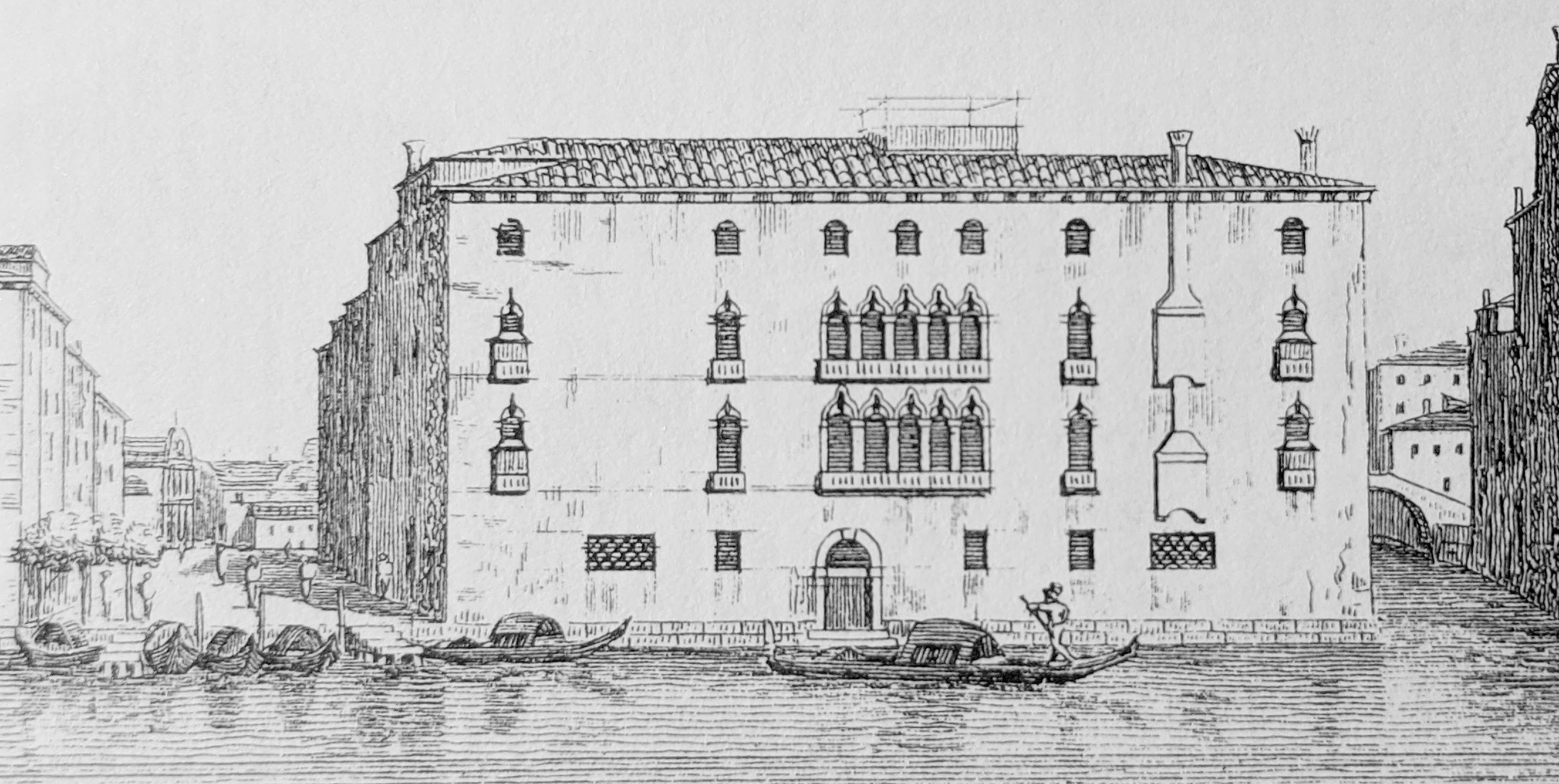
View of the Palazzo Pisani Gritti, Venice, in 1828
Summary
[edit]
| Description |
English: View of the Palazzo Pisani Gritti in 1828, with the Grand Canal in the foreground, the Campo del Traghetto to the left and the Rio de l'Alboro to the right. At the foot of the Campo del Traghetto, gondolas are assembled at the traghetto di Santa Maria del Giglio (which is visible in the background). |
| Date | |
| Source | Antonio Quadri, Dionisio Moretti, Il Canal Grande di Venezia descritto da Antonio Quadri (book), 1828 |
| Author | Dionisio Moretti |
| Camera location | | View this and other nearby images on: OpenStreetMap |
|---|
Licensing
[edit]
|
This work is in the public domain in its country of origin and other countries and areas where the copyright term is the author's life plus 70 years or fewer. This work is in the public domain in the United States because it was published (or registered with the U.S. Copyright Office) before January 1, 1929. | |
| This file has been identified as being free of known restrictions under copyright law, including all related and neighboring rights. | |
File history
Click on a date/time to view the file as it appeared at that time.
| Date/Time | Thumbnail | Dimensions | User | Comment | |
|---|---|---|---|---|---|
| current | 22:32, 16 July 2020 | | 3,326 × 1,674 (835 KB) | Macrakis (talk | contribs) | Uploaded a work by Dionisio Moretti from Antonio Quadri, Dionisio Moretti, Il Canal Grande di Venezia descritto da Antonio Quadri (book), 1828 with UploadWizard |
You cannot overwrite this file.
File usage on Commons
There are no pages that use this file.
File usage on other wikis
The following other wikis use this file:
- Usage on de.wikipedia.org
- Usage on en.wikipedia.org
- Usage on uk.wikipedia.org