File:Painswick Road Crossing - geograph.org.uk - 302764.jpg
Jump to navigation
Jump to search
Size of this preview: 600 × 599 pixels. Other resolutions: 240 × 240 pixels | 639 × 638 pixels.
Original file (639 × 638 pixels, file size: 40 KB, MIME type: image/jpeg)
Captions
Captions
Add a one-line explanation of what this file represents
Summary
[edit]
| Description |
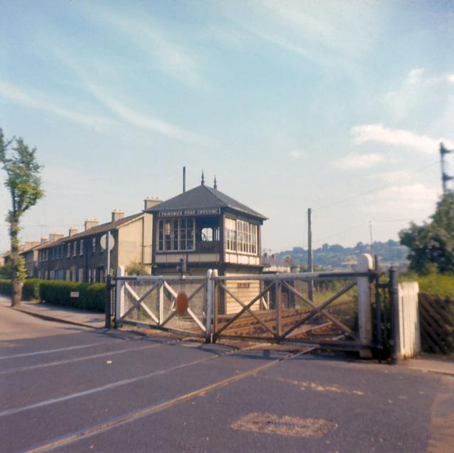
English: Painswick Road Crossing. The level crossing on former Midland Railway line through Gloucester. This line was plagued with a succession of level crossings and was eventually closed in the 1970s. In this 1968 view the signal box controlling the crossing can be seen along with one of the semaphore signals which were still in use at that time. Compare with 77884 (this picture was taken from by the further of the two yellow diversion signs in 77884) and 302769. |
| Date | |
| Source | From geograph.org.uk |
| Author | David Stowell |
| Attribution (required by the license) | David Stowell / Painswick Road Crossing / |
| Object location | | View this and other nearby images on: OpenStreetMap |
|---|
_heading:135.00&language=en)
Licensing
[edit]

|
This image was taken from the Geograph project collection. See this photograph's page on the Geograph website for the photographer's contact details. The copyright on this image is owned by David Stowell and is licensed for reuse under the Creative Commons Attribution-ShareAlike 2.0 license.
|
This file is licensed under the Creative Commons Attribution-Share Alike 2.0 Generic license.
Attribution: David Stowell
- You are free:
- to share – to copy, distribute and transmit the work
- to remix – to adapt the work
- Under the following conditions:
- attribution – You must give appropriate credit, provide a link to the license, and indicate if changes were made. You may do so in any reasonable manner, but not in any way that suggests the licensor endorses you or your use.
- share alike – If you remix, transform, or build upon the material, you must distribute your contributions under the same or compatible license as the original.
File history
Click on a date/time to view the file as it appeared at that time.
| Date/Time | Thumbnail | Dimensions | User | Comment | |
|---|---|---|---|---|---|
| current | 22:17, 22 December 2010 | | 639 × 638 (40 KB) | GeographBot (talk | contribs) | == {{int:filedesc}} == {{Information |description={{en|1=Painswick Road Crossing The level crossing on former Midland Railway line through Gloucester. This line was plagued with a succession of level crossings and was eventually closed in the 1970s. In t |
You cannot overwrite this file.
File usage on Commons
There are no pages that use this file.