File:Pagan-Airstrip-Diagram.png
Jump to navigation
Jump to search

Size of this preview: 511 × 599 pixels. Other resolutions: 205 × 240 pixels | 409 × 480 pixels | 655 × 768 pixels | 873 × 1,024 pixels | 2,495 × 2,927 pixels.
Original file (2,495 × 2,927 pixels, file size: 185 KB, MIME type: image/png)
Captions
Captions
Add a one-line explanation of what this file represents
Summary
[edit]
| Description |
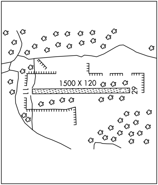
English: Airport Diagram for Pagan Airstrip (TT01) on Pagan Island, Northern Mariana Islands |
| Date | |
| Source | United States Government Flight Information Publication - Chart Supplement Pacific |
| Author | Federal Aviation Administration |
Licensing
[edit]
This image or file is a work of a Federal Aviation Administration employee, taken or made as part of that person's official duties. As a work of the U.S. federal government, the image is in the public domain in the United States.
|
 |
File history
Click on a date/time to view the file as it appeared at that time.
| Date/Time | Thumbnail | Dimensions | User | Comment | |
|---|---|---|---|---|---|
| current | 11:19, 23 July 2021 | | 2,495 × 2,927 (185 KB) | Recoil16 (talk | contribs) | Uploaded a work by Federal Aviation Administration from United States Government Flight Information Publication - Chart Supplement Pacific with UploadWizard |
You cannot overwrite this file.
File usage on Commons
The following page uses this file:
File usage on other wikis
The following other wikis use this file:
- Usage on en.wikipedia.org
- Usage on pl.wikipedia.org