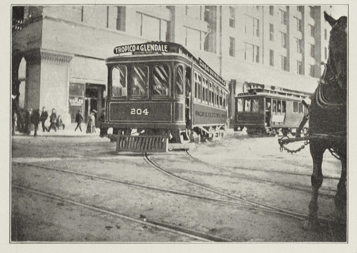
File:Pacific Electric to Tropico Glendale and Casa Verdugo 1906.jpg
Original file (1,197 × 848 pixels, file size: 364 KB, MIME type: image/jpeg)
Captions
Captions
Summary
[edit]
| Description |
English: Pacific Electric to Tropico Glendale and Casa Verdugo 1906 |
| Date | |
| Source |
https://digital.library.ucla.edu/catalog/ark:/21198/zz00096f64 Item Overview TITLE Birdseye view of Casa Verdugo Villa tract, a sub-division of a portion of the old Rancho San Rafael CARTOGRAPHER Haynes, E. G. DATE CREATED circa 1906 PUBLISHER San Rafael Investment Company LANGUAGE English COLLECTION Maps of Los Angeles, California, the United States and the World, circa 1516-1970 Notes DESCRIPTION "Showing the inter-urban railway route from Huntington Building Los Angeles, to Casa Verdugo" Digitization took place as part of the California Cultures Project. Relief shown pictorially. Verso has map of the Casa-Verdugo-Villa tract as well as photographs and publisher's real estate promotional information. Panel left of view: "The scenic trolley route, how to get there" Physical Description EXTENT 1 view DIMENSIONS 24.5 x 53 cm. on sheet 26 x 66 cm. folded to 26 x 10.7 cm. Keywords GENRE cartographic bird's-eye views LOCATION Glendale Region (Calif.)--Aerial views Glendale Region (Calif.)--Description and travel--Maps RESOURCE TYPE still image SUBJECTS Real property--California--Los Angeles County--Maps |
| Author | San Rafael Investment Co. |
Licensing
[edit]
This work is in the public domain in the United States because it was published (or registered with the U.S. Copyright Office) before January 1, 1929.
Public domain works must be out of copyright in both the United States and in the source country of the work in order to be hosted on the Commons. If the work is not a U.S. work, the file must have an additional copyright tag indicating the copyright status in the source country.
Note: This tag should not be used for sound recordings. |
File history
Click on a date/time to view the file as it appeared at that time.
| Date/Time | Thumbnail | Dimensions | User | Comment | |
|---|---|---|---|---|---|
| current | 07:37, 27 September 2023 | | 1,197 × 848 (364 KB) | Jengod (talk | contribs) | Uploaded a work by San Rafael Investment Co. from https://digital.library.ucla.edu/catalog/ark:/21198/zz00096f64 Item Overview TITLE Birdseye view of Casa Verdugo Villa tract, a sub-division of a portion of the old Rancho San Rafael CARTOGRAPHER Haynes, E. G. DATE CREATED circa 1906 PUBLISHER San Rafael Investment Company LANGUAGE English COLLECTION Maps of Los Angeles, California, the United States and the World, circa 1516-1970 Notes DESCRIPTION "Showing the inter-urban railway route from... |
You cannot overwrite this file.
File usage on Commons
The following page uses this file:
File usage on other wikis
The following other wikis use this file:
- Usage on en.wikipedia.org