File:PUTNAM MEMORIAL STATE PARK.jpg
Jump to navigation
Jump to search
Size of this preview: 396 × 599 pixels. Other resolutions: 158 × 240 pixels | 317 × 480 pixels | 508 × 768 pixels | 677 × 1,024 pixels | 1,354 × 2,048 pixels | 3,464 × 5,240 pixels.
Original file (3,464 × 5,240 pixels, file size: 2.15 MB, MIME type: image/jpeg)
Captions
Captions
Add a one-line explanation of what this file represents
Summary
[edit]
| Description |
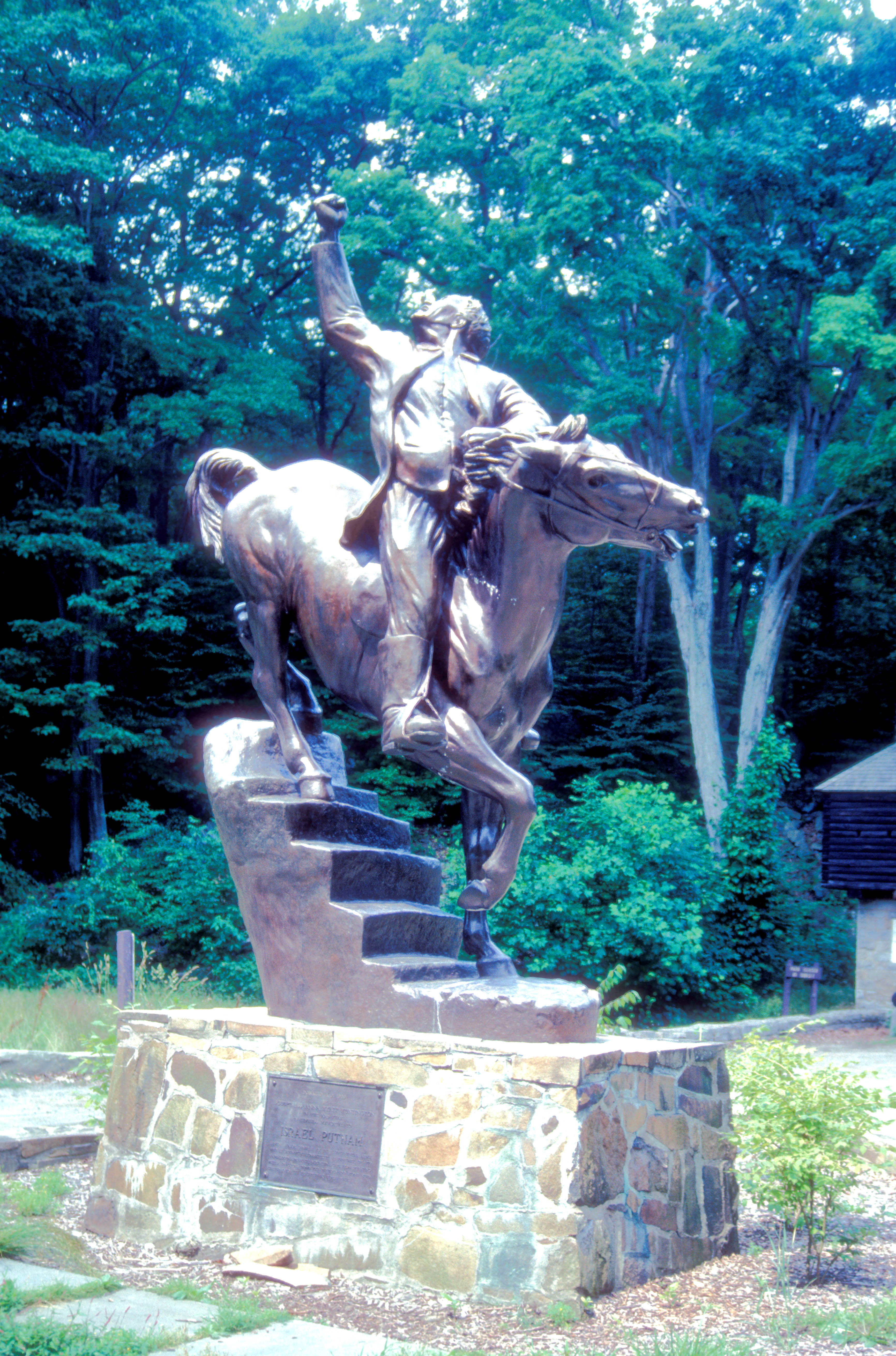
English: THIS STATUE DEPICTS PUTNAM ESCAPING BRITISH CAPTURE BY RIDING HIS HORSE DOWN A FLIGHT OF STAIRS DURING THE REVOLUTIONARY WAR
|
||
| Date | |||
| Source | Own work | ||
| Author | ROY KLOTZ M.D. |
| Camera location | | View this and other nearby images on: OpenStreetMap |
|---|
Licensing
[edit]
This work is in the public domain in the United States because it was published in the United States between 1929 and 1977, inclusive, without a copyright notice. For further explanation, see Commons:Hirtle chart as well as a detailed definition of "publication" for public art. Note that it may still be copyrighted in jurisdictions that do not apply the rule of the shorter term for US works (depending on the date of the author's death), such as Canada (50 p.m.a.), Mainland China (50 p.m.a., not Hong Kong or Macao), Germany (70 p.m.a.), Mexico (100 p.m.a.), Switzerland (70 p.m.a.), and other countries with individual treaties.
|
 |
I, the copyright holder of this work, hereby publish it under the following license:
This file is licensed under the Creative Commons Attribution-Share Alike 3.0 Unported license.
- You are free:
- to share – to copy, distribute and transmit the work
- to remix – to adapt the work
- Under the following conditions:
- attribution – You must give appropriate credit, provide a link to the license, and indicate if changes were made. You may do so in any reasonable manner, but not in any way that suggests the licensor endorses you or your use.
- share alike – If you remix, transform, or build upon the material, you must distribute your contributions under the same or compatible license as the original.
File history
Click on a date/time to view the file as it appeared at that time.
| Date/Time | Thumbnail | Dimensions | User | Comment | |
|---|---|---|---|---|---|
| current | 17:14, 17 November 2012 | | 3,464 × 5,240 (2.15 MB) | Ras67 (talk | contribs) | losslessly cropped with Jpegcrop, GPS data added |
| 00:24, 11 October 2012 |  | 3,946 × 5,782 (2.5 MB) | KLOTZ (talk | contribs) | User created page with UploadWizard |
You cannot overwrite this file.
File usage on Commons
The following 2 pages use this file:
File usage on other wikis
The following other wikis use this file:
- Usage on ceb.wikipedia.org
- Usage on de.wikipedia.org
- Usage on en.wikipedia.org
- Usage on es.wikipedia.org
- Usage on www.wikidata.org