File:POL Wisła Dziechcinka Wiadukt kolejowy - tabliczka.JPG
Jump to navigation
Jump to search
Size of this preview: 666 × 599 pixels. Other resolutions: 267 × 240 pixels | 533 × 480 pixels | 1,000 × 900 pixels.
Original file (1,000 × 900 pixels, file size: 402 KB, MIME type: image/jpeg)
Captions
Captions
Add a one-line explanation of what this file represents
Summary
[edit]
| Description |
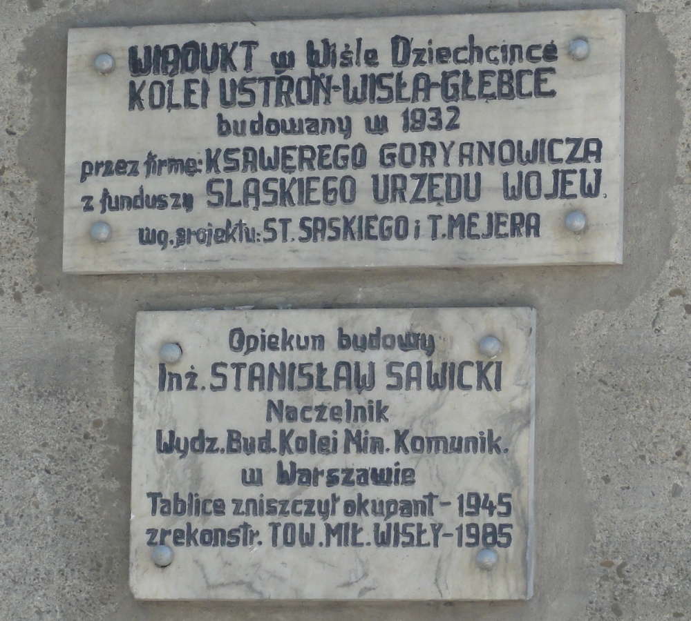
Polski: Tablica pamiątkowa na filarze wiaduktu kolejowego zlokalizowanego w południowej części Wisły przebiegającego nad potokiem Dziechcinka. Wiadukt kolejowy o długości 68,60 metrów wykonany został w 1932 roku według projektu Stanisława Saskiego i Tadeusza Mejera.
English: Plaque under railway bridge in Wisła. |
| Source | Own work |
| Author | D T G |
| Camera location | | View this and other nearby images on: OpenStreetMap |
|---|
Licensing
[edit]
I, the copyright holder of this work, hereby publish it under the following licenses:

|
Permission is granted to copy, distribute and/or modify this document under the terms of the GNU Free Documentation License, Version 1.2 or any later version published by the Free Software Foundation; with no Invariant Sections, no Front-Cover Texts, and no Back-Cover Texts. A copy of the license is included in the section entitled GNU Free Documentation License. |
This file is licensed under the Creative Commons Attribution 3.0 Unported license.
- You are free:
- to share – to copy, distribute and transmit the work
- to remix – to adapt the work
- Under the following conditions:
- attribution – You must give appropriate credit, provide a link to the license, and indicate if changes were made. You may do so in any reasonable manner, but not in any way that suggests the licensor endorses you or your use.
You may select the license of your choice.
File history
Click on a date/time to view the file as it appeared at that time.
| Date/Time | Thumbnail | Dimensions | User | Comment | |
|---|---|---|---|---|---|
| current | 18:26, 6 May 2011 | | 1,000 × 900 (402 KB) | D T G (talk | contribs) | {{Information |Description ={{en|1=Plaque under railway bridge in Wisła Dziechcinka}} {{pl|1=Tabliczka pod kolejowym mostem w Wiśle-Dziechcince}} |Source ={{own}} |Author =D T G |Date = |Permission = |othe |
You cannot overwrite this file.
File usage on Commons
The following page uses this file: