File:PIA21571 - Dunes of the Southern Highlands.jpg

Original file (2,880 × 1,800 pixels, file size: 711 KB, MIME type: image/jpeg)
Captions
Captions
Summary
[edit]
| Description |
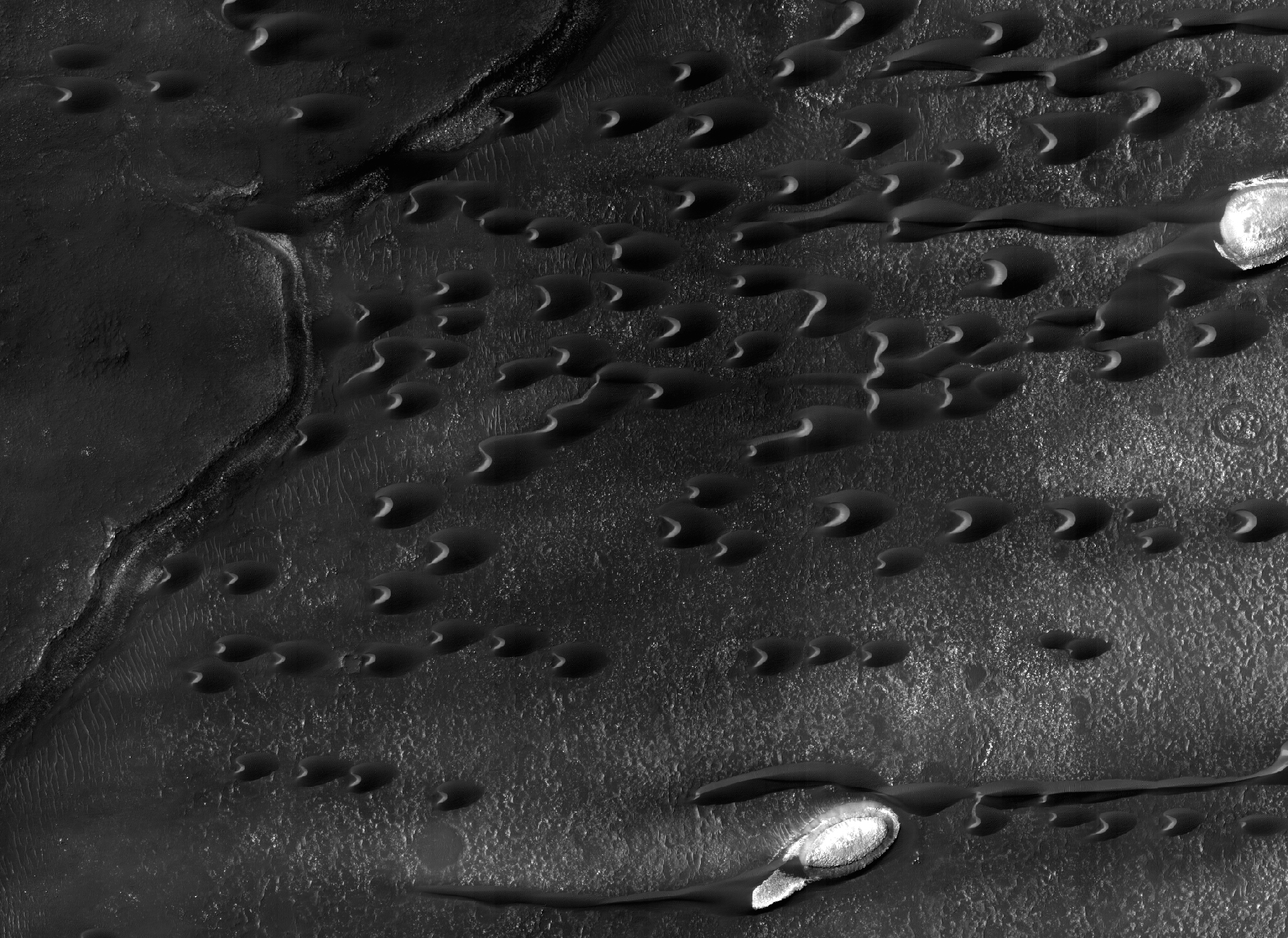
English: Sand dunes are scattered across Mars and one of the larger populations exists in the Southern hemisphere, just west of the Hellas impact basin. The Hellespontus region features numerous collections of dark, dune formations that collect both within depressions such as craters, and among "extra-crater" plains areas.
This image displays the middle portion of a large dune field composed primarily of crescent-shaped "barchan" dunes. Here, the steep, sunlit side of the dune, called a slip face, indicates the down-wind side of the dune and direction of its migration. Other long, narrow linear dunes known as "seif" dunes are also here and in other locales to the east. NB: "Seif" comes from the Arabic word meaning "sword." The map is projected here at a scale of 25 centimeters (9.8 inches) per pixel. [The original image scale is 25.5 centimeters (10 inches) per pixel (with 1 x 1 binning); objects on the order of 77 centimeters (30.3 inches) across are resolved.] North is up. The University of Arizona, Tucson, operates HiRISE, which was built by Ball Aerospace & Technologies Corp., Boulder, Colo. NASA's Jet Propulsion Laboratory, a division of Caltech in Pasadena, California, manages the Mars Reconnaissance Orbiter Project for NASA's Science Mission Directorate, Washington. |
| Date | 6 February 2017 (published 23 March 2017) |
| Source | Catalog page · Full-res (JPEG · TIFF) |
| Author | NASA/JPL-Caltech/Univ. of Arizona |
| Location on Mars | View this and other nearby images on: Google Maps |
|---|
This image or video was catalogued by Jet Propulsion Laboratory of the United States National Aeronautics and Space Administration (NASA) under Photo ID: PIA21571. This tag does not indicate the copyright status of the attached work. A normal copyright tag is still required. See Commons:Licensing. Other languages:
|
 |
This media is a product of the Mars Reconnaissance Orbiter mission Credit and attribution belongs to the High Resolution Imaging Science Experiment (HiRISE) team, NASA/JPL-Caltech/Univ. of Arizona |
Licensing
[edit]
| This file is in the public domain in the United States because it was solely created by NASA. NASA copyright policy states that "NASA material is not protected by copyright unless noted". (See Template:PD-USGov, NASA copyright policy page or JPL Image Use Policy.) | ||
 |
Warnings:
|
File history
Click on a date/time to view the file as it appeared at that time.
| Date/Time | Thumbnail | Dimensions | User | Comment | |
|---|---|---|---|---|---|
| current | 16:39, 24 March 2017 | | 2,880 × 1,800 (711 KB) | PhilipTerryGraham (talk | contribs) | User created page with UploadWizard |
You cannot overwrite this file.
File usage on Commons
The following page uses this file: