File:PIA21217 - Colorful Bedrock Exposed in a Landslide Scarp.jpg
Jump to navigation
Jump to search

Size of this preview: 800 × 500 pixels. Other resolutions: 320 × 200 pixels | 640 × 400 pixels | 1,024 × 640 pixels | 1,280 × 800 pixels | 2,880 × 1,800 pixels.
Original file (2,880 × 1,800 pixels, file size: 871 KB, MIME type: image/jpeg)
Captions
Captions
Add a one-line explanation of what this file represents
Summary
[edit]
| Description |
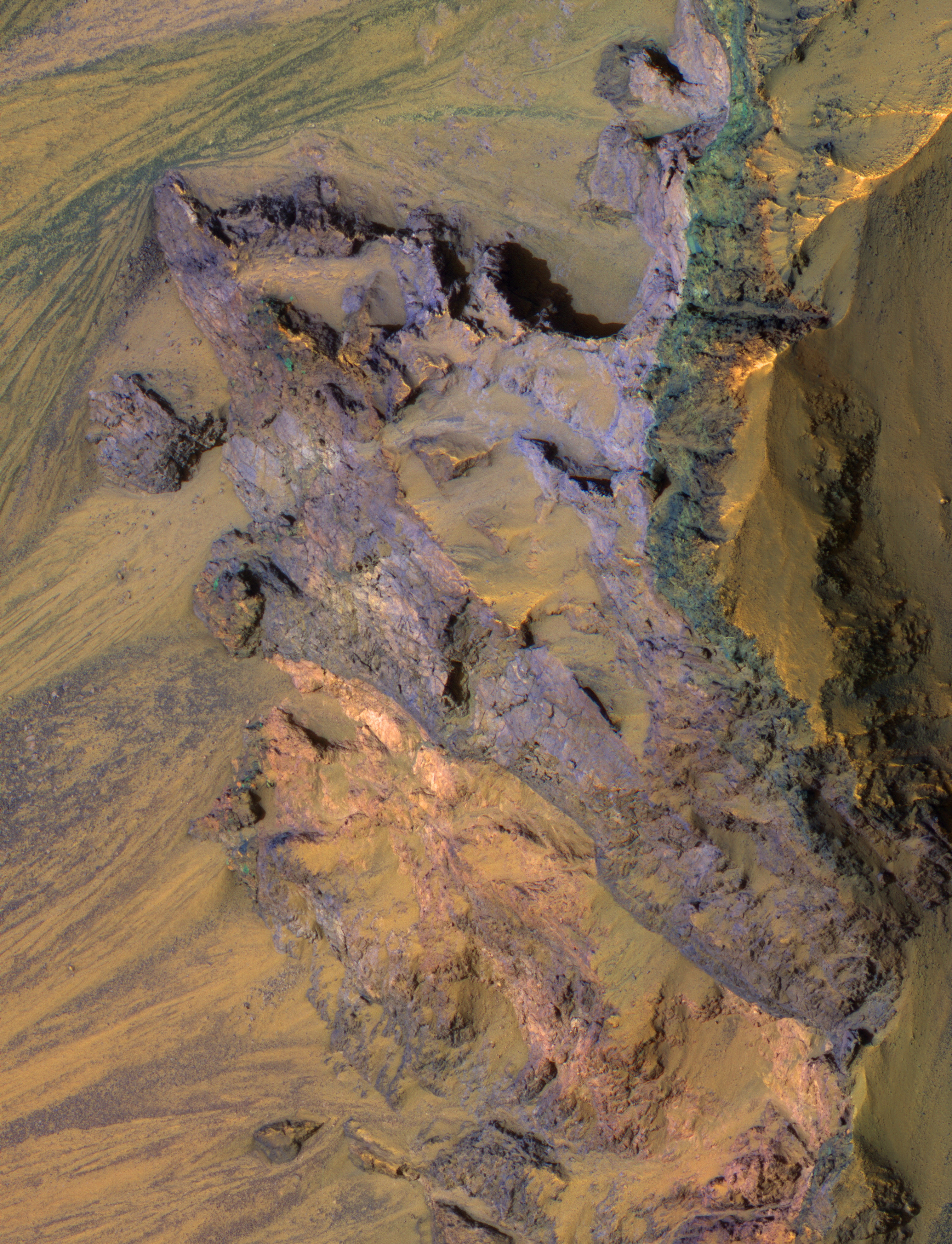
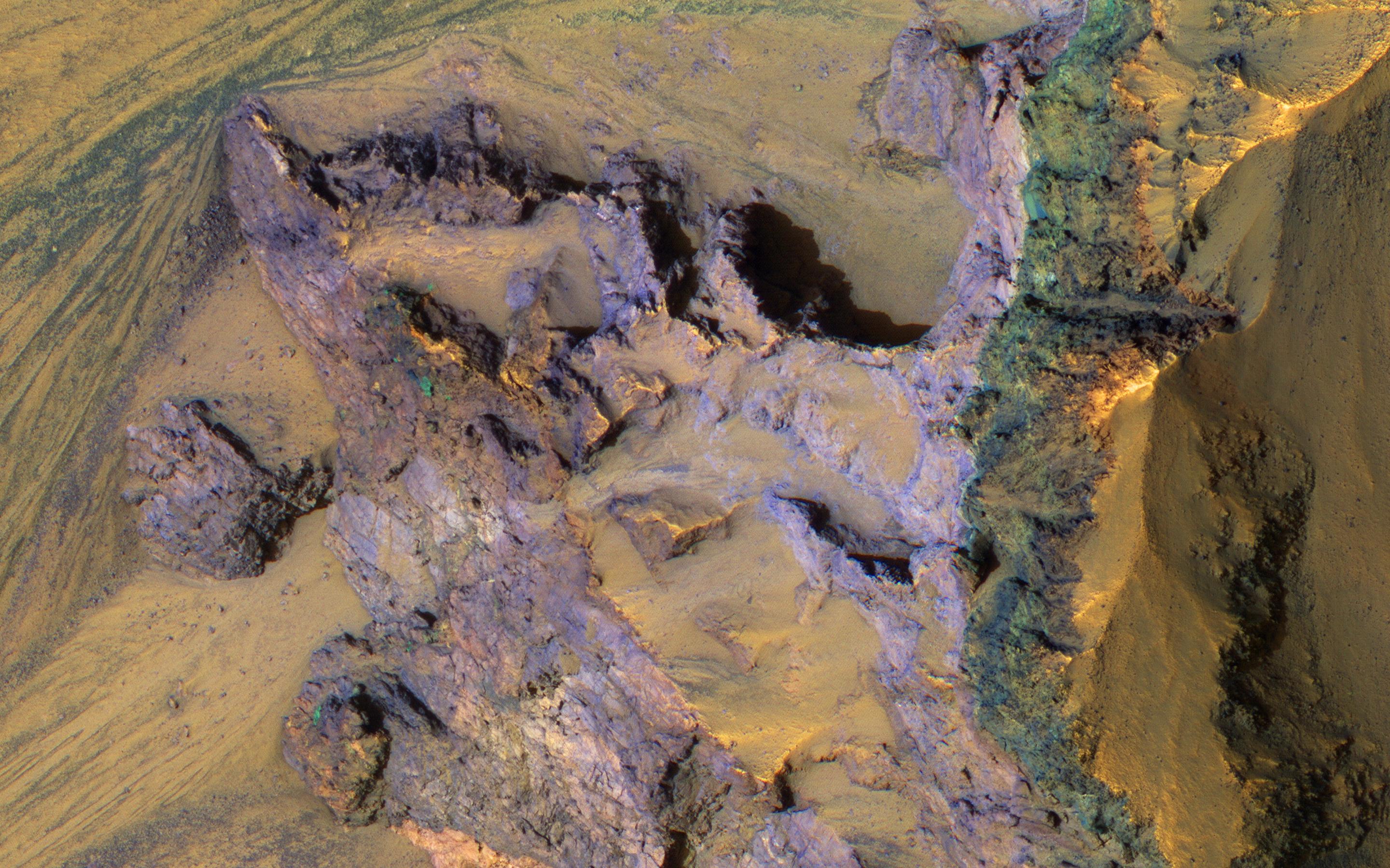
English: The steep walls of Valles Marineris sometimes fail, creating giant landslides. This provides a clean exposure of the underlying bedrock.
This image of the north wall of Ganges Chasma reveals bedrock with diverse colors and textures, representing different geologic units. The University of Arizona, Tucson, operates HiRISE, which was built by Ball Aerospace & Technologies Corp., Boulder, Colo. NASA's Jet Propulsion Laboratory, a division of Caltech in Pasadena, California, manages the Mars Reconnaissance Orbiter Project for NASA's Science Mission Directorate, Washington. |
| Date | 13 September 2016 (published 7 December 2016) |
| Source | Catalog page · Full-res (JPEG · TIFF) |
| Author | NASA/JPL-Caltech/Univ. of Arizona |
| Location on Mars | View this and other nearby images on: Google Maps |
|---|
This image or video was catalogued by Jet Propulsion Laboratory of the United States National Aeronautics and Space Administration (NASA) under Photo ID: PIA21217. This tag does not indicate the copyright status of the attached work. A normal copyright tag is still required. See Commons:Licensing. Other languages:
|
 |
This media is a product of the Mars Reconnaissance Orbiter mission Credit and attribution belongs to the mission team, if not already specified in the "author" row |
Licensing
[edit]
| This file is in the public domain in the United States because it was solely created by NASA. NASA copyright policy states that "NASA material is not protected by copyright unless noted". (See Template:PD-USGov, NASA copyright policy page or JPL Image Use Policy.) | ||
 |
Warnings:
|
File history
Click on a date/time to view the file as it appeared at that time.
| Date/Time | Thumbnail | Dimensions | User | Comment | |
|---|---|---|---|---|---|
| current | 14:04, 25 February 2017 | | 2,880 × 1,800 (871 KB) | PhilipTerryGraham (talk | contribs) | User created page with UploadWizard |
You cannot overwrite this file.
File usage on Commons
The following page uses this file: