File:PIA09211.jpg
Original file (1,544 × 1,292 pixels, file size: 330 KB, MIME type: image/jpeg)
Captions
Captions
Summary
[edit]
| Description |
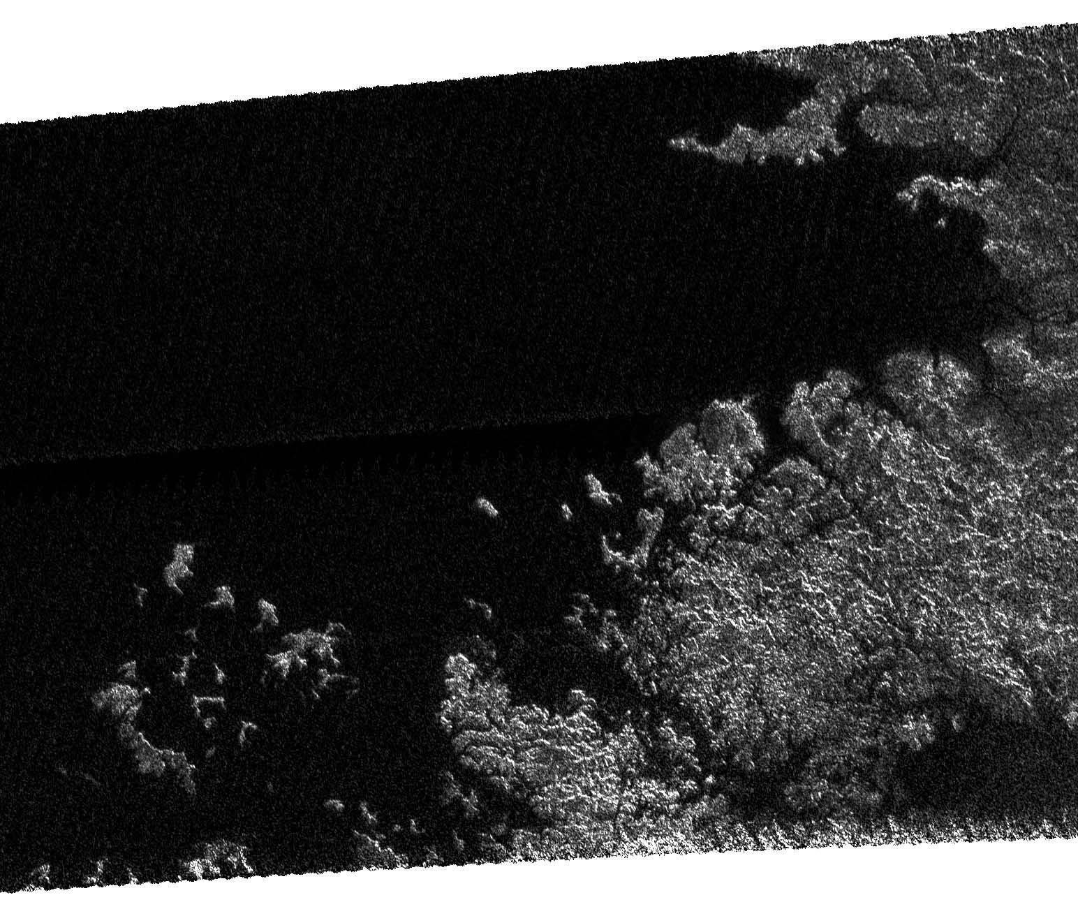
On May 12, 2007, Cassini completed its 31st flyby of Saturn's moon Titan, which the team calls T30. The radar instrument obtained this image showing the coastline and numerous island groups of a portion of a large sea, consistent with the larger sea seen by the Cassini imaging instrument (See Seeing Farther North). Like other bodies of liquid seen on Titan, this feature reveals channels, islands, bays, and other features typical of terrestrial coastlines, and the liquid, most likely a combination of methane and ethane, appears very dark to the radar instrument. What is striking about this portion of the sea compared to other liquid bodies on Titan is the relative absence of brighter regions within it, suggesting that the depth of the liquid here exceeds tens of meters (tens of yards). Of particular note is the presence of isolated islands, which follow the same direction as the peninsula to their lower right, suggesting that they may be part of a mountain ridgeline that has been flooded. This is analogous to, for example, Catalina Island off the coast of Southern California. The image as shown is about 160 kilometers (100 miles) by 270 kilometers (170 miles) at 300-meter (980-foot) resolution. The image is centered near 70 degrees north latitude and 310 west longitude. |
| Date | |
| Source | http://saturn.jpl.nasa.gov/multimedia/images/image-details.cfm?imageID=2614 |
| Author | NASA/JPL |
Licensing
[edit]
| This file is in the public domain in the United States because it was solely created by NASA. NASA copyright policy states that "NASA material is not protected by copyright unless noted". (See Template:PD-USGov, NASA copyright policy page or JPL Image Use Policy.) | ||
 |
Warnings:
|
File history
Click on a date/time to view the file as it appeared at that time.
| Date/Time | Thumbnail | Dimensions | User | Comment | |
|---|---|---|---|---|---|
| current | 17:12, 24 May 2007 | | 1,544 × 1,292 (330 KB) | PeterfromTitan~commonswiki (talk | contribs) | {{Information |Description=On May 12, 2007, Cassini completed its 31st flyby of Saturn's moon Titan, which the team calls T30. The radar instrument obtained this image showing the coastline and numerous island groups of a portion of a large sea, consisten |
You cannot overwrite this file.
File usage on Commons
There are no pages that use this file.
File usage on other wikis
The following other wikis use this file:
- Usage on ar.wikipedia.org
- Usage on ca.wikipedia.org
- Usage on en.wikipedia.org
- Usage on hi.wikipedia.org
- Usage on hy.wikipedia.org
- Usage on ja.wikipedia.org
- Usage on ka.wikipedia.org
- Usage on nl.wikipedia.org
- Usage on pt.wikipedia.org
- Usage on ru.wikipedia.org
- Usage on ta.wikipedia.org
- Usage on xmf.wikipedia.org
- Usage on zh.wikipedia.org