File:PADLOCK (FindID 581867).jpg

Original file (1,760 × 1,455 pixels, file size: 501 KB, MIME type: image/jpeg)
Captions
Captions
Summary
[edit].jpg&action=edit§ion=1)
| PADLOCK | |||
|---|---|---|---|
| Photographer |
Kent County Council, Richie Morrissey, 2017-06-17 14:10:22 |
||
| Title |
PADLOCK |
||
| Description |
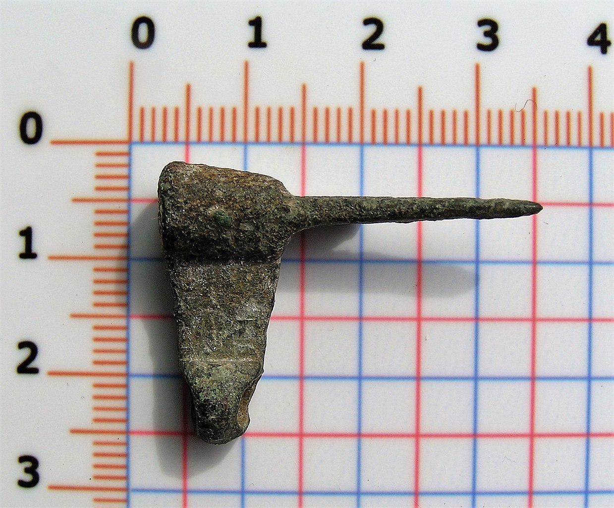
English: An incomplete copper alloy Medieval cylindrical barrel padlock mechanism, c.AD 1200-1400. The padlock mechanism consists of a two cylindrical sections connected by a rectangular central section. The upper cylindrical section has a circular perforation, the lower is solid. The rectangular projection has a small circular projection in its centre.The solid cylindrical section has two rectangular projections which have circular perforations at the terminals and show evidence of solder on both the upper and lower face. Measurements: 31.49mm in length, 7.94mm in width, 23.31mm high and 6.46g in wieght Discussion: Similar objects are recorded in Read 'Metal Artefacts of Antiquity' 2001 fig47 page 73 no 571, and are frequently reported to the PAS such as :<a href="https://finds.org.uk/database/artefacts/record/id/778937" title="View details for KENT-FCD35D">KENT-FCD35D</a> and<a href="https://finds.org.uk/database/artefacts/record/id/766723" title="View details for WILT-885032">WILT-885032</a>. |
||
| Depicted place | (County of findspot) Suffolk | ||
| Date | between 1200 and 1400 | ||
| Accession number |
FindID: 581867 Old ref: PUBLIC-4EC075 Filename: P5300032.JPG |
||
| Credit line |
|
||
| Source |
https://finds.org.uk/database/ajax/download/id/619206 Catalog: https://finds.org.uk/database/images/image/id/619206/recordtype/artefacts archive copy at the Wayback Machine |
||
| Permission (Reusing this file) |
Attribution License version 2.0 (verified 21 November 2020) | ||
| Object location | | View this and other nearby images on: OpenStreetMap |
|---|
.jpg¶ms=052.311900_N_0001.478200_E_globe:Earth_class:object_type:object__&language=en)
Licensing
[edit].jpg&action=edit§ion=2)
- You are free:
- to share – to copy, distribute and transmit the work
- to remix – to adapt the work
- Under the following conditions:
- attribution – You must give appropriate credit, provide a link to the license, and indicate if changes were made. You may do so in any reasonable manner, but not in any way that suggests the licensor endorses you or your use.
File history
Click on a date/time to view the file as it appeared at that time.
| Date/Time | Thumbnail | Dimensions | User | Comment | |
|---|---|---|---|---|---|
| current | 09:48, 15 December 2018 | | 1,760 × 1,455 (501 KB) | Fæ (talk | contribs) | Portable Antiquities Scheme, PUBLIC, FindID: 581867, medieval, page 1489, batch count 5028 |
You cannot overwrite this file.
File usage on Commons
The following page uses this file:
.jpg)
.jpg&oldid=643503980)