File:Pāvilostas dienvidu mols - panoramio.jpg
Jump to navigation
Jump to search

Size of this preview: 800 × 534 pixels. Other resolutions: 320 × 214 pixels | 640 × 427 pixels | 1,024 × 684 pixels | 1,280 × 855 pixels | 2,560 × 1,709 pixels | 5,496 × 3,670 pixels.
Original file (5,496 × 3,670 pixels, file size: 8.88 MB, MIME type: image/jpeg)
Captions
Captions
Add a one-line explanation of what this file represents
Summary
[edit]
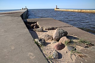
| Description | Pāvilostas dienvidu mols | ||
| Date | Taken on 7 May 2016 | ||
| Source | https://web.archive.org/web/20161103050837/http://www.panoramio.com/photo/130186956 | ||
| Author | Laima Gūtmane (simka… | ||
| Permission (Reusing this file) |
This file is licensed under the Creative Commons Attribution-Share Alike 3.0 Unported license. Attribution: Laima Gūtmane (simka…
|
||
| Panoramio Tags | Pāvilosta, *LATVIA, 2016, sea |
| Camera location | | View this and other nearby images on: OpenStreetMap |
|---|
File history
Click on a date/time to view the file as it appeared at that time.
| Date/Time | Thumbnail | Dimensions | User | Comment | |
|---|---|---|---|---|---|
| current | 18:03, 6 July 2017 | | 5,496 × 3,670 (8.88 MB) | Panoramio upload bot (talk | contribs) | == {{int:filedesc}} == {{Information |description=Pāvilostas dienvidu mols |date={{Taken on|2016-05-07}} |source=http://www.panoramio.com/photo/130186956 |author=[http://www.panoramio.com/user/1038849?with_photo_id=130186956 Laima Gūtmane (simka…]... |
You cannot overwrite this file.
File usage on Commons
There are no pages that use this file.