File:Owyhee River BLM.jpg
Jump to navigation
Jump to search

Size of this preview: 405 × 599 pixels. Other resolutions: 162 × 240 pixels | 634 × 937 pixels.
Original file (634 × 937 pixels, file size: 285 KB, MIME type: image/jpeg)
Captions
Captions
Add a one-line explanation of what this file represents
| Description |
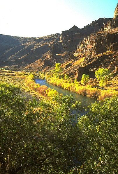
English: The Owyhee River, which flows from northern Nevada through southwestern Idaho, and through southeastern Oregon into the Snake River. |
|||
| Date | ||||
| Source | http://www.oregonencyclopedia.org/entry/view/owyhee_river/ | |||
| Author | U.S. Bureau of Land Management, Oregon | |||
| Permission (Reusing this file) |
|
File history
Click on a date/time to view the file as it appeared at that time.
| Date/Time | Thumbnail | Dimensions | User | Comment | |
|---|---|---|---|---|---|
| current | 00:43, 30 July 2012 | | 634 × 937 (285 KB) | Jsayre64 (talk | contribs) | crop out black space |
| 00:41, 30 July 2012 |  | 667 × 1,000 (351 KB) | Jsayre64 (talk | contribs) | {{Information |Description ={{en|1=The Owyhee River, which flows from northern Nevada through southwestern Idaho and southeastern Oregon, into the Snake River}} |Source =http://www.oregonencyclopedia.org/entry/view/owyhee_river/ |Author ... |
You cannot overwrite this file.
File usage on Commons
The following page uses this file:
File usage on other wikis
The following other wikis use this file:
- Usage on ar.wikipedia.org
- Usage on arz.wikipedia.org
- Usage on ceb.wikipedia.org
- Usage on de.wikipedia.org
- Usage on en.wikipedia.org
- Usage on es.wikipedia.org
- Usage on fr.wikipedia.org
- Usage on kk.wikipedia.org
- Usage on ru.wikipedia.org
- Usage on www.wikidata.org
- Usage on xmf.wikipedia.org
- Usage on zh.wikipedia.org