File:Ouvrage-g (11).jpg
Jump to navigation
Jump to search

Size of this preview: 800 × 600 pixels. Other resolutions: 320 × 240 pixels | 640 × 480 pixels | 1,024 × 768 pixels | 1,280 × 960 pixels | 2,560 × 1,920 pixels | 3,648 × 2,736 pixels.
Original file (3,648 × 2,736 pixels, file size: 3.17 MB, MIME type: image/jpeg)
Captions
Captions
Add a one-line explanation of what this file represents
Summary
[edit]| Description |
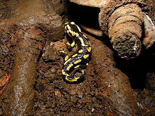
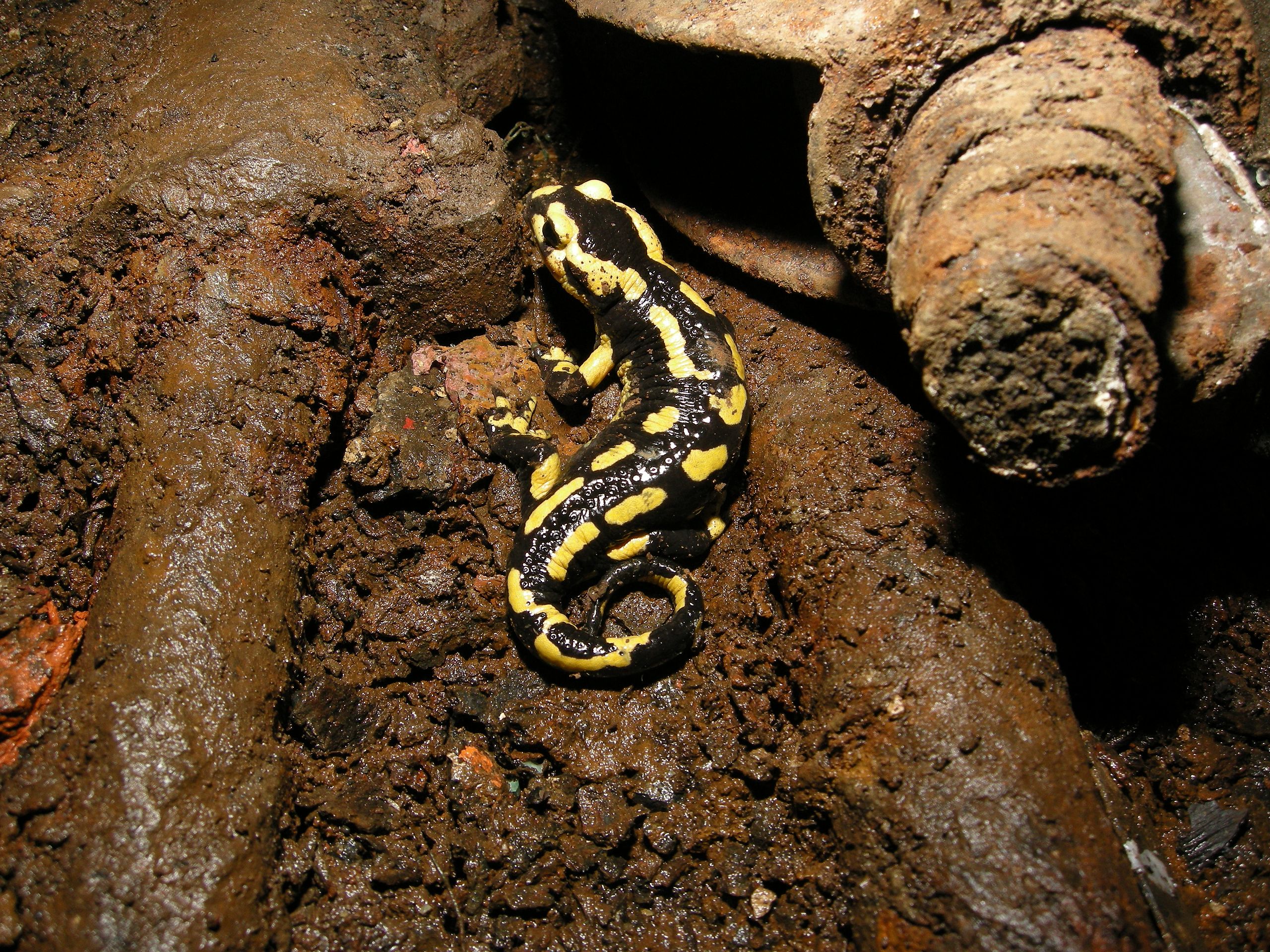
Salamandre, à la sortie du puits n°7 de l'Ouvrage "G" de la D.A.T. (OTAN) Salbert hill fortifications. Old NATO station. |
||||||||||||||||||||||
| Date | |||||||||||||||||||||||
| Source |
|
||||||||||||||||||||||
| Author |
Thomas Bresson from Belfort, France
|
||||||||||||||||||||||
| Other versions | Derivative works of this file: Ouvrage-g (11) cropped.jpg | ||||||||||||||||||||||

.jpg&action=edit§ion=1)
_cropped.jpg)
| Camera location | | View this and other nearby images on: OpenStreetMap |
|---|
.jpg¶ms=047.659922_N_0006.812569_E_globe:Earth_type:camera_source:Flickr_&language=en)
Licensing
[edit].jpg&action=edit§ion=2)
This file is licensed under the Creative Commons Attribution 2.0 Generic license.
- You are free:
- to share – to copy, distribute and transmit the work
- to remix – to adapt the work
- Under the following conditions:
- attribution – You must give appropriate credit, provide a link to the license, and indicate if changes were made. You may do so in any reasonable manner, but not in any way that suggests the licensor endorses you or your use.
| This image, originally posted to Flickr, was reviewed on May 1, 2010 by the administrator or reviewer File Upload Bot (Magnus Manske), who confirmed that it was available on Flickr under the stated license on that date. |
This image has been assessed using the Quality image guidelines and is considered a Quality image.
|
File history
Click on a date/time to view the file as it appeared at that time.
| Date/Time | Thumbnail | Dimensions | User | Comment | |
|---|---|---|---|---|---|
| current | 13:35, 1 May 2010 | | 3,648 × 2,736 (3.17 MB) | File Upload Bot (Magnus Manske) (talk | contribs) | {{Information |Description=Salamandre, � la sortie du puits n�7 de l'Ouvrage "G" de la D.A.T. (OTAN) Salbert hill fortifications. Old NATO station. |Source=[http://www.flickr.com/photos/36519414@N00/4567870730/ Salamandridae sp.] * Uploade |
You cannot overwrite this file.
File usage on Commons
The following 8 pages use this file:
- User:ComputerHotline/Archive 1
- User:ComputerHotline/Fort du Salbert
- Commons:Featured picture candidates/File:Ouvrage-g (11).jpg
- Commons:Featured picture candidates/Log/May 2010
- Commons:Quality images/Subject/Animals/Amphibians
- Commons:Quality images candidates/Archives May 2010
- Commons:Valued image candidates/Ouvrage-g (11).jpg
- File:Ouvrage-g (11) cropped.jpg
.jpg)
.jpg)
File usage on other wikis
The following other wikis use this file:
- Usage on en.wikipedia.org
- Usage on fr.wikipedia.org
- Usage on ru.wikipedia.org
.jpg&oldid=923308829)