File:Outline Map of Altai Krai.svg
Jump to navigation
Jump to search

Size of this PNG preview of this SVG file: 512 × 382 pixels. Other resolutions: 320 × 239 pixels | 640 × 478 pixels | 1,024 × 764 pixels | 1,280 × 955 pixels | 2,560 × 1,910 pixels.
Original file (SVG file, nominally 512 × 382 pixels, file size: 295 KB)
Captions
Captions
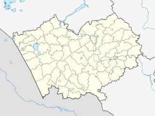
Position map of Altai Krai
Summary
[edit]| Description |
Русский: Позиционная карта Алтайского края
|top    = 55
|bottom = 50
|left   = 77
|right  = 88
English: Positional map of the Altai Territory
The projection is equiangular. The standard parallel is 52°30'N. Template parameters (edge coordinates): |
| Date | |
| Source |
|
| Author | Виктор В |
| Other versions |
[] |
| SVG development |


Licensing
[edit]
This file is licensed under the Creative Commons Attribution-Share Alike 2.0 Generic license.
- You are free:
- to share – to copy, distribute and transmit the work
- to remix – to adapt the work
- Under the following conditions:
- attribution – You must give appropriate credit, provide a link to the license, and indicate if changes were made. You may do so in any reasonable manner, but not in any way that suggests the licensor endorses you or your use.
- share alike – If you remix, transform, or build upon the material, you must distribute your contributions under the same or compatible license as the original.
File history
Click on a date/time to view the file as it appeared at that time.
| Date/Time | Thumbnail | Dimensions | User | Comment | |
|---|---|---|---|---|---|
| current | 22:51, 28 August 2016 | | 512 × 382 (295 KB) | Gajmar (talk | contribs) | Slavgorod, Kamen-na-Obi |
| 16:08, 26 September 2010 |  | 512 × 382 (294 KB) | Виктор В (talk | contribs) | == {{int:filedesc}} == {{Information |Description={{ru|1=Позиционная карта Алтайского края *Проекция — равноугольная. *Стандартная параллель — 52°30'с.ш. *Параметры ш� |
You cannot overwrite this file.
File usage on Commons
The following 3 pages use this file:
File usage on other wikis
The following other wikis use this file:
- Usage on af.wikipedia.org
- Usage on alt.wikipedia.org
- Usage on ar.wikipedia.org
- Usage on azb.wikipedia.org
- ارموشیخا
- اوبرازتسووکا
- اوبسکوی، روسیه
- اوترادا، آلتای دیاری
- اوترادنوی، آلتای دیاری
- زاکلادنوی
- زاکووریاشینو
- اوتیانکا
- زاوتی ایلییچا، آلتای دیاری
- بلوقلازووو
- اودالنوی
- بلووو، آلتای دیاری
- اودینتسووکا
- بلوی، آلتای دیاری
- زتلان، روسیه
- زرکالی، روسیه
- زرنو، روسیه
- زلاتوپول، آلتای دیاری
- کیسلوخا، روسیه
- زلیونایا پولیانا، آلتای دیاری
- زلیونایا دوبراوا
- زلیونایا دوبراوا، آلتای دیاری
- زلیونایا روشچا، آلتای دیاری
- اورخووو، آلتای دیاری
- زلیونی لوق
- بوبرووکا
- بوبرووکا، آلتای دیاری
- کیلتی، آلتای دیاری
- اورژوم، آلتای دیاری
- زملیانوخا
- بوبکووو، روسیه
- زنئیمنکا، آلتای دیاری
- اورلاپووو
- کینرال، روسیه
- اورلووکا، آلتای دیاری
- اورلووو، روسیه
- اورلین، آلتای دیاری
- زوزرنی، آلتای دیاری
- بور-فورپوزت
- بور-کوزوبولات
- زولوتوخا، آلتای دیاری
- کئیمنکا، آلتای دیاری
- بورانووکا
View more global usage of this file.