File:Outdoor DSLAM Endstufe.JPG
From Wikimedia Commons, the free media repository
Jump to navigation
Jump to search
Size of this preview: 800 × 580 pixels. Other resolutions: 320 × 232 pixels | 640 × 464 pixels | 1,024 × 743 pixels | 1,280 × 928 pixels | 2,518 × 1,826 pixels.
Original file (2,518 × 1,826 pixels, file size: 2.78 MB, MIME type: image/jpeg)
File information
Structured data
Captions
Summary
[edit]DescriptionOutdoor DSLAM Endstufe.JPG |
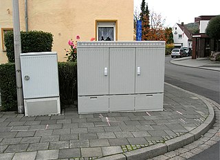
Deutsch: Kabelverzweiger (links), Multifunktionsgehäuse mit Outdoor-DSLAM (rechts) |
Date | |
Source | Own work |
Author | FEXX |
Object location | 50° 42′ 02.5″ N, 7° 11′ 10.7″ E | View this and other nearby images on: OpenStreetMap | 50.700694; 7.186306 |
---|
Licensing
[edit]Public domainPublic domainfalsefalse |
I, the copyright holder of this work, release this work into the public domain. This applies worldwide. In some countries this may not be legally possible; if so: I grant anyone the right to use this work for any purpose, without any conditions, unless such conditions are required by law. |
Location (estimated from maps and description)
[edit]Camera location | 50° 42′ 02.16″ N, 7° 11′ 10.88″ E | View this and other nearby images on: OpenStreetMap | 50.700600; 7.186355 |
---|
Evidence:
- Street sign on the right side of the image (Römlinghovener Straße)
- DSLAM can be seen on Google Earth
Retouched picture
[edit]This is a retouched picture, which means that it has been digitally altered from its original version. Modifications: fixed tilt, distortion & brightness.
|
File history
Click on a date/time to view the file as it appeared at that time.
Date/Time | Thumbnail | Dimensions | User | Comment | |
---|---|---|---|---|---|
current | 18:44, 10 August 2010 | 2,518 × 1,826 (2.78 MB) | WikiMichi (talk | contribs) | fixed tilt, distortion & brightness | |
23:58, 5 November 2005 | 2,592 × 1,944 (1.22 MB) | FEXX (talk | contribs) |
You cannot overwrite this file.
File usage on Commons
There are no pages that use this file.
File usage on other wikis
The following other wikis use this file:
- Usage on ar.wikipedia.org
- Usage on ca.wikipedia.org
- Usage on de.wikipedia.org
Metadata
This file contains additional information such as Exif metadata which may have been added by the digital camera, scanner, or software program used to create or digitize it. If the file has been modified from its original state, some details such as the timestamp may not fully reflect those of the original file. The timestamp is only as accurate as the clock in the camera, and it may be completely wrong.
Camera manufacturer | NIKON |
---|---|
Camera model | E5900 |
Exposure time | 10/2,047 sec (0.0048851978505129) |
F-number | f/4.8 |
ISO speed rating | 64 |
Date and time of data generation | 15:18, 3 November 2005 |
Lens focal length | 7.8 mm |
Latitude | 50° 42′ 2.16″ N |
Longitude | 7° 11′ 10.88″ E |
Altitude | 69 meters above sea level |
City shown | Königswinter |
Orientation | Normal |
Horizontal resolution | 300 dpi |
Vertical resolution | 300 dpi |
Software used | GIMP 2.6.10 |
File change date and time | 20:04, 10 August 2010 |
Y and C positioning | Co-sited |
Exposure Program | Normal program |
Exif version | 2.2 |
Date and time of digitizing | 15:18, 3 November 2005 |
Meaning of each component |
|
Image compression mode | 4 |
APEX exposure bias | 0 |
Maximum land aperture | 3 APEX (f/2.83) |
Metering mode | Pattern |
Light source | Unknown |
Flash | Flash did not fire, compulsory flash suppression |
Supported Flashpix version | 1 |
Color space | sRGB |
File source | Digital still camera |
Scene type | A directly photographed image |
Custom image processing | Normal process |
Exposure mode | Auto exposure |
White balance | Auto white balance |
Digital zoom ratio | 0 |
Focal length in 35 mm film | 38 mm |
Scene capture type | Night scene |
Scene control | None |
Contrast | Normal |
Saturation | Normal |
Sharpness | Normal |
Subject distance range | Unknown |
GPS time (atomic clock) | 14:18 |
Satellites used for measurement | 0 |
Reference for direction of image | True direction |
Direction of image | 343 |
Geodetic survey data used | WGS-84 |
Latitude destination | 50° 42′ 2.75″ N |
Longitude of destination | 7° 11′ 10.59″ E |
GPS date | 3 November 2005 |
GPS tag version | 0.0.2.2 |
Supported Flashpix version | 1 |
Image width | 2,592 px |
Image height | 1,944 px |
Date metadata was last modified | 02:07, 6 August 2010 |
Code for country shown | DEU |
Country shown | Deutschland |
Province or state shown | Nordrhein-Westfalen |
IIM version | 4 |