File:Ottawa River from satellite.jpg
Ottawa_River_from_satellite.jpg (300 × 284 pixels, file size: 16 KB, MIME type: image/jpeg)
Captions
Captions
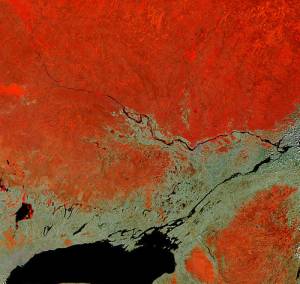
Ottawa River satellite image NASA
Source: NASA, Visible Earth
Credit:Jacques Descloitres, MODIS Land Rapid Response Team, NASA/GSFC
Satellite: Terra
Sensor: MODIS
Date: 04-06-2002
UE Record ID: 19156
Remarks: Unless otherwise noted, all images and animations made available through Visible Earth are generally not copyrighted. You may use NASA imagery, video and audio material for educational or informational purposes, including photo collections, textbooks, public exhibits, and Internet web pages.
| This file is in the public domain in the United States because it was solely created by NASA. NASA copyright policy states that "NASA material is not protected by copyright unless noted". (See Template:PD-USGov, NASA copyright policy page or JPL Image Use Policy.) | ||
 |
Warnings:
|
File history
Click on a date/time to view the file as it appeared at that time.
| Date/Time | Thumbnail | Dimensions | User | Comment | |
|---|---|---|---|---|---|
| current | 03:16, 2 April 2006 | | 300 × 284 (16 KB) | Jkelly (talk | contribs) | Ottawa River satellite image NASA Source: NASA, Visible Earth Credit:Jacques Descloitres, MODIS Land Rapid Response Team, NASA/GSFC Satellite: Terra Sensor: MODIS Date: 04-06-2002 UE Record ID: 19156 Remarks: Unless otherwise noted, all images and |
You cannot overwrite this file.
File usage on Commons
There are no pages that use this file.
File usage on other wikis
The following other wikis use this file:
- Usage on en.wikipedia.org
- Usage on es.wikipedia.org
- Usage on fa.wikipedia.org
- Usage on fr.wikipedia.org
- Usage on mt.wikipedia.org
- Usage on ru.wikipedia.org
- Usage on ta.wikipedia.org