File:Otok Rab,planinarska staza uvala Mišnjak-vrh Kamenjak.jpg
Jump to navigation
Jump to search

Size of this preview: 799 × 600 pixels. Other resolutions: 320 × 240 pixels | 639 × 480 pixels | 1,023 × 768 pixels | 1,280 × 961 pixels | 2,560 × 1,922 pixels | 4,592 × 3,448 pixels.
Original file (4,592 × 3,448 pixels, file size: 7.51 MB, MIME type: image/jpeg)
Captions
Captions
Add a one-line explanation of what this file represents
Summary
[edit]
| Description |
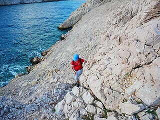
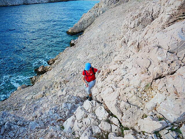
Hrvatski: Staza kreće od uvale Mišnjak preko uvale Mag pa sve do uvale Vadiškala ,zatim se diže iznad obale po strmom usponu do vrha Srednjak (331 m). Put nas dalje vodi po rubu vršnog dijela otoka sve do najvećeg vrha Kamenjak (408 m). Dionica je odlično markirana, te je preporuka strogo praćenje markacije ,jer je staza dosta zahtjevna (ljuti krš,oštro kamenje).Treba izbjegavati pješačenje po jakoj buri, kao i u ljetnim mjesecima kada su jako visoke temperature. Dužina dionice iznosi cca 14km,te je potrebno prosječnom pješaku oko 7 sati da je završi. |
| Date | |
| Source | Own work |
| Author | Vladimirmi81 |
Licensing
[edit]
I, the copyright holder of this work, hereby publish it under the following license:
This file is licensed under the Creative Commons Attribution-Share Alike 4.0 International license.
- You are free:
- to share – to copy, distribute and transmit the work
- to remix – to adapt the work
- Under the following conditions:
- attribution – You must give appropriate credit, provide a link to the license, and indicate if changes were made. You may do so in any reasonable manner, but not in any way that suggests the licensor endorses you or your use.
- share alike – If you remix, transform, or build upon the material, you must distribute your contributions under the same or compatible license as the original.
This image was uploaded as part of Wiki Loves Earth 2019.
|
 |
File history
Click on a date/time to view the file as it appeared at that time.
| Date/Time | Thumbnail | Dimensions | User | Comment | |
|---|---|---|---|---|---|
| current | 21:29, 29 June 2019 | | 4,592 × 3,448 (7.51 MB) | Vladimirmi81 (talk | contribs) | User created page with UploadWizard |
You cannot overwrite this file.
File usage on Commons
There are no pages that use this file.