File:Otani station overview 20171009.jpg
Original file (4,032 × 3,024 pixels, file size: 5.96 MB, MIME type: image/jpeg)
Captions
Summary
[edit]DescriptionOtani station overview 20171009.jpg |
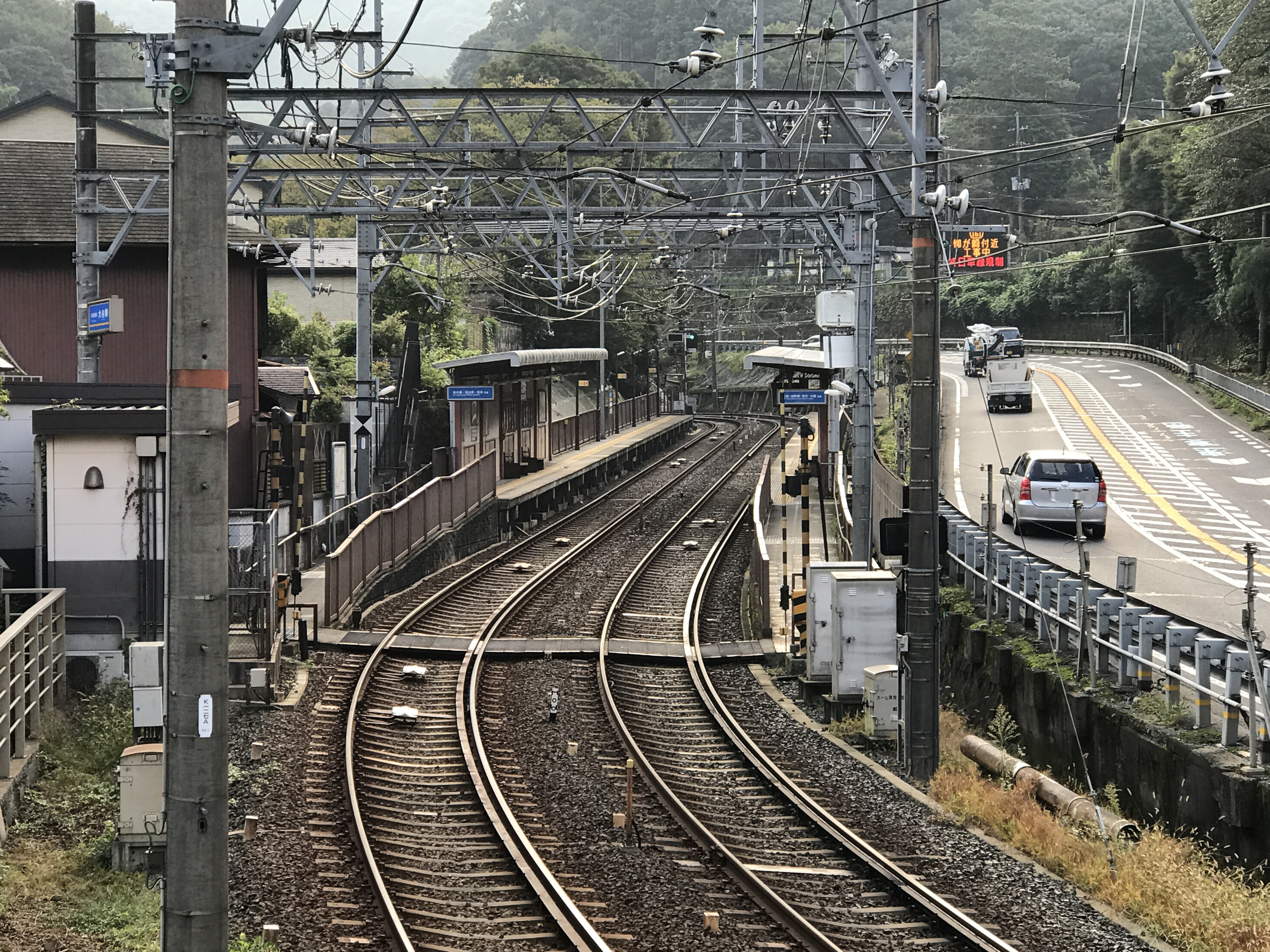
English: Otani station overview. The station locate at the top of "Osaka goe" summit and next to the Japanese route 1.
日本語: 大谷駅全景。この駅は、「逢坂越え」の頂上付近にあり、国道1号線に隣接している。 |
Date | |
Source | Own work |
Author | Hahifuheho |
Camera location | 34° 59′ 39.74″ N, 135° 51′ 09.64″ E | View this and other nearby images on: OpenStreetMap | 34.994372; 135.852678 |
---|
Licensing
[edit]This file is made available under the Creative Commons CC0 1.0 Universal Public Domain Dedication. | |
The person who associated a work with this deed has dedicated the work to the public domain by waiving all of their rights to the work worldwide under copyright law, including all related and neighboring rights, to the extent allowed by law. You can copy, modify, distribute and perform the work, even for commercial purposes, all without asking permission.
http://creativecommons.org/publicdomain/zero/1.0/deed.enCC0Creative Commons Zero, Public Domain Dedicationfalsefalse |
File history
Click on a date/time to view the file as it appeared at that time.
Date/Time | Thumbnail | Dimensions | User | Comment | |
---|---|---|---|---|---|
current | 01:46, 9 October 2017 | 4,032 × 3,024 (5.96 MB) | Hahifuheho (talk | contribs) | User created page with UploadWizard |
You cannot overwrite this file.
File usage on Commons
The following 2 pages use this file:
File usage on other wikis
The following other wikis use this file:
- Usage on ja.wikipedia.org
- Usage on nl.wikipedia.org
- Usage on www.wikidata.org
Metadata
This file contains additional information such as Exif metadata which may have been added by the digital camera, scanner, or software program used to create or digitize it. If the file has been modified from its original state, some details such as the timestamp may not fully reflect those of the original file. The timestamp is only as accurate as the clock in the camera, and it may be completely wrong.
Camera manufacturer | Apple |
---|---|
Camera model | iPhone 7 Plus |
Exposure time | 1/120 sec (0.0083333333333333) |
F-number | f/2.8 |
ISO speed rating | 32 |
Date and time of data generation | 07:22, 9 October 2017 |
Lens focal length | 6.6 mm |
Latitude | 34° 59′ 39.74″ N |
Longitude | 135° 51′ 9.64″ E |
Altitude | 156.738 meters above sea level |
Width | 4,032 px |
Height | 3,024 px |
Bits per component |
|
Pixel composition | RGB |
Orientation | Normal |
Number of components | 3 |
Horizontal resolution | 72 dpi |
Vertical resolution | 72 dpi |
Software used | Adobe Photoshop Elements 14.0 (Windows) |
File change date and time | 10:17, 9 October 2017 |
Y and C positioning | Centered |
Exposure Program | Normal program |
Exif version | 2.21 |
Date and time of digitizing | 07:22, 9 October 2017 |
Meaning of each component |
|
APEX shutter speed | 6.9079878665319 |
APEX aperture | 2.970853573907 |
APEX brightness | 6.8083333333333 |
APEX exposure bias | 0 |
Metering mode | Pattern |
Flash | Flash did not fire, compulsory flash suppression |
DateTimeOriginal subseconds | 286 |
DateTimeDigitized subseconds | 286 |
Supported Flashpix version | 1 |
Color space | Uncalibrated |
Sensing method | One-chip color area sensor |
Scene type | A directly photographed image |
Exposure mode | Auto exposure |
White balance | Auto white balance |
Digital zoom ratio | 1.3670886075949 |
Focal length in 35 mm film | 78 mm |
Scene capture type | Standard |
GPS time (atomic clock) | 22:22 |
Speed unit | Kilometers per hour |
Speed of GPS receiver | 0 |
Reference for direction of image | True direction |
Direction of image | 114.23454833597 |
Reference for bearing of destination | True direction |
Bearing of destination | 114.23454833597 |
GPS date | 8 October 2017 |
Lens used | iPhone 7 Plus back dual camera 6.6mm f/2.8 |
Date metadata was last modified | 19:17, 9 October 2017 |
Unique ID of original document | 50D99109E2D6C35C97A36B4DF220E575 |
IIM version | 32,766 |