File:Ostend Radar Tower R01.jpg
Jump to navigation
Jump to search

Size of this preview: 800 × 563 pixels. Other resolutions: 320 × 225 pixels | 640 × 451 pixels | 1,024 × 721 pixels | 1,280 × 901 pixels | 2,560 × 1,802 pixels | 3,784 × 2,664 pixels.
Original file (3,784 × 2,664 pixels, file size: 5.31 MB, MIME type: image/jpeg)
Captions
Captions
Add a one-line explanation of what this file represents
Summary
[edit]
| Description |
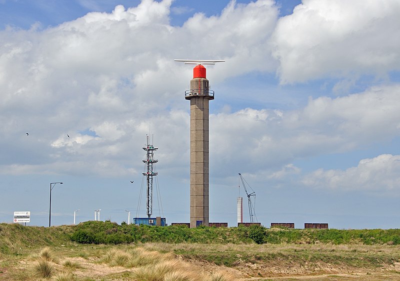
Nederlands: Oostende (België): voormalige radartoren van de Schelderadarketen (Vessel Taffic Service voor de Westerschelde en de Belgische Noordzeekust); gesloopt in 2019 English: Ostend (Belgium): former radar tower of the Schelderadarketen (VTS for the Western Scheldt and the Belgian North Sea coast); demolished in 2019 Français : Ostende (Belgique) : l'ancienne tour radar du Schelderadarketen (service de contrôle du trafic maritime sur l'Escaut Occidental et le long de la côte belge); démoli en 2019 |
| Date | |
| Source | Own work |
| Author | Marc Ryckaert |
| Camera location | | View this and other nearby images on: OpenStreetMap |
|---|
Licensing
[edit]
I, the copyright holder of this work, hereby publish it under the following license:
This file is licensed under the Creative Commons Attribution 3.0 Unported license.
- You are free:
- to share – to copy, distribute and transmit the work
- to remix – to adapt the work
- Under the following conditions:
- attribution – You must give appropriate credit, provide a link to the license, and indicate if changes were made. You may do so in any reasonable manner, but not in any way that suggests the licensor endorses you or your use.
File history
Click on a date/time to view the file as it appeared at that time.
| Date/Time | Thumbnail | Dimensions | User | Comment | |
|---|---|---|---|---|---|
| current | 19:20, 17 May 2013 | | 3,784 × 2,664 (5.31 MB) | MJJR (talk | contribs) | User created page with UploadWizard |
You cannot overwrite this file.
File usage on Commons
The following page uses this file:
File usage on other wikis
The following other wikis use this file:
- Usage on nl.wikipedia.org