File:Orzesze location map.png

Original file (1,862 × 2,139 pixels, file size: 2.87 MB, MIME type: image/png)
Captions
Captions
Summary
[edit]
| Description |
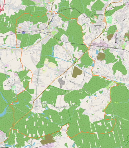
English: Location map |
| Date | |
| Source | Own work |
| Author | Smat |
| Description |
Polski: Mapa Orzesza, Polska
English: Map of Orzesze, Poland |
|||||||||
| Date | ||||||||||
| Source | You may find a page on the OpenStreetMap wiki page for Orzesze | |||||||||
| Creator |
OpenStreetMap contributors OpenStreetMap contributors |
|||||||||
| Permission (Reusing this file) |
OpenStreetMap data is available under the Open Database License (details). Map tiles are licensed under the Creative Commons Attribution-ShareAlike 2.0 license (CC-BY-SA 2.0).
This file is licensed under the Creative Commons Attribution-Share Alike 2.0 Generic license.
|
|||||||||
| Geotemporal data | ||||||||||
| Bounding box |
|
|||||||||
| Georeferencing | If inappropriate please set warp_status = skip to hide. | |||||||||
Licensing
[edit]
| This work contains information from OpenStreetMap, which is made available under the Open Database License (ODbL).
The ODbL does not require any particular license for maps produced from ODbL data. Prior to 1 August 2020, map tiles produced by the OpenStreetMap Foundation were licensed under the CC-BY-SA-2.0 license. Maps produced by other people may be subject to other licences. |
File history
Click on a date/time to view the file as it appeared at that time.
| Date/Time | Thumbnail | Dimensions | User | Comment | |
|---|---|---|---|---|---|
| current | 11:43, 19 October 2018 | | 1,862 × 2,139 (2.87 MB) | Smat (talk | contribs) | User created page with UploadWizard |
You cannot overwrite this file.
File usage on Commons
There are no pages that use this file.
File usage on other wikis
The following other wikis use this file:
- Usage on pl.wikipedia.org
- Parafia św. Antoniego z Padwy w Orzeszu
- Woszczyce
- Góra Świętego Wawrzyńca (Orzesze)
- Jaśkowice (Orzesze)
- Zawada (Orzesze)
- Królówka (Orzesze)
- Zawiść (Orzesze)
- Zazdrość (Orzesze)
- Mościska (Orzesze)
- Zgoń
- Parafia św. Wawrzyńca w Orzeszu
- Parafia Męczeństwa św. Jana Chrzciciela w Orzeszu
- Parafia św. Jana Chrzciciela w Orzeszu
- Parafia Ewangelicko-Augsburska Świętego Ducha w Orzeszu
- Parafia Nawiedzenia Najświętszej Maryi Panny w Orzeszu
- Gardawice
- Orzesze Jaśkowice
- Parafia św. Maksymiliana Kolbego w Orzeszu
- Parafia św. Apostołów Piotra i Pawła w Orzeszu
- Parafia Przemienienia Pańskiego w Orzeszu
- Parafia Miłosierdzia Bożego w Orzeszu
- Orzesze (stacja kolejowa)
- Orzesze Miasto
- Orzesze Zawada
- Orzesze Zawiść
- Zbór Kościoła Chrześcijan Baptystów w Orzeszu
- Pałac w Orzeszu
- Pałac w Orzeszu-Zawiści
- Kościół św. Wawrzyńca w Orzeszu
- Kościół Świętych Apostołów Piotra i Pawła w Orzeszu
- Kościół Nawiedzenia Najświętszej Maryi Panny w Orzeszu
- Kościół Narodzenia św. Jana Chrzciciela w Orzeszu
- Kościół św. Antoniego z Padwy w Orzeszu
- Kościół ewangelicko-augsburski Ducha Świętego w Orzeszu
- Moduł:Mapa/dane/Orzesze
- Śródmieście (Orzesze)
- Usage on pl.wikibooks.org
- Usage on pt.wikipedia.org