File:Oregon & Washington MODIS image, April 2002.jpg
Jump to navigation
Jump to search

Size of this preview: 466 × 599 pixels. Other resolutions: 187 × 240 pixels | 373 × 480 pixels | 597 × 768 pixels | 796 × 1,024 pixels | 1,400 × 1,800 pixels.
Original file (1,400 × 1,800 pixels, file size: 502 KB, MIME type: image/jpeg)
Captions
Captions
Add a one-line explanation of what this file represents
Summary
[edit]
| Description |
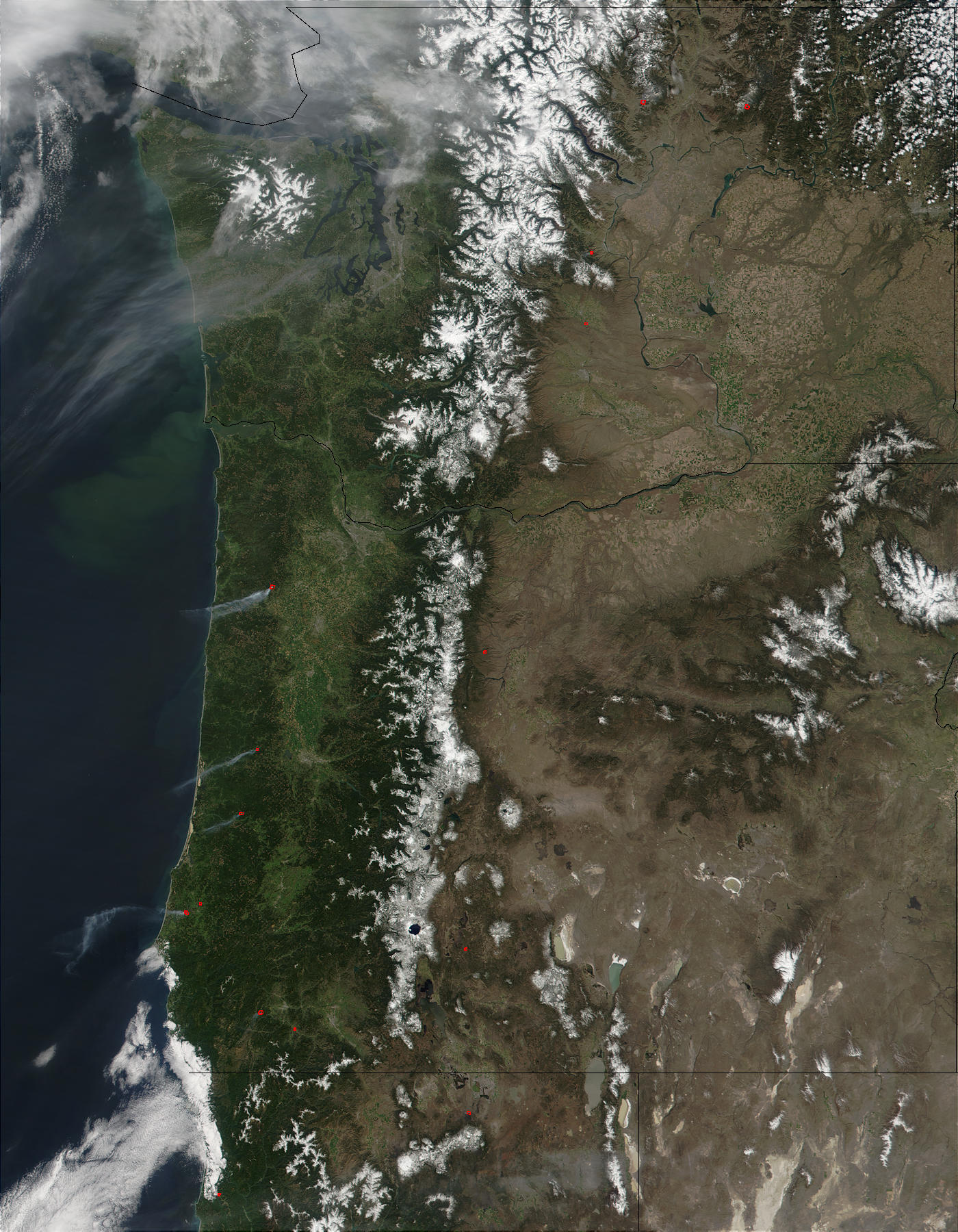
English: "East and west of the snow-capped Cascade Mountain Range, scattered fires were burning in Washington (top) and Oregon (below) on April 24, 2002. Plumes of smoke drifted westward out over the Pacific. At the upper left, hazy skies over northwest Washington and the Puget Sound are likely a mixture of smoke and clouds. The Columbia River marks the boundary between Washington and Oregon, and provides irrigation water to the agricultural land of Washington’s interior." Scroll over the image to see annotations identifying more features. |
| Date | |
| Source | description page, image only |
| Author |
"Image courtesy Jacques Descloitres, MODIS Land Rapid Response Team at NASA GSFC" From the Moderate-resolution Imaging Spectroradiometer (MODIS) aboard NASA’s Terra satellite |
Licensing
[edit]
| This file is in the public domain in the United States because it was solely created by NASA. NASA copyright policy states that "NASA material is not protected by copyright unless noted". (See Template:PD-USGov, NASA copyright policy page or JPL Image Use Policy.) | ||
 |
Warnings:
|
| Annotations | This image is annotated: View the annotations at Commons |
File history
Click on a date/time to view the file as it appeared at that time.
| Date/Time | Thumbnail | Dimensions | User | Comment | |
|---|---|---|---|---|---|
| current | 18:15, 17 October 2015 | | 1,400 × 1,800 (502 KB) | Jsayre64 (talk | contribs) | {{Information |Description ={{en|1="East and west of the snow-capped Cascade Mountain Range, scattered fires were burning in Washington (top) and Oregon (below) on April 24, 2002. Plumes of smoke drifted westward out over the Pacific. At the upper l... |
You cannot overwrite this file.
File usage on Commons
The following page uses this file: