File:OregonStateArchives.JPG
Jump to navigation
Jump to search

Size of this preview: 800 × 552 pixels. Other resolutions: 320 × 221 pixels | 640 × 442 pixels | 1,024 × 707 pixels | 1,280 × 884 pixels | 2,455 × 1,695 pixels.
Original file (2,455 × 1,695 pixels, file size: 828 KB, MIME type: image/jpeg)
Captions
Captions
Add a one-line explanation of what this file represents
| Description | |
| Date | 17 August 2007 (original upload date) |
| Source | Transferred from en.wikipedia to Commons by Aboutmovies using CommonsHelper. |
| Author | M.O. Stevens |
Licensing
[edit]
I, the copyright holder of this work, hereby publish it under the following license:

|
Permission is granted to copy, distribute and/or modify this document under the terms of the GNU Free Documentation License, Version 1.2 or any later version published by the Free Software Foundation; with no Invariant Sections, no Front-Cover Texts, and no Back-Cover Texts. A copy of the license is included in the section entitled GNU Free Documentation License. |
| This file is licensed under the Creative Commons Attribution-Share Alike 3.0 Unported license. | ||
| ||
| This licensing tag was added to this file as part of the GFDL licensing update. |
Original upload log
[edit]
The original description page was here. All following user names refer to en.wikipedia.
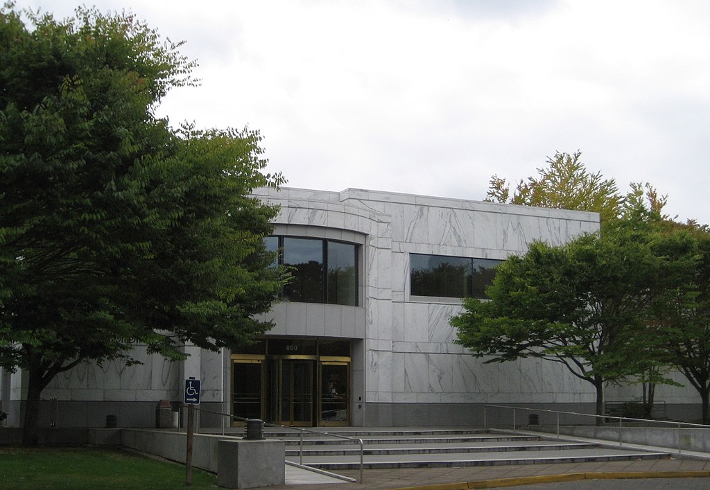
- 2007-08-17 22:05 Aboutmovies 2455×1695× (848044 bytes) [[Oregon State Archives]] building in [[Salem, Oregon]]
File history
Click on a date/time to view the file as it appeared at that time.
| Date/Time | Thumbnail | Dimensions | User | Comment | |
|---|---|---|---|---|---|
| current | 18:33, 6 April 2010 | | 2,455 × 1,695 (828 KB) | File Upload Bot (Magnus Manske) (talk | contribs) | {{BotMoveToCommons|en.wikipedia|year={{subst:CURRENTYEAR}}|month={{subst:CURRENTMONTHNAME}}|day={{subst:CURRENTDAY}}}} {{Information |Description={{en|en:Oregon State Archives building in en:Salem, Oregon}} |Source=Transferred from [http://en |
You cannot overwrite this file.
File usage on Commons
More than 100 pages use this file. The following list shows the first 100 pages that use this file only. A full list is available.
- File:Agricultural and Life Sciences Building, Oregon State University, Corvallis - DPLA - a5d71a890456dfa19e221f5906c05ca3.jpg
- File:Albany - DPLA - b3fe6a4c2515d6d1b087112ebe85b9c0.jpg
- File:Alkali Lake, U.S. Highway 395 - DPLA - ad92eb92b7dc9a40cb5e1f18b4942b1c.jpg
- File:Anthony Lakes Ski Area, Elkhorn Scenic Byway - DPLA - ccd4ed2247fa0485710c23294773e03a.jpg
- File:Applegate River, Applegate - DPLA - 0c7e753eafd72f59b1d7854dd30effbc.jpg
- File:Applegate River - DPLA - 07fe0e9f04448a96b39b949624c56725.jpg
- File:Astoria Waterworks, Astoria - DPLA - 5e40f2758b74044aa9a676e801cd8673.jpg
- File:Bandon - DPLA - 0a219914b183afffe40c4ad6c93d4e4a.jpg
- File:Bandon - DPLA - faa85b646bc9fb17bbb3139f30e7e179.jpg
- File:Burnt River Canyon - DPLA - 99786c7229f64c0805c495ef344fb2be.jpg
- File:Canyon City - DPLA - c4e2275cb6aec5426c2b6a595301bc66.jpg
- File:Capitol Mall, Salem - DPLA - c49a1cb5acc4d8294199c11af54969d2.jpg
- File:Chimney Rock Campground, Crooked River - DPLA - 6d30960613d657b36d6b17e731a10267.jpg
- File:Columbia River Highway, The Dalles - DPLA - 23e512f4a1869a64a33763debd6528d5.jpg
- File:Columbia River at Hood River - DPLA - 568f0dd2cf615d440772fcb76226249e.jpg
- File:Crater Lake, West Rim Drive, Crater Lake National Park - DPLA - 416500feea5ba8f46290d5985fc762b5.jpg
- File:Crow Creek Road - DPLA - 9751aef95080bdd4f600f55015d4693d.jpg
- File:Crystal Springs Rhododendron Garden, Portland - DPLA - 1c6a5b3a13bc5c0b228ea258875e268f.jpg
- File:Ecola State Park, Tillamook Head - DPLA - 0ab9a70bf4a825d33458a8517b58e202.jpg
- File:Elk Lake, South Sister, Cascade Mountains, Cascade Lakes Scenic Byway - DPLA - b286fb871224054299df08c9657e9b50.jpg
- File:Elkhorn Drive Overlook, Wallowa Mountains - DPLA - aca5a8b9fe386c94c076ad691900eb86.jpg
- File:Forest Grove, Grove Theater - DPLA - 99983502238a99bb366d257221a87c58.jpg
- File:Forest Grove - DPLA - 65c833d64054dcfa0f3cb7a86dacca74.jpg
- File:Fremont Bridge, Willamette River, Portland - DPLA - af3e6767c71161ea06d4c3257522cafd.jpg
- File:Gateway Grade Road - DPLA - a3879694660acc7e30192e7c5e56119d.jpg
- File:Grass Valley - DPLA - a4dfc3d4e1375444e681d1897f3a2810.jpg
- File:Greaser Canyon, Highway 140 - DPLA - d316772fc9925754b4dffe1fec93c4c8.jpg
- File:Grotto, Northeast Portland - DPLA - 5e073b5136b418b03ba3157617119b2f.jpg
- File:Hale Ridge Road - DPLA - 580e64c78313eadea66bdc2f573ae9dd.jpg
- File:Hell's Canyon Overlook, Hell's Canyon National Recreation Area, Snake River Canyon - DPLA - ddb116297da598d18935d3333ff82d62.jpg
- File:Highway 206, Condon - DPLA - 4492000e9d7984840cdc2aa37b7daebd.jpg
- File:Highway 26 - DPLA - 54ab99a0f8a2c658e03d84d229556bb7.jpg
- File:House Chamber, Oregon State Capitol, Salem - DPLA - a2e62b4709d3af4c424f1873d78cf820.jpg
- File:Johnson Millpond County Pond - DPLA - 73a5cde2e2601d1c65d298f8fc824b5b.jpg
- File:Keating Cutoff Road - DPLA - 9ca27a37a6794b3736aa7044c49b760b.jpg
- File:Knox Butte Road, Albany - DPLA - b7896c84f927d58b5ac0a1a619151121.jpg
- File:Ladd Hill Road - DPLA - 610f667ee95a542bf7af0b1e95bb943d.jpg
- File:Larwood Covered Bridge, Crabtree Creek - DPLA - e8d35c9c1cf7a872dbc5ddfeeb9da116.jpg
- File:Latham Road - DPLA - 3191b1f717340082a185f909fab7a946.jpg
- File:Lava Butte, National Newberry Volcanic Monument - DPLA - 9eff97713b895ce821d3d8586eb4b20b.jpg
- File:Leslie Gulch - DPLA - 1624d19bb81d60b4e589b0616fee317f.jpg
- File:Linn County Courthouse, Albany - DPLA - 2e2e3ef74081ce54d6c3e712d720714c.jpg
- File:Lobster Creek Road - DPLA - 2b8d57fc42fc476bfe0c30cef570a7a5.jpg
- File:Lowell Covered Bridge, Dexter Reservoir, Highway 58 - DPLA - 9b2f3ff8f5ba99f2aad9b44877955a6e.jpg
- File:Maury Mountains Agate Beds - DPLA - 2258f271d488dee0f7c3dd388f41bff6.jpg
- File:McDowell Creek Falls County Park, Lebanon - DPLA - 9cbc1c1e256cbb3c3810a993e9ab9941.jpg
- File:McMenamin's Grand Lodge Hotel, Forest Grove - DPLA - 4025c0d7315a8511cb2c984289f17852.jpg
- File:Metolius River, Fish Hatchery, NF 14 - DPLA - a0fc2cebcb962b4d4f64afeef5ccce23.jpg
- File:Molalla River, Upper Molalla River Road - DPLA - 370d1698da37f8f7dbbaf6ca2e8d5b11.jpg
- File:Morrow Crane Building, Salem - DPLA - c503c62ede4fd3c8dc07821304bcdd93.jpg
- File:Mt. Hood, Blooming Fern Hill Road - DPLA - 3ec0cb54ef26c55c4e3780f6c9b417c2.jpg
- File:Newport - DPLA - 9a1b0f098d3108e51d3900c74ba9067d.jpg
- File:North Fork John Day River, U.S. Highway 395, Blue Mountains, Dale - DPLA - ca7aa77625d298b82265a6241eac818d.jpg
- File:Old Mohawk Road - DPLA - a50aced0b1e53ae142bdc554f5def960.jpg
- File:Oregon State Capitol, Salem - DPLA - ebdf40a5ccd9ea1bd7ed6da28d442a4d.jpg
- File:Painted Hills Unit, John Day Fossil Beds National Monument - DPLA - 0d10ca4f926bc2757cff463f06d12ad9.jpg
- File:Paulina Lake in Newberry National Volcanic Monument - DPLA - 9f2fb8c9005ea891ab2a2ccd02afa48f.jpg
- File:Phillips Lake - DPLA - 9e9874989472481b817fabf95d6db9a8.jpg
- File:Pillars of Rome - DPLA - a1e8355e3de1681a8438c66487130d5f.jpg
- File:Powell Butte Road - DPLA - 0c3d1e8d63f548d4a595b6806c4daf57.jpg
- File:Promise, Promise Road - DPLA - c372b8239112e77f69dfb74812b0dd03.jpg
- File:Rimrock, Rowe Creek Road - DPLA - d6fb5a2a9723a8f5d4b92f294aac2eb2.jpg
- File:SW Jericho Lane - DPLA - f958025e222c1b9a5fa580ea2435086a.jpg
- File:Seaside - DPLA - 30999db0dd8aa5e18c6348f57f727996.jpg
- File:Shore Acres State Park - DPLA - 0d566ff0bfe9f4123c3c91f90869cc13.jpg
- File:Silver Falls State Park, Trail of Ten Falls, Lower South Falls - DPLA - 831069206eb36b7d9131fecc2ab4719e.jpg
- File:Silver Lake Road, Klamath Marsh National Wildlife Refuge - DPLA - 53141d966c730afeee96e33e775561c3.jpg
- File:Sisters Rock - DPLA - 1db8228963e220c8168efe4a4eebf01e.jpg
- File:Sixes River - DPLA - c170bcc9c1c79e3f6d4b5d9c41046a55.jpg
- File:Smith Rock, 9th Street, Terrebonne - DPLA - 7594c3827d92971fa5cbc58225c62190.jpg
- File:Smith Rock State Park, Crooked River, Terrebonne - DPLA - ad790843862910fdef5c1a32a8b580dd.jpg
- File:Snake River Correctional Facility, Ontario - DPLA - 6b9cab0c20ba5d1034f7040f2cee7fd0.jpg
- File:State Capitol Building, Salem - DPLA - 471d9c1c133bc6c5ccfa69a647b52290.jpg
- File:Succor Creek Road - DPLA - 1b44987e7707ee6b3026d7a475ad4cad.jpg
- File:Sun Rise Cemetery, North Sawtooth Road, Wasco - DPLA - 6eaecb17e93100ed1d93904c6f9c8f53.jpg
- File:The Dalles - DPLA - 50b6446bfc6db6db7e18756ed85c0ed7.jpg
- File:The Dalles Bridge - DPLA - 2c2fbd0565447ad23bfd0fe2cd78d2bf.jpg
- File:The Pinnacles, Crater Lake National Park - DPLA - 760392cbd6cf2d7ff701f97386e826cd.jpg
- File:Thomsen Road - DPLA - 02795fad122f295943474c72284be673.jpg
- File:Tillamook Bay, Barview - DPLA - e7aea640c9d2f9c705702dc89a9f182f.jpg
- File:Tillamook Bay - DPLA - fdf0fd2827f887055a678a637193f49c.jpg
- File:Tillamook County Pioneer Museum, Tillamook - DPLA - 7d0cf771ff93e94bf076c7265d32009c.jpg
- File:Totem Pole Road - DPLA - 09893a982710ea3cfb955cc7caece5ad.jpg
- File:Tualatin Commons, Tualatin - DPLA - 064749bdba631a1ae98b8e577f90a17a.jpg
- File:Twickenham Road - DPLA - bf9dbc28fa2a1acc4700836141708c47.jpg
- File:Twin Tunnels, Historic Columbia Highway Trail, Mosier - DPLA - 9617ad7debe8bc465c8a9218084e4893.jpg
- File:Unity Canyon, Highway 26 - DPLA - 24a29ccc599f6d01c357adafa8899ec1.jpg
- File:View of Mt. St. Helens and a canal from East Honeyman Road - DPLA - 9164bf1731d03c1ee24c097f871be029.jpg
- File:Wahkeena Falls, Historic Columbia River Highway, Columbia River Gorge - DPLA - fbd7851cf61ef6344f1e1d0f286849c4.jpg
- File:Waldo Hills Drive - DPLA - a607572f78bd553f7fb75492c73be5a3.jpg
- File:Wallowa Lake Lodge - DPLA - db7f6cf8ad502070898f4987a5dacf83.jpg
- File:Wallowa Union Railroad (WURR), Elgin - DPLA - df214b7bf95a34a55b84ade41e5b3b7f.jpg
- File:Warnock Road - DPLA - fd20c04f57a20cc63e7538cc8adc7157.jpg
- File:Washington County Courthouse, Hillsboro - DPLA - c959062eebb69b41f9a35980234ec8fa.jpg
- File:White River Falls State Park - DPLA - 99f134d5e10fa0185f34bf6c7f0cd7aa.jpg
- File:Willamette River, Portland - DPLA - 0c8a81c97a5ca94fe46dd8ee12dd093b.jpg
- File:Willamette River, San Salvador Boat Launch, Horseshoe Lake Road - DPLA - 1fa5644d6382a42f36eadf29f6e02dcb.jpg
- File:Wolf Creek Reservoir - DPLA - 629c9677fc7b752396bdd4ceb2b5505d.jpg
- File:Wooden Shoe Tulip Farm, Woodburn - DPLA - 4c2cbd59f82987cbcd8d3effd7e58bc1.jpg
- File:Yaquina Bay State Park, Newport - DPLA - a422947dbcc8023cc64563b010461187.jpg
,_Elgin_-_DPLA_-_df214b7bf95a34a55b84ade41e5b3b7f.jpg)
View more links to this file.
File usage on other wikis
The following other wikis use this file:
- Usage on en.wikipedia.org
- Usage on www.wikidata.org