File:Ordnance Survey Drawings - Fordham (OSD 297).jpg
Jump to navigation
Jump to search
Size of this preview: 800 × 588 pixels. Other resolutions: 320 × 235 pixels | 640 × 471 pixels | 1,024 × 753 pixels | 1,280 × 941 pixels | 2,560 × 1,883 pixels | 4,000 × 2,942 pixels.
Original file (4,000 × 2,942 pixels, file size: 2.76 MB, MIME type: image/jpeg)
Captions
Captions
Add a one-line explanation of what this file represents
| River Ouse (OSD 297)
|
|||||
|---|---|---|---|---|---|
| Title |
Ordnance Survey Drawings: Fordham (OSD 297) |
.jpg) | |||
| Object type |
manuscript map |
||||
| Description |
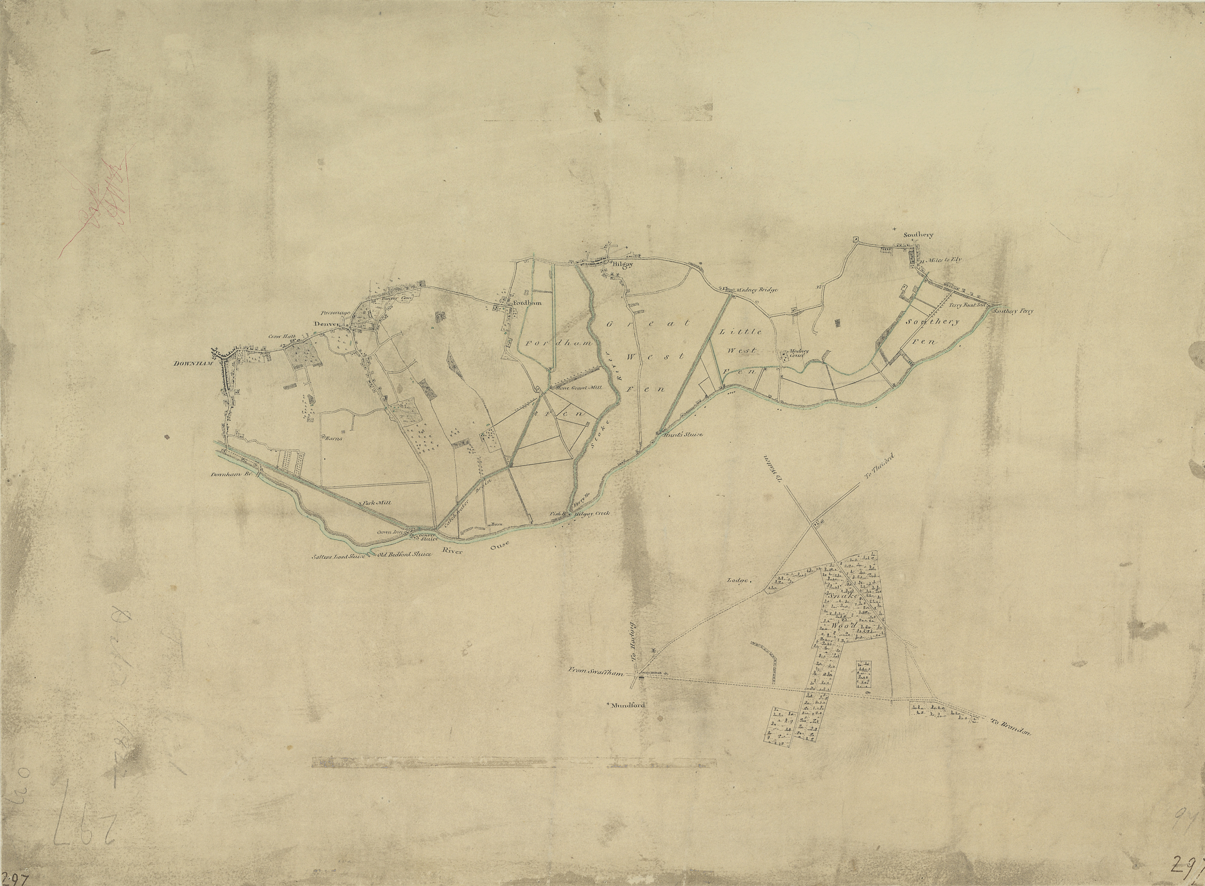
 Centre of map shown on a map of England
English: .This plan is dominated by arable land divided by straight, water-filled dykes., This was a new landscape in the English fenlands., It was only in the preceding century that the Dutch engineer Vermuyden had designed the elaborate system of drains and river diversions that made possible the conversion of pasture to arable land in this region., On the top left of the manuscript, a crossed-out inscription in red ink, 'Ex AWR', reveals that the drawing was examined by Royal Military Surveyor and,Draughtsman,Alexander W Robe..
This image has been georeferenced.
|
||||
| Language |
English |
||||
| Date | 1822 | ||||
| Medium | Pen and ink on paper | ||||
| Dimensions | height: 160 mm (6.29 in); width: 210 mm (8.26 in) | ||||
| Collection | |||||
| Accession number |
Maps OSD 297 |
||||
| Credit line | British Library | ||||
| Notes |
Scale 2 inches : 1 mile (1:31680). Please note that the British Library provides these digital files "as-is"; materials will not be rephotographed under this programme. If resupply of files is required, the requestor will be required to purchase them at the standard rate. |
||||
| References |
http://www.bl.uk/onlinegallery/onlineex/ordsurvdraw/r/002osd000000004u00259000.html (English) |
||||
| Source/Photographer |
|
||||
| Permission (Reusing this file) |
|
||||


_(St_Edwards_Crown).svg)
.jpg¶ms=52.561257_N_0.356594_E_)
.jpg¶ms=52.488861_N_0.267183_E_)
.jpg¶ms=52.633653_N_0.446004_E_)
.jpg¶ms=52.624487_N_0.446004_E_)
.jpg¶ms=52.633653_N_0.285895_E_)
.jpg¶ms=52.498027_N_0.267183_E_)
.jpg¶ms=52.488861_N_0.427293_E_)
File history
Click on a date/time to view the file as it appeared at that time.
| Date/Time | Thumbnail | Dimensions | User | Comment | |
|---|---|---|---|---|---|
| current | 18:17, 26 September 2013 | | 4,000 × 2,942 (2.76 MB) | LibraryBot (talk | contribs) | {{subst:User:Andrew Gray/OSD|ID= 002OSD000000004U00259000 |OSD_NUM= OSD 297 |MEDIUM= Pen and ink on paper |TITLE= Fordham |CREATOR= |YEAR= 1822 |DESCRIPTION= .This plan is dominated by arable land divided by straight, water-filled dykes., This was a n... |
You cannot overwrite this file.
File usage on Commons
The following page uses this file:
File usage on other wikis
The following other wikis use this file:
- Usage on www.wikidata.org
.jpg&oldid=827182996)