File:Oostende Halve Maan R07.jpg
Jump to navigation
Jump to search
Size of this preview: 800 × 533 pixels. Other resolutions: 320 × 213 pixels | 640 × 426 pixels | 1,024 × 682 pixels | 1,280 × 853 pixels | 2,560 × 1,705 pixels | 4,856 × 3,235 pixels.
Original file (4,856 × 3,235 pixels, file size: 9.23 MB, MIME type: image/jpeg)
Captions
Captions
Add a one-line explanation of what this file represents
Summary
[edit]
| Description |
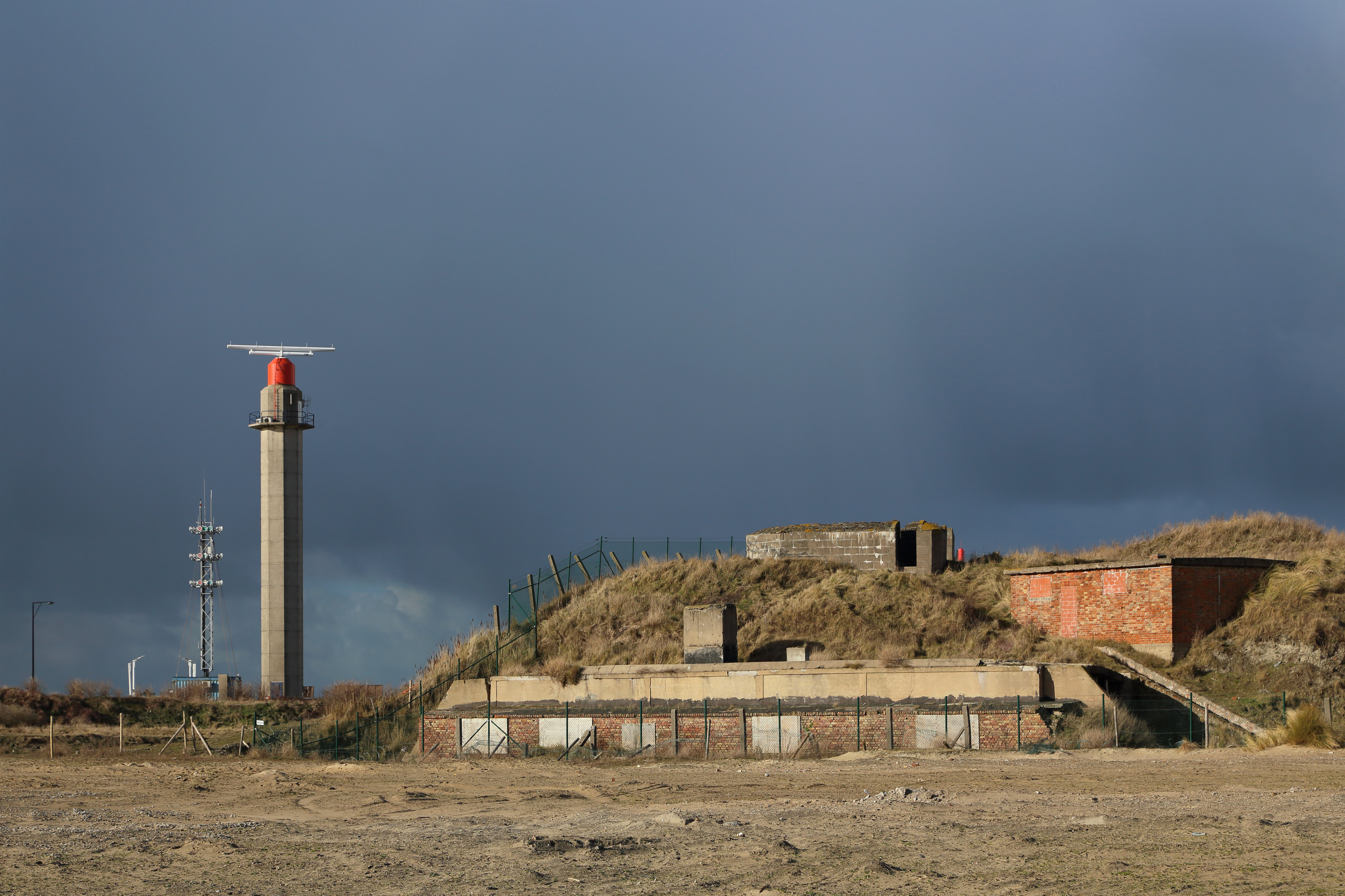
Nederlands: Oostende (België). Links: de radartoren van de Halvemaandijk, onderdeel van de Schelderadarketen (scheepvaartbegeleidingssysteem of Vessel Traffic Services) in Nederland en België. Rechts: een gedeelte van de voormalige Duitse luchtafweerbatterij van de Halve Maan, voorheen deel uitmakend van de Atlantikwall (Tweede Wereldoorlog). Nederlands: Ostend (Belgium). Left: the Halvemaandijk radar tower of the Vessel Traffic Services (VTS) on the river Scheldt and part of the North Sea coast in Belgium and the Netherlands. Right: a part of the former German anti-aircraft battery of the Halve Maan (Atlantic Wall, WW 2) Français : Ostende (Belgique). A gauche : la tour radar du Halvemaandijk, dédié au service VTS (système de contrôle de la navigation) sur l'Escaut en Belgique et aux Pays-Bas. A droite : une partie de l'ancienne batterie anti-aérienne allemande de la Halve Maan, ayant fait partie du Mur de l'Atlantique pendant la seconde guerre mondiale |
| Date | |
| Source | Own work |
| Author | Marc Ryckaert |
| Camera location | | View this and other nearby images on: OpenStreetMap |
|---|
Licensing
[edit]
I, the copyright holder of this work, hereby publish it under the following license:
This file is licensed under the Creative Commons Attribution 3.0 Unported license.
- You are free:
- to share – to copy, distribute and transmit the work
- to remix – to adapt the work
- Under the following conditions:
- attribution – You must give appropriate credit, provide a link to the license, and indicate if changes were made. You may do so in any reasonable manner, but not in any way that suggests the licensor endorses you or your use.
File history
Click on a date/time to view the file as it appeared at that time.
| Date/Time | Thumbnail | Dimensions | User | Comment | |
|---|---|---|---|---|---|
| current | 10:26, 6 March 2015 | | 4,856 × 3,235 (9.23 MB) | MJJR (talk | contribs) | User created page with UploadWizard |
You cannot overwrite this file.
File usage on Commons
The following page uses this file: