File:Oorlogsmonument in Zwammerdam.jpg
Jump to navigation
Jump to search
Size of this preview: 450 × 600 pixels. Other resolutions: 180 × 240 pixels | 360 × 480 pixels | 576 × 768 pixels | 768 × 1,024 pixels | 1,536 × 2,048 pixels | 3,240 × 4,320 pixels.
Original file (3,240 × 4,320 pixels, file size: 9.57 MB, MIME type: image/jpeg)
Captions
Captions
Add a one-line explanation of what this file represents
Summary
[edit]
| Description |
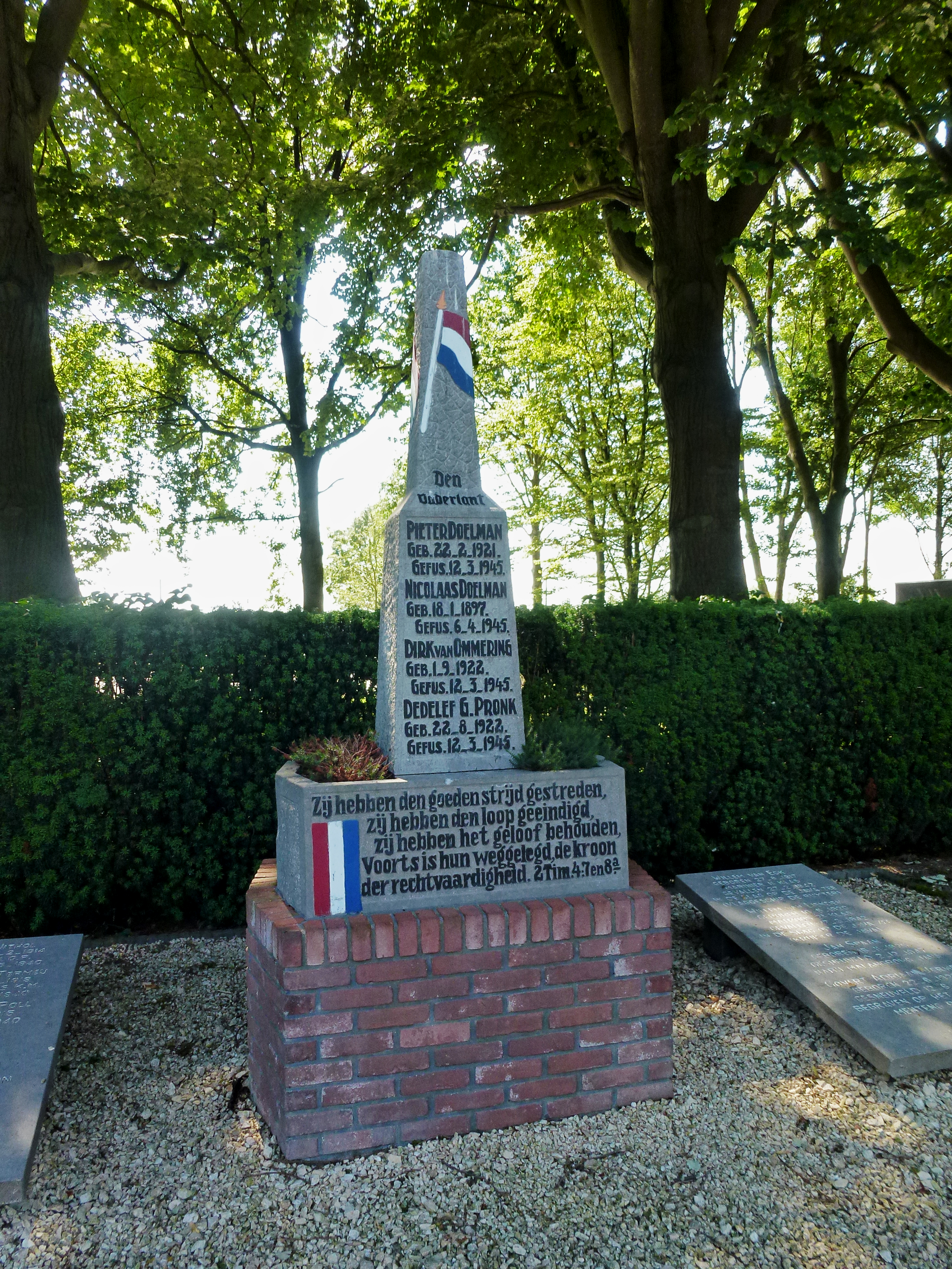
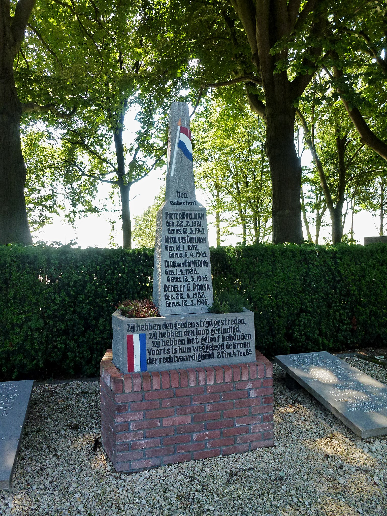
Nederlands: Monument voor militairen in dienst van het Nederland Koninkrijk na 1945, militairen in dienst van het Nederland Koninkrijk 1940-1945, Verzet Nederland. Begraafplaats Buitendorp, algemene begraafplaats, Spoorlaan 14, Zwammerdam (gemeente Alphen aan de Rijn)
Gedenk hen die toen het volk verslagen en macht’loos scheen, de vaan der vrijheid hoog hebben gedragen door alles heen. Zij hebben den goede strijd gestreden, zij hebben den loop geëindigd, zij hebben het geloof behouden. Voorts is hun weggelegd de kroon der rechtvaardigheid. 2Tim. 4:7 en 8a
Pieter Doelman, Nicolaas Doelman, Dirk van Ommering, Dedelef G. Pronk.
|
| Date | |
| Source | Own work |
| Author | Agaath |
| Camera location | | View this and other nearby images on: OpenStreetMap |
|---|
|
This is an image of a war memorial in the Netherlands, number: 822
|
Licensing
[edit]
I, the copyright holder of this work, hereby publish it under the following license:
This file is licensed under the Creative Commons Attribution-Share Alike 4.0 International license.
- You are free:
- to share – to copy, distribute and transmit the work
- to remix – to adapt the work
- Under the following conditions:
- attribution – You must give appropriate credit, provide a link to the license, and indicate if changes were made. You may do so in any reasonable manner, but not in any way that suggests the licensor endorses you or your use.
- share alike – If you remix, transform, or build upon the material, you must distribute your contributions under the same or compatible license as the original.
File history
Click on a date/time to view the file as it appeared at that time.
| Date/Time | Thumbnail | Dimensions | User | Comment | |
|---|---|---|---|---|---|
| current | 14:47, 11 November 2015 | | 3,240 × 4,320 (9.57 MB) | Agaath (talk | contribs) | User created page with UploadWizard |
You cannot overwrite this file.
File usage on Commons
There are no pages that use this file.
File usage on other wikis
The following other wikis use this file:
- Usage on nl.wikipedia.org
- Usage on www.wikidata.org