File:Omega Loop. River Mile 664.85. April 2009. (e2555ac0-bc3e-408c-81d1-b6a2a82fb2b0).JPG
Jump to navigation
Jump to search

Size of this preview: 800 × 533 pixels. Other resolutions: 320 × 213 pixels | 640 × 427 pixels | 1,024 × 683 pixels | 1,280 × 853 pixels | 2,560 × 1,707 pixels | 3,504 × 2,336 pixels.
Original file (3,504 × 2,336 pixels, file size: 3.96 MB, MIME type: image/jpeg)
Captions
Captions
Add a one-line explanation of what this file represents

|
The categories of this image need checking. You can do so here.
|
.JPG&action=edit&withJS=MediaWiki:Catcheck.js)
Summary
[edit].JPG&action=edit§ion=1)
| English: Omega Loop. River Mile 664.85. April 2009. | ||||
|---|---|---|---|---|
| Photographer |
English: NPS photo |
|||
| Title |
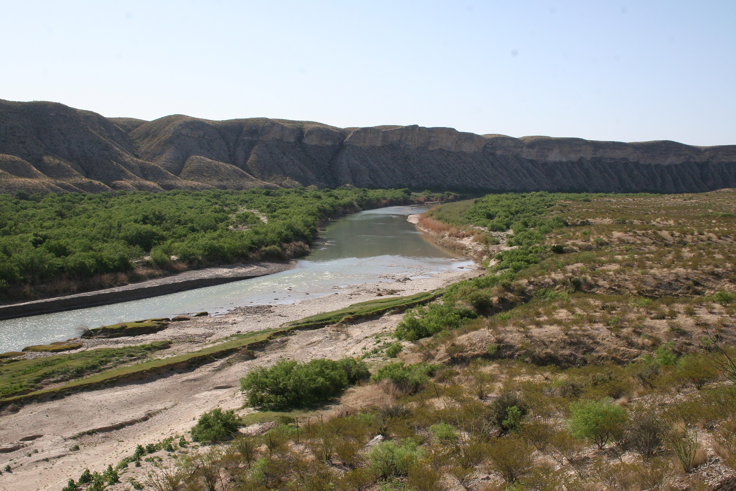
English: Omega Loop. River Mile 664.85. April 2009. |
|||
| Description |
English: Rio Grande Rio Grande vegetation monitoring, Omega Loop photopoint, April 2009. |
|||
| Depicted place |
English: Rio Grande Wild and Scenic River, Texas; Big Bend National Park, Brewster County, Texas; Latitude: 29.3278388977051, Longitude: -103.205894470215 |
|||
| Date | Taken on 17 April 2009 | |||
| Accession number | ||||
| Source |
English: NPGallery |
|||
| Permission (Reusing this file) |
|
|||
| NPS Unit Code | RIGR, BIBE | |||
| Album(s) | English: Rio Grande Veg Monitoring |
|||
File history
Click on a date/time to view the file as it appeared at that time.
| Date/Time | Thumbnail | Dimensions | User | Comment | |
|---|---|---|---|---|---|
| current | 17:13, 24 May 2021 | | 3,504 × 2,336 (3.96 MB) | BMacZeroBot (talk | contribs) | Batch upload (Commons:Batch uploading/NPGallery) |
You cannot overwrite this file.
File usage on Commons
The following page uses this file:
.JPG)
.JPG&oldid=564081920)