File:Oman CIA map.gif
Oman_CIA_map.gif (325 × 349 pixels, file size: 18 KB, MIME type: image/gif)
Captions
Captions
Summary
[edit]
| Description |
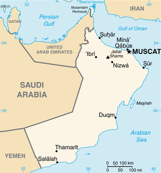
English: Map of Oman.
Italiano: Mappa dell'Oman. |
|||
| Date | ||||
| Source | https://www.cia.gov/library/publications/the-world-factbook/geos/mu.html | |||
| Author | Directorate of Intelligence, CIA | |||
| Permission (Reusing this file) |
|
Licensing
[edit]
This image is in the public domain because it contains materials that originally came from the United States Central Intelligence Agency's World Factbook.
|
 |

Thanks a lot for contributing to the Wikimedia Commons! Here's a tip to make your uploads more useful: Why not add some categories to describe them? This will help more people to find and use them.
Here's how:
1) If you're using the UploadWizard, you can add categories to each file when you describe it. Just click "more options" for the file and add the categories which make sense:

2) You can also pick the file from your list of uploads, edit the file description page, and manually add the category code at the end of the page.
[[Category:Category name]]
For example, if you are uploading a diagram showing the orbits of comets, you add the following code:
[[Category:Astronomical diagrams]][[Category:Comets]]
This will make the diagram show up in the categories "Astronomical diagrams" and "Comets".
When picking categories, try to choose a specific category ("Astronomical diagrams") over a generic one ("Illustrations").
Thanks again for your uploads! More information about categorization can be found in Commons:Categories, and don't hesitate to leave a note on the help desk.Edoardo Cavaleri (talk) 14:21, 7 July 2013 (UTC)
File history
Click on a date/time to view the file as it appeared at that time.
| Date/Time | Thumbnail | Dimensions | User | Comment | |
|---|---|---|---|---|---|
| current | 12:42, 13 March 2022 | | 325 × 349 (18 KB) | Lojwe (talk | contribs) | Cropped 1 % horizontally, 1 % vertically using CropTool with precise mode. |
| 16:37, 29 June 2013 |  | 329 × 353 (19 KB) | Edoardo Cavaleri (talk | contribs) | {{Information |Description ={{en|1=Map of Oman.}} {{it|1=Mappa dell'Oman.}} |Source =https://www.cia.gov/library/publications/the-world-factbook/geos/mu.html |Author =Directorate of Intelligence, CIA |Date =29 giugno 2013 |... |
You cannot overwrite this file.
File usage on Commons
There are no pages that use this file.
File usage on other wikis
The following other wikis use this file:
- Usage on it.wikipedia.org
- Usage on lt.wiktionary.org
- Usage on th.wikipedia.org