File:Old Stone Inn.jpg
Jump to navigation
Jump to search

Size of this preview: 800 × 557 pixels. Other resolutions: 320 × 223 pixels | 640 × 445 pixels | 1,024 × 713 pixels | 1,280 × 891 pixels | 2,560 × 1,782 pixels | 4,654 × 3,239 pixels.
Original file (4,654 × 3,239 pixels, file size: 2.04 MB, MIME type: image/jpeg)
Captions
Captions
Add a one-line explanation of what this file represents
|
This is an image of a place or building that is listed on the National Register of Historic Places in the United States of America. Its reference number is 76000944. |
| Camera location | | View this and other nearby images on: OpenStreetMap |
|---|
| Description |
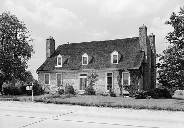
English: Front of the Old Stone Inn, located along U.S. Route 60 east of Simpsonville in Shelby County, Kentucky, United States. Built in 1816, it is listed on the National Register of Historic Places. |
|||||
| Date | ||||||
| Source | Library of Congress, Prints and Photograph Division HABS: KY,106-SHELB.V,2-1 | |||||
| Author | Lester Jones | |||||
| Permission (Reusing this file) |
|


|
This image is available from the United States Library of Congress's Prints and Photographs division
under the digital ID hhh.ky0112. This tag does not indicate the copyright status of the attached work. A normal copyright tag is still required. See Commons:Licensing.
|
File history
Click on a date/time to view the file as it appeared at that time.
| Date/Time | Thumbnail | Dimensions | User | Comment | |
|---|---|---|---|---|---|
| current | 15:11, 20 January 2010 | | 4,654 × 3,239 (2.04 MB) | Nyttend (talk | contribs) | {{Location|38|13|21|N|85|20|52|W}} {{Information |Description={{en|Front of the {{w|Old Stone Inn}}, located along {{w|U.S. Route 68}} east of {{w|Simpsonville, Kentucky|Simpsonville}} in {{w|Shelby County, Kentucky|Shelby County}}, {{w|Kentucky}}, {{w|Un |
You cannot overwrite this file.
File usage on Commons
There are no pages that use this file.
File usage on other wikis
The following other wikis use this file:
- Usage on arz.wikipedia.org
- Usage on ceb.wikipedia.org
- Usage on de.wikipedia.org
- Usage on en.wikipedia.org
- Usage on ro.wikipedia.org
- Usage on www.wikidata.org
Metadata
Categories:
- Built in Kentucky in 1816
- Black and white photographs of buildings
- Black and white photographs of Kentucky
- Federal architecture in Kentucky
- Historic American Buildings Survey of Kentucky
- Hotels in Kentucky
- National Register of Historic Places in Shelby County, Kentucky
- Stone buildings in Shelby County, Kentucky
- U.S. Route 60 in Kentucky
- 1940 in Kentucky