File:Old Presbyterian Meeting House, Old Town Alexandria, Virginia (14311211489).jpg

Original file (4,000 × 3,000 pixels, file size: 3.54 MB, MIME type: image/jpeg)
Captions
Captions
Summary
[edit].jpg&action=edit§ion=1)
| Description |
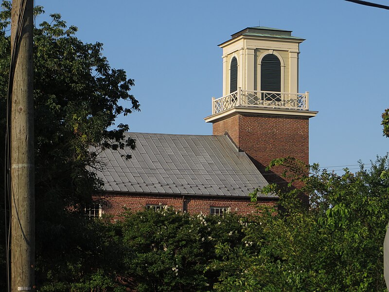
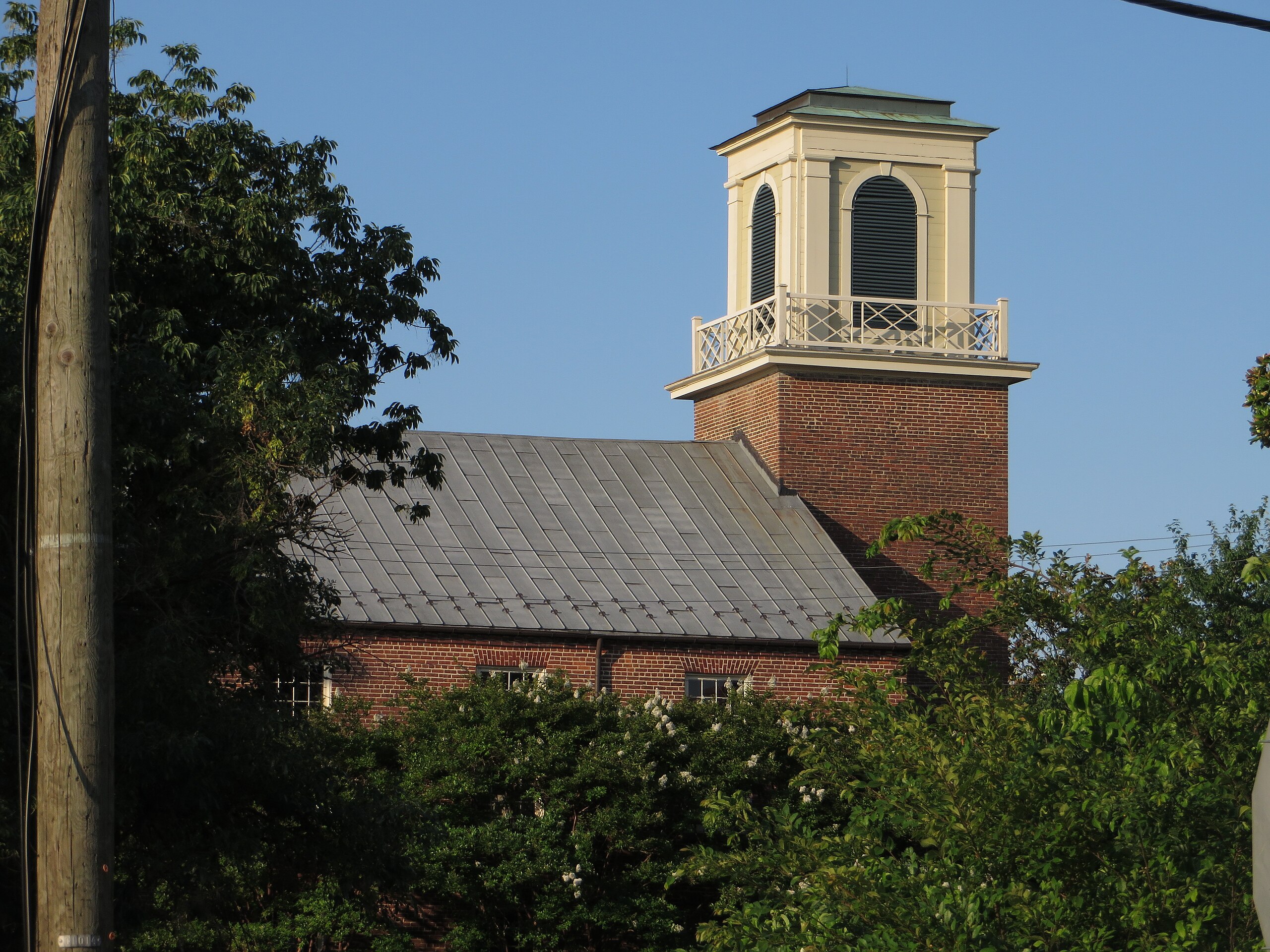
The heritage of the Old Presbyterian Meeting House in Alexandria, Virginia dates from the early eighteenth century. Scottish Presbyterians were among the early European settlers of Northern Virginia and were involved in establishing Alexandria as a port in 1749. The Society of Presbyterians worshiped publicly in the city from the 1760s, and the congregation’s first installed minister arrived in 1772. The Meeting House was erected in 1775. Largely destroyed by fire in 1835, it was subsequently rebuilt, maintaining a Reformed Protestant plain-style appearance. Except for a bell tower added in 1843 and granite entrance stairs installed in 1853, it remains little altered to the present day. Alexandrians have gathered at the Meeting House for public worship many times over the years. Among other such services that George Washington attended here was one conducted by the Rev. Dr. James Muir for the National Day of Solemn Humiliation, Fasting, and Prayer in 1798. Alexandria’s memorial services for George Washington in 1799 were held in this sanctuary. The church bell tolled in mourning during the four days between his death and burial. Adjoining the Meeting House is a Burial Ground and several buildings: Flounder House, built in 1787, was originally a parsonage; Elliot House (1844) was originally a private residence; and the Education Building was constructed in 1957. The Burial Ground is the final resting place of many patriots of the Revolutionary War, including one unidentified soldier who is honored by the Tomb of an Unknown Soldier of the American Revolution. Among the more than 300 persons buried in this graveyard are John Carlyle, founder and first overseer of Alexandria; Dr. James Craik, Physician General of the Continental Army and close friend of George Washington; and William Hunter, Jr., mayor of Alexandria and founder of the St. Andrew's Society. <a href="http://en.wikipedia.org/wiki/Old_Presbyterian_Meeting_House" rel="nofollow">en.wikipedia.org/wiki/Old_Presbyterian_Meeting_House</a> <a href="http://en.wikipedia.org/wiki/Wikipedia:Text_of_Creative_Commons_Attribution-ShareAlike_3.0_Unported_License" rel="nofollow">en.wikipedia.org/wiki/Wikipedia:Text_of_Creative_Commons_...</a> |
| Date | |
| Source | Old Presbyterian Meeting House, Old Town Alexandria, Virginia |
| Author | Ken Lund from Reno, Nevada, USA |
| Camera location | | View this and other nearby images on: OpenStreetMap |
|---|
.jpg¶ms=038.802288_N_-077.043078_E_globe:Earth_type:camera_source:Flickr_&language=en)
Licensing
[edit].jpg&action=edit§ion=2)
- You are free:
- to share – to copy, distribute and transmit the work
- to remix – to adapt the work
- Under the following conditions:
- attribution – You must give appropriate credit, provide a link to the license, and indicate if changes were made. You may do so in any reasonable manner, but not in any way that suggests the licensor endorses you or your use.
- share alike – If you remix, transform, or build upon the material, you must distribute your contributions under the same or compatible license as the original.
| This image was originally posted to Flickr by Ken Lund at https://flickr.com/photos/75683070@N00/14311211489. It was reviewed on 10 December 2021 by FlickreviewR 2 and was confirmed to be licensed under the terms of the cc-by-sa-2.0. |
File history
Click on a date/time to view the file as it appeared at that time.
| Date/Time | Thumbnail | Dimensions | User | Comment | |
|---|---|---|---|---|---|
| current | 19:38, 10 December 2021 | | 4,000 × 3,000 (3.54 MB) | Geo Swan (talk | contribs) | Transferred from Flickr via #flickr2commons |
You cannot overwrite this file.
File usage on Commons
There are no pages that use this file.
.jpg&oldid=886183345)