File:Olawamiejska.jpg
Jump to navigation
Jump to search
Size of this preview: 800 × 390 pixels. Other resolutions: 320 × 156 pixels | 640 × 312 pixels | 1,024 × 500 pixels | 1,280 × 625 pixels | 3,344 × 1,632 pixels.
Original file (3,344 × 1,632 pixels, file size: 2.82 MB, MIME type: image/jpeg)
Captions
Captions
Add a one-line explanation of what this file represents
| Description |
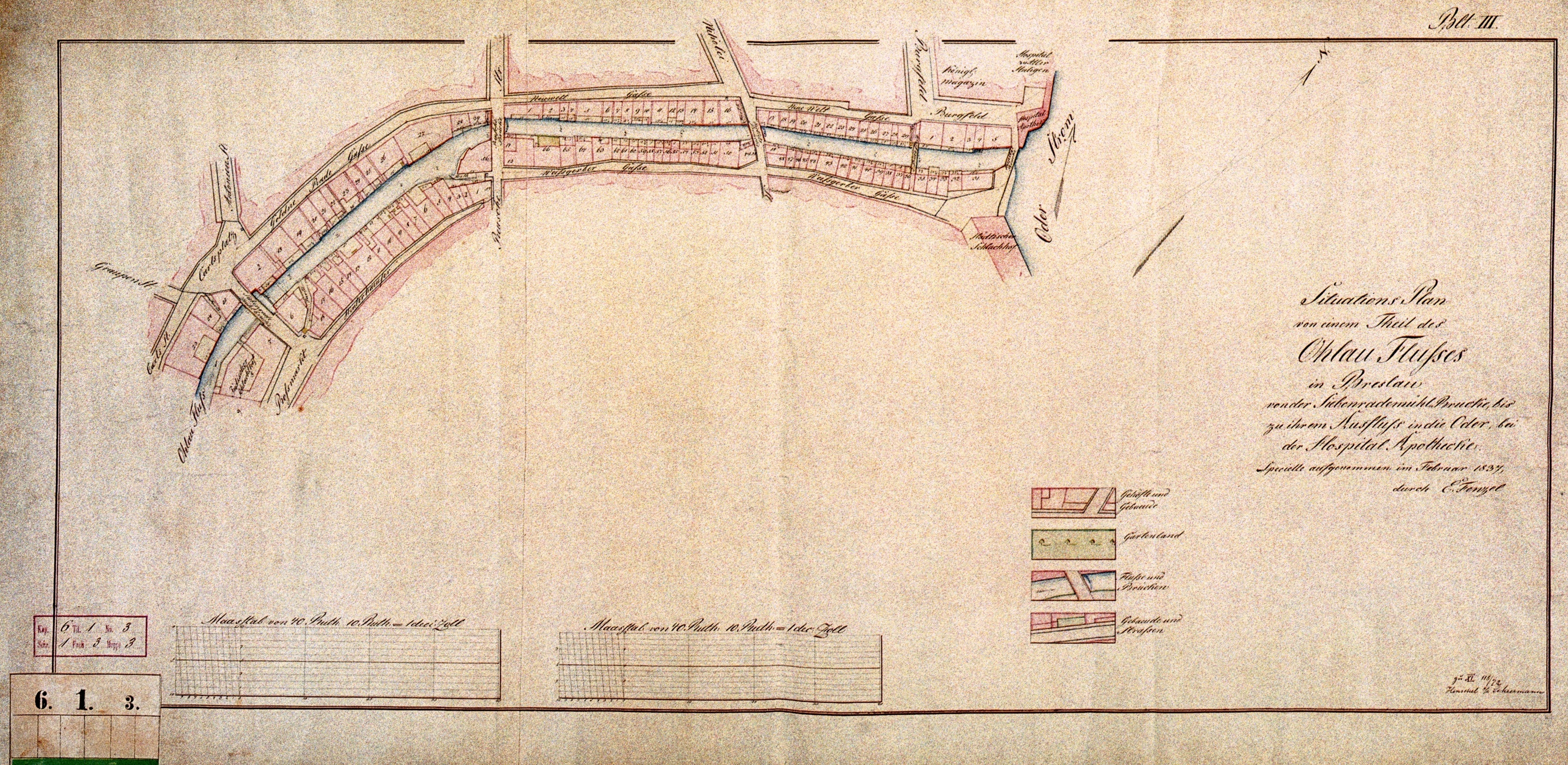
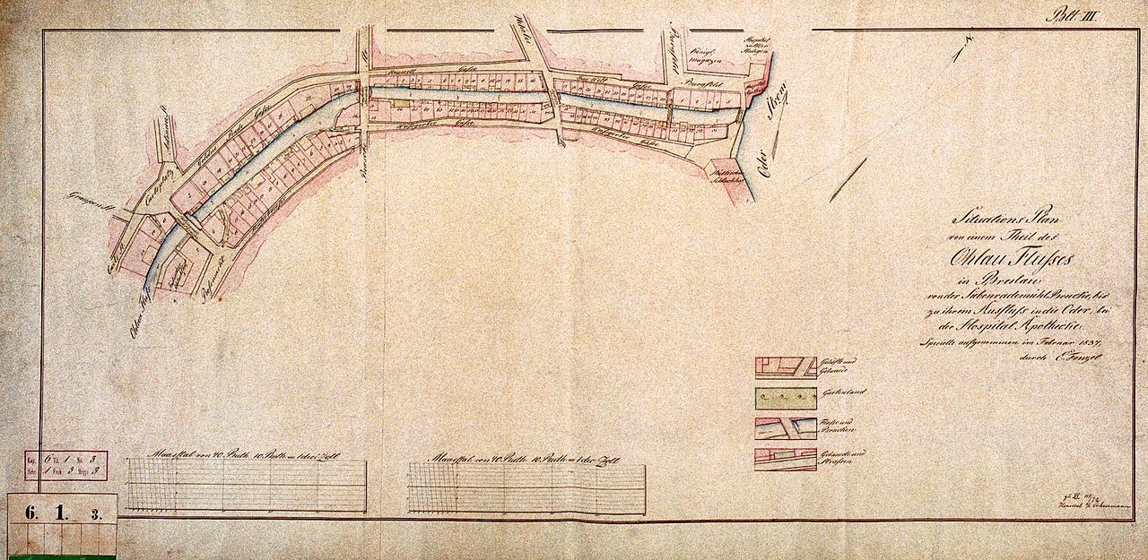
Polski: Jedna z map centrum Wrocławia z 1837, przedstawiająca odcinek Oławy miejskiej pomiędzy ul. Szajnochy (Rossmarkt na mapie) i placem Boh. Getta (Carlsplatz) - na południowym zachodzie, z lewej strony mapy, a ujściem do Odry (Oder Strom) na północnym wschodzie (po prawej) Mosty (od lewej): • Siebenradebrücke (Most Siedmiu Kół, dziś rejon pl. Boh. Getta) • Reuschebrücke (Most Ruski, dziś rejon skrzyżowania ul. Ruskiej i Kazimierza Wielkiego) • Nikolaibrücke (Most św. Mikołaja, dziś rejon skrzyżowania ul. św. Mikołaja i Kazimierza Wielkiego) • Weißgerbersteg (Kładka Białoskórnicza, dziś rejon skrzyżowania ul. Cieszyńskiego i ul. Nowy Świat) • Hospitalbrücke albo Allenheiligenbrücke (Most Szpitalny, zwany też Mostem Wszystkich Świętych, tuż przy ujściu do Odry) |
||||
| Date | |||||
| Source | maps of Stadt Breslau, 1837; page nr 6.1.3 | ||||
| Author | E. Fenzel (?) | ||||
| Permission (Reusing this file) |
|
||||
scanned by kudelin at Julo's request, see also http://wroclaw.hydral.com.pl/70752,foto.html
File history
Click on a date/time to view the file as it appeared at that time.
| Date/Time | Thumbnail | Dimensions | User | Comment | |
|---|---|---|---|---|---|
| current | 21:44, 20 January 2009 | | 3,344 × 1,632 (2.82 MB) | Julo (talk | contribs) | cropped, noise reduced |
You cannot overwrite this file.
File usage on Commons
There are no pages that use this file.
File usage on other wikis
The following other wikis use this file: