File:Ohrenbach Wiesenthal Gönz.jpg
Jump to navigation
Jump to search

Size of this preview: 686 × 599 pixels. Other resolutions: 275 × 240 pixels | 550 × 480 pixels | 879 × 768 pixels | 1,173 × 1,024 pixels | 2,077 × 1,814 pixels.
Original file (2,077 × 1,814 pixels, file size: 3.9 MB, MIME type: image/jpeg)
Captions
Captions
Add a one-line explanation of what this file represents
Summary
[edit]
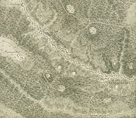
| Description |
Deutsch: Auschnitt aus Blatt 16 der Haas´schen Karte mit den Dörfern Ohrenbach und Wiesenthal. ACHTUNG die Karte muss etwa 30° im Uhrzeigersinn gedreht werden, damit Norden oben ist. |
| Date | circa 1800 |
| Source | Haas´sche Karte Militärische Situationskarte in XXIV Blättern von den Ländern zwischen dem Rhein Main und Neckar nebst den angränzenden Gegenden. |
| Author | Johann Heinrich Haas (1758–1810) |
Licensing
[edit]
|
This work is in the public domain in its country of origin and other countries and areas where the copyright term is the author's life plus 70 years or fewer. | |
| This file has been identified as being free of known restrictions under copyright law, including all related and neighboring rights. | |
File history
Click on a date/time to view the file as it appeared at that time.
| Date/Time | Thumbnail | Dimensions | User | Comment | |
|---|---|---|---|---|---|
| current | 09:10, 29 October 2019 | | 2,077 × 1,814 (3.9 MB) | Granpar (talk | contribs) | {{Information |description ={{de|1=Auschnitt aus Blatt 16 der Haas´schen Karte mit den Dörfern Ohrenbach und Wisenthal. ACHTUNG die Karte muss etwa 30° im Uhrzeigersinn gedreht werden, damit Norden oben ist.}} |date =~1800 |source =Haas´sche Karte Militärische Situationskarte in XXIV Blättern von den Ländern zwischen dem Rhein Main und Neckar nebst den angränzenden Gegenden. |author =Johann Heinrich Haas (1758–1810) }} Category:Ohrenbach (Weilbach) [[Category:Wie... |
You cannot overwrite this file.
File usage on Commons
The following page uses this file:
File usage on other wikis
The following other wikis use this file:
- Usage on de.wikipedia.org
- Usage on www.wikidata.org