File:Ogden Lane, Rastrick - geograph.org.uk - 38929.jpg
Jump to navigation
Jump to search
No higher resolution available.
Ogden_Lane,_Rastrick_-_geograph.org.uk_-_38929.jpg (640 × 397 pixels, file size: 74 KB, MIME type: image/jpeg)
Captions
Captions
Add a one-line explanation of what this file represents
Summary
[edit]
| Description |
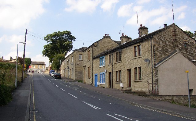
English: Ogden Lane, Rastrick. This is part of the old main road up through Rastrick. It was turnpiked in the early 19C, and was the A643 until the mid-20C when the parallel road to the W received that dubious honour. The photo was taken from the junction with Toothill Bank at the foot of the hill. The building to the right of the parked vehicles is the former Rastrick lock-up, the window of which is still just visible at pavement level. |
| Date | |
| Source | From geograph.org.uk |
| Author | Humphrey Bolton |
| Attribution (required by the license) | Humphrey Bolton / Ogden Lane, Rastrick / |
| Camera location | | View this and other nearby images on: OpenStreetMap |
|---|
_heading:292.00&language=en)
| Object location | | View this and other nearby images on: OpenStreetMap |
|---|
_heading:292.00&language=en)
Licensing
[edit]

|
This image was taken from the Geograph project collection. See this photograph's page on the Geograph website for the photographer's contact details. The copyright on this image is owned by Humphrey Bolton and is licensed for reuse under the Creative Commons Attribution-ShareAlike 2.0 license.
|
This file is licensed under the Creative Commons Attribution-Share Alike 2.0 Generic license.
Attribution: Humphrey Bolton
- You are free:
- to share – to copy, distribute and transmit the work
- to remix – to adapt the work
- Under the following conditions:
- attribution – You must give appropriate credit, provide a link to the license, and indicate if changes were made. You may do so in any reasonable manner, but not in any way that suggests the licensor endorses you or your use.
- share alike – If you remix, transform, or build upon the material, you must distribute your contributions under the same or compatible license as the original.
File history
Click on a date/time to view the file as it appeared at that time.
| Date/Time | Thumbnail | Dimensions | User | Comment | |
|---|---|---|---|---|---|
| current | 15:53, 30 January 2010 | | 640 × 397 (74 KB) | GeographBot (talk | contribs) | == {{int:filedesc}} == {{Information |description={{en|1=Ogden Lane, Rastrick. This is part of the old main road up through Rastrick. It was turnpiked in the early 19C, and was the A643 until the mid-20C when the parallel road to the W received that dubi |
You cannot overwrite this file.
File usage on Commons
There are no pages that use this file.