File:Ofu-Olosega USGS 1963 topo map.jpg
Jump to navigation
Jump to search
Size of this preview: 800 × 421 pixels. Other resolutions: 320 × 168 pixels | 640 × 336 pixels | 1,024 × 538 pixels | 1,280 × 673 pixels | 2,393 × 1,258 pixels.
Original file (2,393 × 1,258 pixels, file size: 809 KB, MIME type: image/jpeg)
Captions
Captions
Add a one-line explanation of what this file represents
Summary
[edit]
| Description |
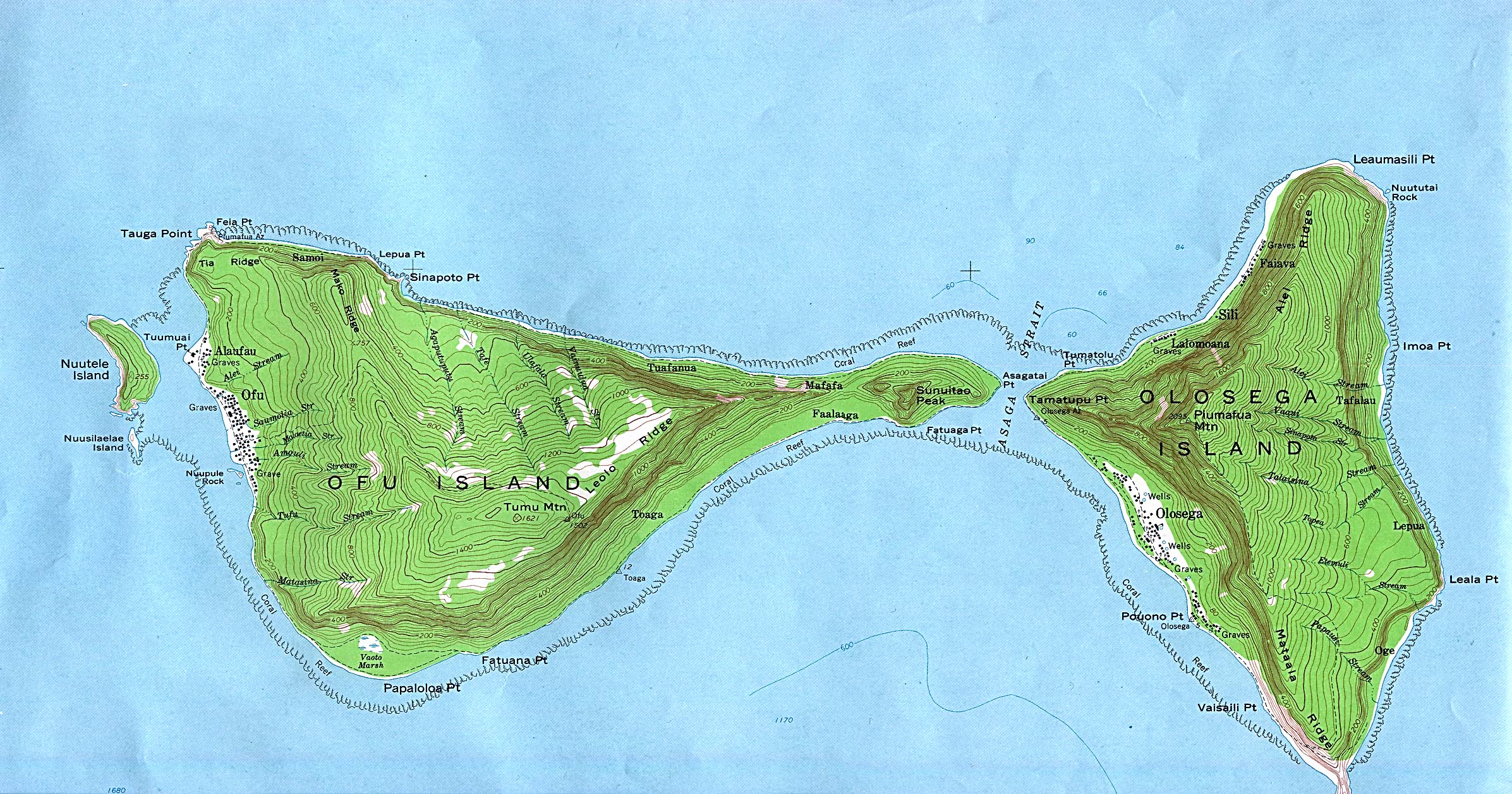
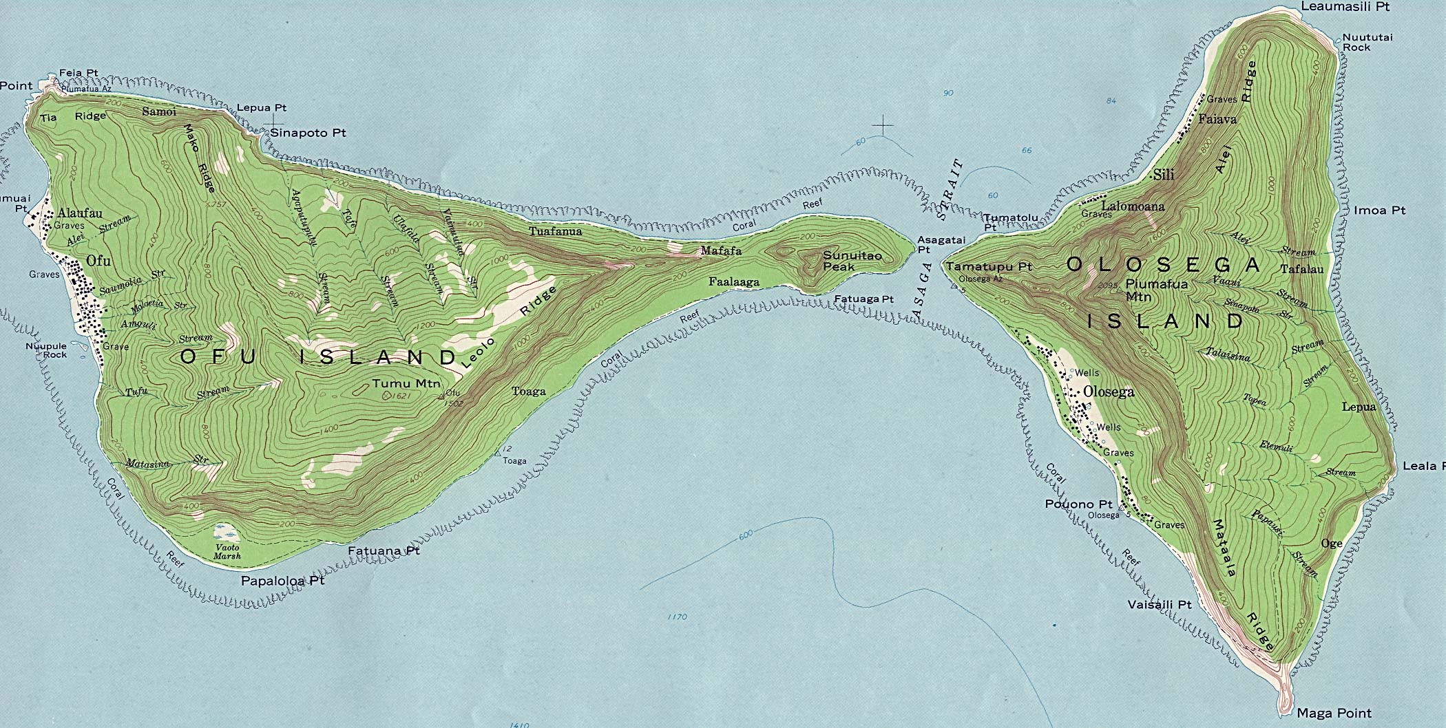
English: part of topographic map sheet showing Ofu and Olosega islands, part of Manu'a Islands, American Samoa, Pacific Ocean |
| Date | |
| Source | http://www.lib.utexas.edu/maps/islands_oceans_poles/ofu_olosega_63.jpg |
| Author | USGS |
Licensing
[edit]
| This work is from the Library of Congress. According to the library, there are no known copyright restrictions on the use of this work. |  |
File history
Click on a date/time to view the file as it appeared at that time.
| Date/Time | Thumbnail | Dimensions | User | Comment | |
|---|---|---|---|---|---|
| current | 13:03, 17 October 2016 | | 2,393 × 1,258 (809 KB) | Ratzer (talk | contribs) | User created page with UploadWizard |
You cannot overwrite this file.
File usage on Commons
There are no pages that use this file.
File usage on other wikis
The following other wikis use this file:
- Usage on de.wikipedia.org
- Usage on hr.wikipedia.org