File:Oertzenhof Bahnhof Empfangsgebäude 2013-06-23 15c.jpg
From Wikimedia Commons, the free media repository
Jump to navigation
Jump to search
![File:Oertzenhof Bahnhof Empfangsgebäude 2013-06-23 15c.jpg](https://upload.wikimedia.org/wikipedia/commons/thumb/6/62/Oertzenhof_Bahnhof_Empfangsgeb%C3%A4ude_2013-06-23_15c.jpg/800px-Oertzenhof_Bahnhof_Empfangsgeb%C3%A4ude_2013-06-23_15c.jpg?20130625072819)
Size of this preview: 800 × 539 pixels. Other resolutions: 320 × 216 pixels | 640 × 431 pixels | 1,024 × 690 pixels | 1,280 × 863 pixels | 2,416 × 1,628 pixels.
Original file (2,416 × 1,628 pixels, file size: 2.8 MB, MIME type: image/jpeg)
File information
Structured data
Captions
Captions
Add a one-line explanation of what this file represents
DescriptionOertzenhof Bahnhof Empfangsgebäude 2013-06-23 15c.jpg |
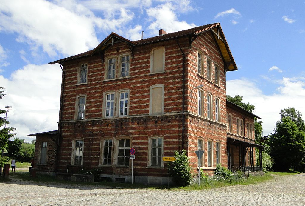
Deutsch: Empfangsgebäude im Bahnhof in Oertzenhof im Landkreis Mecklenburgische Seenplatte, Mecklenburg-Vorpommern, Deutschland
English: Train station building in Oertzenhof, district Mecklenburgische Seenplatte, Mecklenburg-Vorpommern, Germany |
Date | |
Source | Self-photographed |
Author | Niteshift |
Permission (Reusing this file) |
I, the copyright holder of this work, hereby publish it under the following license: ![]() ![]() ![]() This file is licensed under the Creative Commons Attribution-Share Alike 3.0 Unported license.
|
Camera location | 53° 31′ 04.04″ N, 13° 34′ 20.96″ E ![]() | View this and other nearby images on: OpenStreetMap | ![]() |
---|
File history
Click on a date/time to view the file as it appeared at that time.
Date/Time | Thumbnail | Dimensions | User | Comment | |
---|---|---|---|---|---|
current | 07:28, 25 June 2013 | ![]() | 2,416 × 1,628 (2.8 MB) | Niteshift (talk | contribs) | {{subst:User:Niteshift/MV |deobjekt=Empfangsgebäude im Bahnhof |enobjekt=Train station building |Pos=in |enPos=in |Ort=Oertzenhof |Landkreis=Mecklenburgische Seenplatte |Jahr=2013 |Monat=06 |Tag=23 |GPS={{GPS EXIF}} }} Category:Bahnhof Oertzenhof |
You cannot overwrite this file.
File usage on Commons
The following 2 pages use this file:
Metadata
This file contains additional information such as Exif metadata which may have been added by the digital camera, scanner, or software program used to create or digitize it. If the file has been modified from its original state, some details such as the timestamp may not fully reflect those of the original file. The timestamp is only as accurate as the clock in the camera, and it may be completely wrong.
Camera manufacturer | SONY |
---|---|
Camera model | DSC-HX1 |
Exposure time | 1/1,000 sec (0.001) |
F-number | f/4 |
ISO speed rating | 125 |
Date and time of data generation | 12:07, 23 June 2013 |
Lens focal length | 5.5 mm |
Latitude | 53° 31′ 4.04″ N |
Longitude | 13° 34′ 20.96″ E |
Altitude | 96 meters above sea level |
Horizontal resolution | 72 dpi |
Vertical resolution | 72 dpi |
Software used | Paint.NET v3.5.10 |
File change date and time | 12:07, 23 June 2013 |
Y and C positioning | Co-sited |
Exposure Program | Normal program |
Exif version | 2.21 |
Date and time of digitizing | 12:07, 23 June 2013 |
Meaning of each component |
|
Image compression mode | 5 |
APEX exposure bias | 0 |
Maximum land aperture | 3 APEX (f/2.83) |
Metering mode | Pattern |
Light source | Unknown |
Flash | Flash did not fire, compulsory flash suppression |
Supported Flashpix version | 1 |
Color space | sRGB |
File source | Digital still camera |
Scene type | A directly photographed image |
Custom image processing | Normal process |
Exposure mode | Auto exposure |
White balance | Auto white balance |
Scene capture type | Landscape |
Contrast | Normal |
Saturation | Normal |
Sharpness | Normal |
GPS time (atomic clock) | 11:07 |
Geodetic survey data used | WGS-84 |
GPS date | 23 June 2013 |
GPS tag version | 2.2.0.0 |