File:Odrzywół (gmina) location map.png
Jump to navigation
Jump to search

Size of this preview: 508 × 600 pixels. Other resolutions: 203 × 240 pixels | 407 × 480 pixels | 699 × 825 pixels.
Original file (699 × 825 pixels, file size: 164 KB, MIME type: image/png)
Captions
Captions
Add a one-line explanation of what this file represents
| Description |
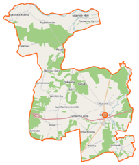
Polski: Mapa gminy Odrzywół, Polska
English: Map of Gmina Odrzywół, Poland |
|||||||||
| Date | ||||||||||
| Source | You may find a page on the OpenStreetMap wiki page for Odrzywół (gmina) | |||||||||
| Creator |
OpenStreetMap contributors OpenStreetMap contributors |
|||||||||
| Permission (Reusing this file) |
OpenStreetMap data is available under the Open Database License (details). Map tiles are licensed under the Creative Commons Attribution-ShareAlike 2.0 license (CC-BY-SA 2.0).
This file is licensed under the Creative Commons Attribution-Share Alike 2.0 Generic license.
|
|||||||||
| Geotemporal data | ||||||||||
| Bounding box |
|
|||||||||
| Georeferencing | If inappropriate please set warp_status = skip to hide. | |||||||||
File history
Click on a date/time to view the file as it appeared at that time.
| Date/Time | Thumbnail | Dimensions | User | Comment | |
|---|---|---|---|---|---|
| current | 14:53, 24 September 2014 | | 699 × 825 (164 KB) | VanWiel (talk | contribs) | {{OpenStreetMap | name = Odrzywół (gmina) | location = Odrzywół (gmina) | description = {{pl|Mapa gminy Odrzywół, Polska}} {{en|Map of Gmina Odrzywół, Poland}} | top = 51.6199 | left = 20.... |
You cannot overwrite this file.
File usage on Commons
There are no pages that use this file.
File usage on other wikis
The following other wikis use this file:
- Usage on de.wikipedia.org
- Usage on fr.wikipedia.org
- Usage on pl.wikipedia.org
- Odrzywół (gmina)
- Ceteń
- Kłonna
- Kolonia Ossa
- Łęgonice Małe
- Myślakowice
- Myślakowice-Kolonia
- Odrzywół
- Wysokin
- Kamienna Wola (województwo mazowieckie)
- Ossa (województwo mazowieckie)
- Różanna (województwo mazowieckie)
- Walerianów (województwo mazowieckie)
- Dąbrowa (powiat przysuski)
- Janówek (powiat przysuski)
- Jelonek (powiat przysuski)
- Lipiny (powiat przysuski)
- Stanisławów (powiat przysuski)
- Wandzinów
- Kościół św. Jadwigi i św. Stanisława w Odrzywole
- Parafia św. Jadwigi w Odrzywole
- Parafia św. Marii Magdaleny w Łęgonicach Małych
- Leśniczówka (Różanna)
- Badulki
- Dębowa Góra (województwo mazowieckie)
- Emilianów (powiat przysuski)
- Kłonna-Kolonia
- Las Kamiennowolski
- Piaski (gmina Odrzywół)
- Moduł:Mapa/dane/Odrzywół (gmina)
- Kościół św. Marii Magdaleny w Łęgonicach Małych
- Moduł:Mapa/dane/Odrzywół
- Plebania w Odrzywole
- Usage on pl.wikibooks.org
_location_map.png&oldid=519986559)