File:Obertauern aerial 2.jpg
Jump to navigation
Jump to search

Size of this preview: 800 × 600 pixels. Other resolutions: 320 × 240 pixels | 640 × 480 pixels | 1,024 × 768 pixels | 1,280 × 960 pixels | 2,560 × 1,920 pixels | 2,816 × 2,112 pixels.
Original file (2,816 × 2,112 pixels, file size: 4.46 MB, MIME type: image/jpeg)
Captions
Captions
Add a one-line explanation of what this file represents
Summary
[edit]
| Description |
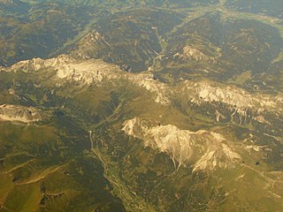
Deutsch: Tauern Autobahn A10 und Tauerntunnel |
| Date | Taken on 28 August 2012, 13:54:43 |
| Source | Own work |
| Author | Andrzej Otrębski |
Licensing
[edit]
I, the copyright holder of this work, hereby publish it under the following license:
This file is licensed under the Creative Commons Attribution-Share Alike 3.0 Unported license.
- You are free:
- to share – to copy, distribute and transmit the work
- to remix – to adapt the work
- Under the following conditions:
- attribution – You must give appropriate credit, provide a link to the license, and indicate if changes were made. You may do so in any reasonable manner, but not in any way that suggests the licensor endorses you or your use.
- share alike – If you remix, transform, or build upon the material, you must distribute your contributions under the same or compatible license as the original.
| Annotations | This image is annotated: View the annotations at Commons |
File history
Click on a date/time to view the file as it appeared at that time.
| Date/Time | Thumbnail | Dimensions | User | Comment | |
|---|---|---|---|---|---|
| current | 19:34, 27 October 2012 | | 2,816 × 2,112 (4.46 MB) | Andrzej O (talk | contribs) | User created page with UploadWizard |
You cannot overwrite this file.
File usage on Commons
There are no pages that use this file.
File usage on other wikis
The following other wikis use this file:
- Usage on en.wikipedia.org
Metadata
Categories:
- Tauerntunnel
- Valleys of Salzburg (state)
- Aerial photographs of the Alps
- Aerial photographs of Salzburg (state)
- U-shaped valleys in Austria
- Tauern Autobahn A10 in Salzburg (state)
- Mosermandl
- Hochfeind
- August 2012 in Salzburg (state)
- August in Bezirk St. Johann im Pongau
- Zederhaus
- Steinfeldspitze
- Großer Pleißlingkeil